Distance: 14.4 mi. out and back
Elevation gain: 1324 ft
This, along with the Kaiser Pass ride and the Auberry Rd. ride, is Bestrides’ introduction to the rich riding region east of Fresno. I’ve just dipped a toe into the area’s resources. In the Adding Miles section of this entry I survey the area’s possibilities beyond what I’ve ridden. If you’re going to the area to ride, be sure to read that discussion.
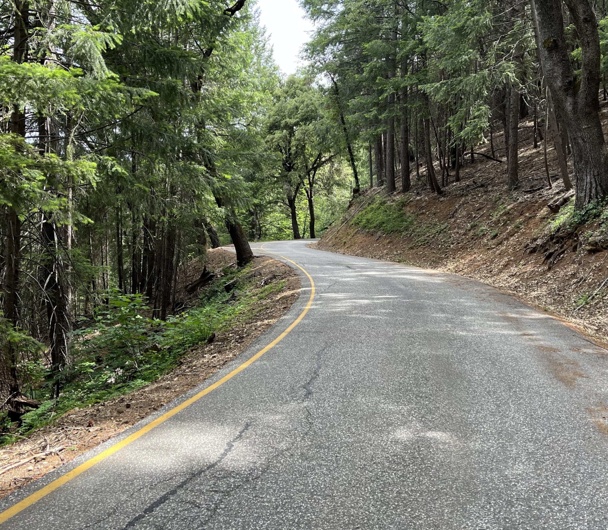
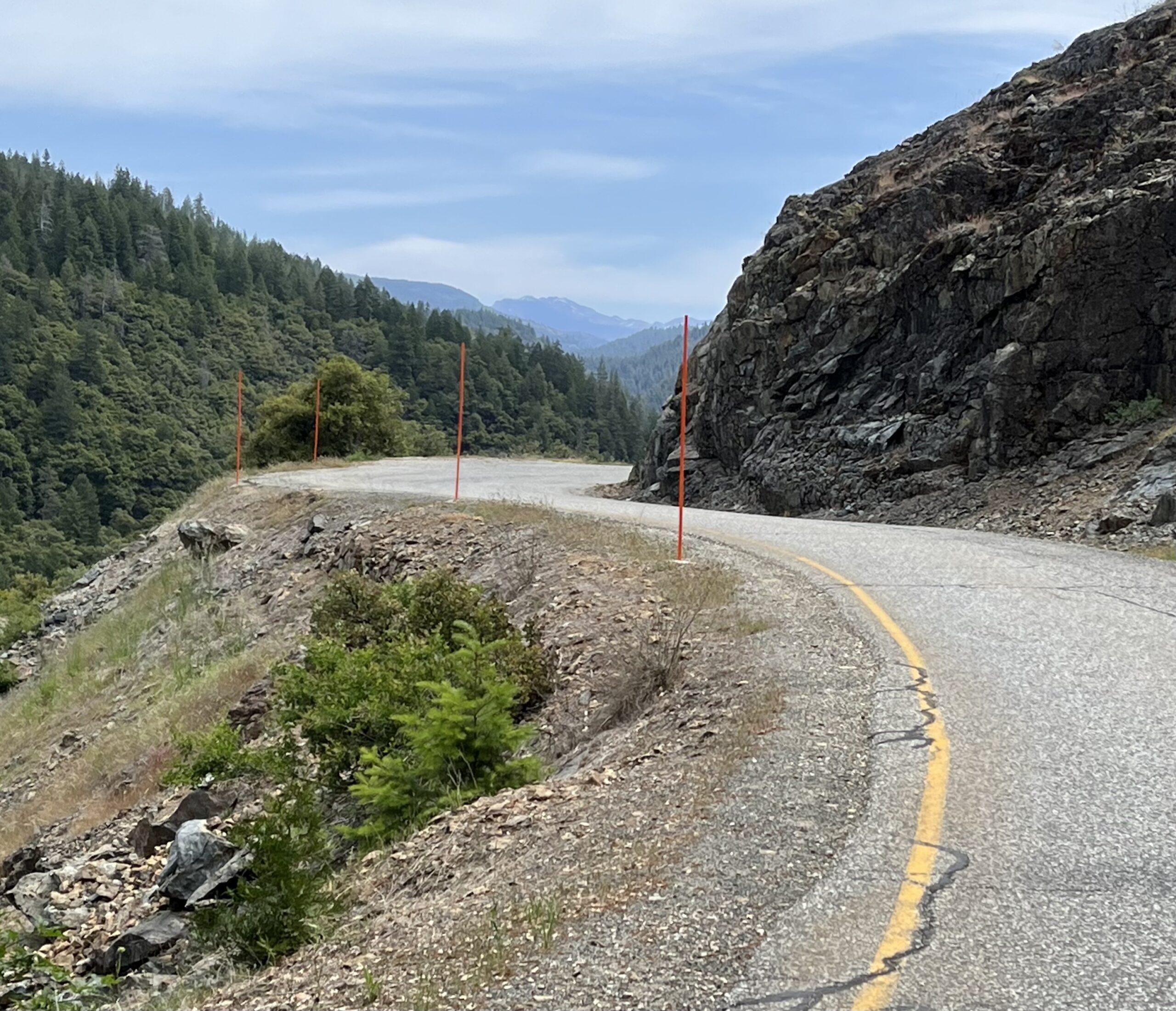
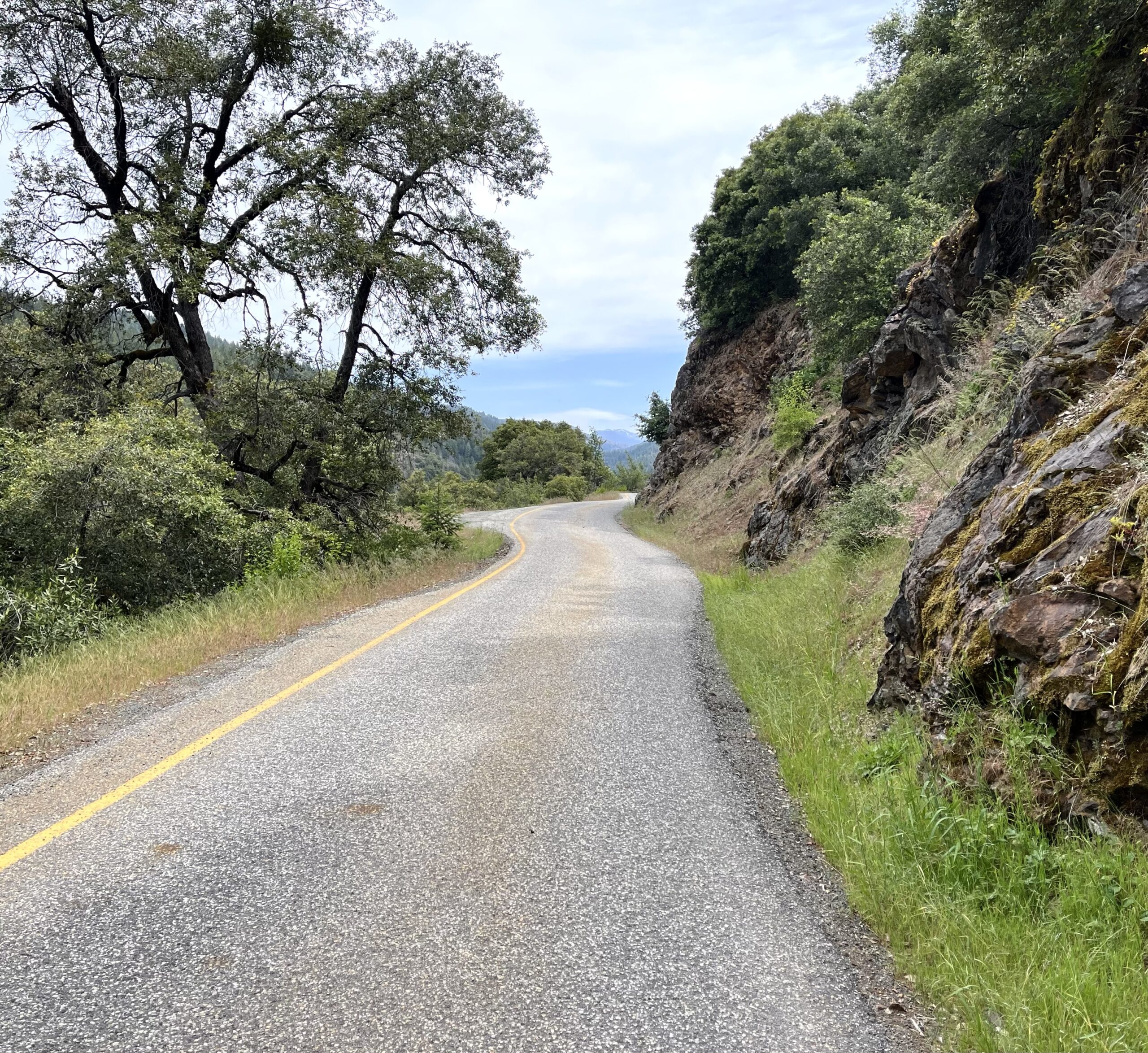
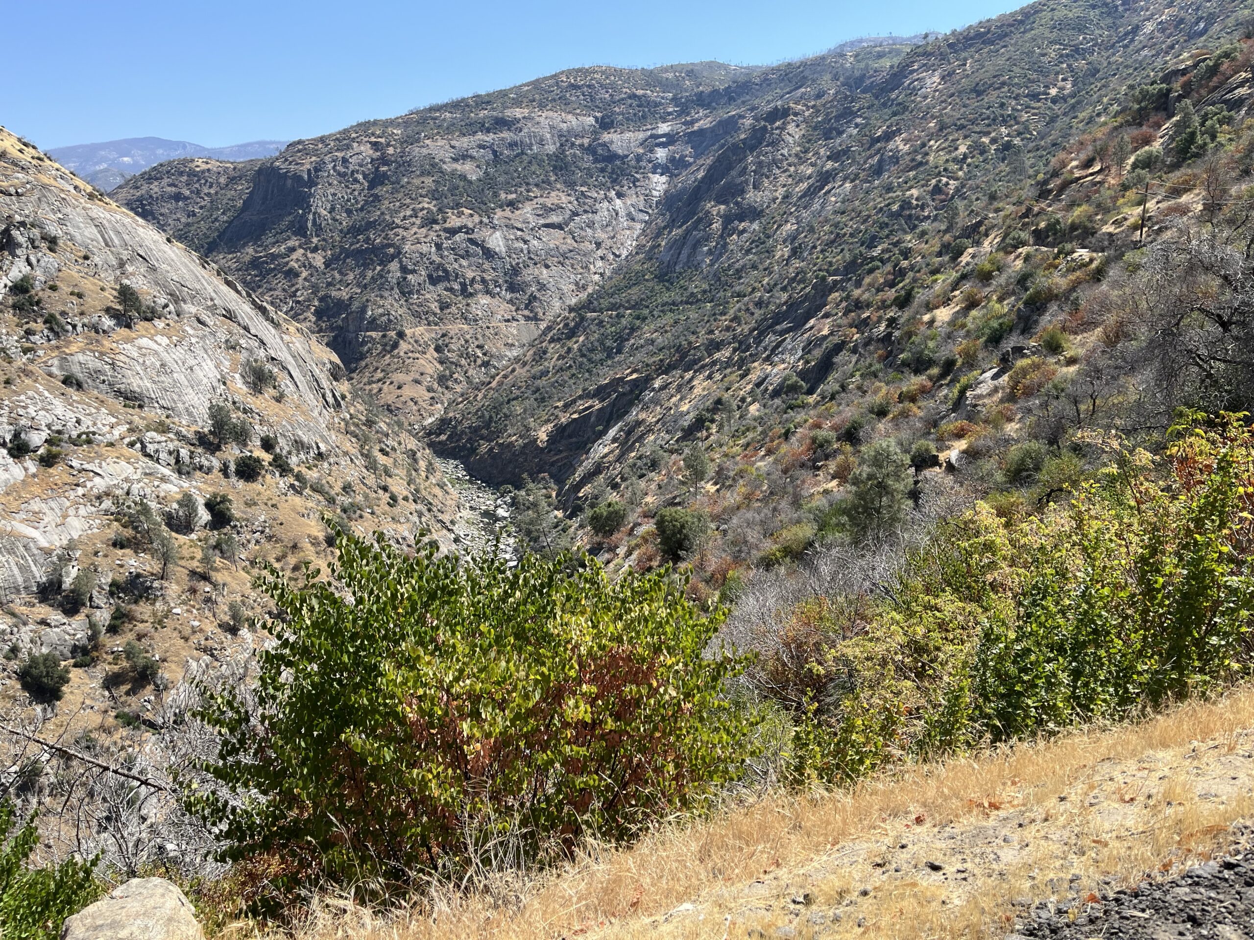
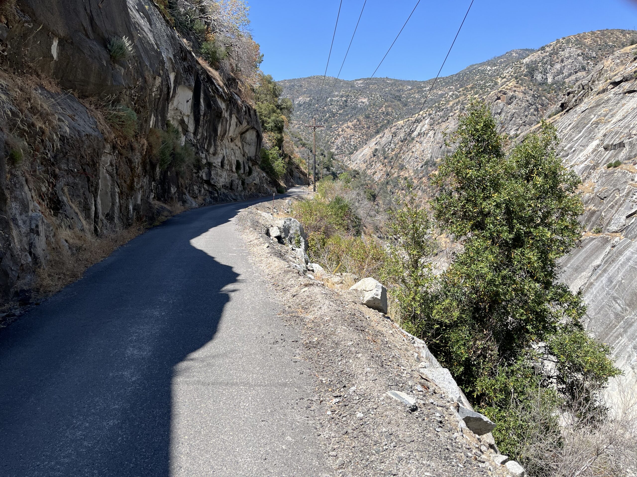
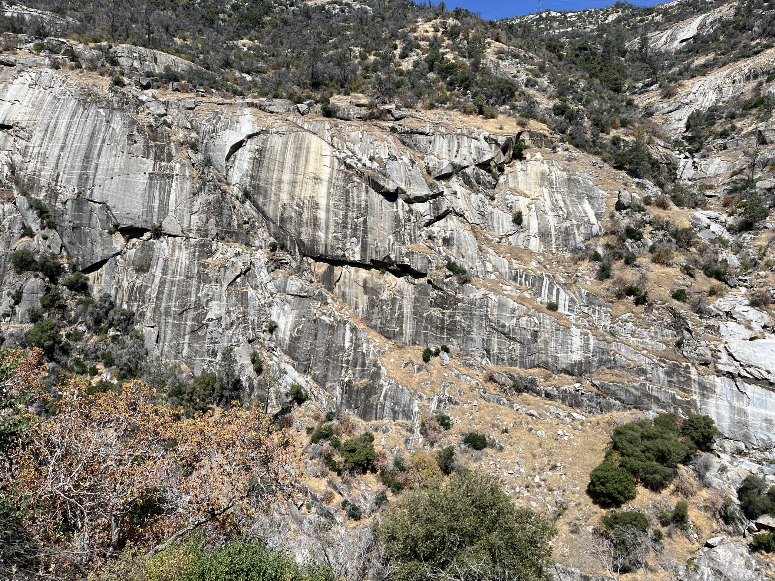
Of our three area roads, Million Dollar Road is the best, a dramatic and memorable ride, and easy to boot. It’s 7.5 miles long and I expect you to do it as an out-and-back, though there’s a sweet 11-mile add-on at the turn-around and a looping option, both of which I’ll discuss in Adding Miles. It’s a relatively flat road (I don’t know where RWGPS is getting its figures, but I did no work) along a steep sidehill through a dramatic rocky San Joaquin River canyon. The rock cuts on your shoulder and the cliff walls across the river are grand. If you’re a rock person like I am, this is your ride.
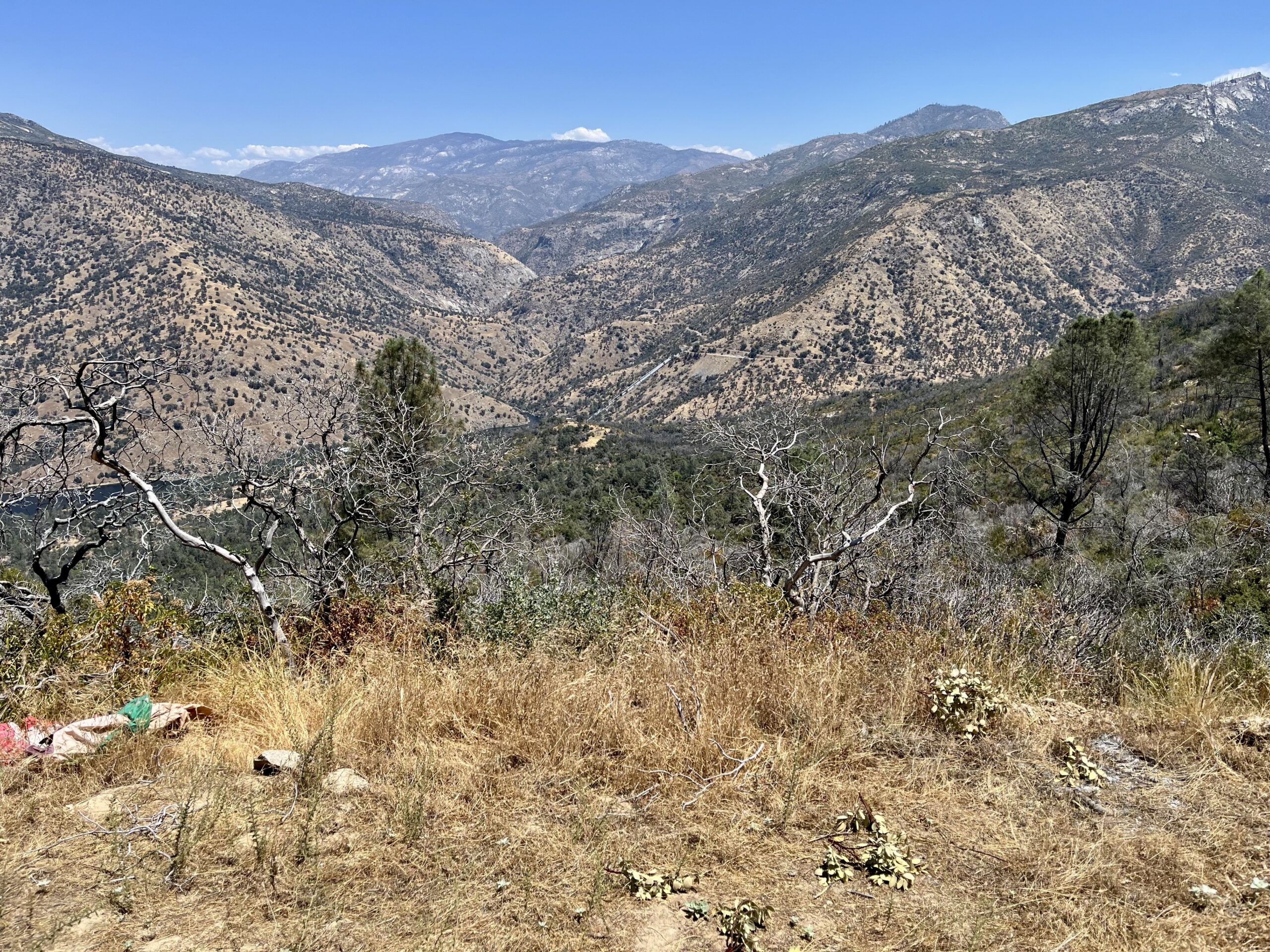
The ride is a tranquil piece of cake (unless you’re troubled by exposure), but it’s hard to get to if you come to it from the south. From the town of Auberry you have 10.6 miles of Jose Basin Rd., a one-lane, battered, twisty 10-mph nerve-racker full of deadly blind corners through unrewarding scrub. I found the drive in much more taxing than the bike ride. It may be easier to come from the west, via Italian Bar Rd. Jose Basin does offer one benefit: miles before you get to MDR you see the San Joaquin River Canyon in front of and far below you, and you can see MDR itself carving its way along the R side of the canyon (see photo below). I know of no other ride you can see the length of from a distance in this way—very dramatic.
MDR is an access road for service vehicles getting to the hydroelectric dam at the north end of the road and the powerhouse, both of which you’ll see on the ride. You can expect to see perhaps one pick-up. The road is a fat one-lane with good pavement throughout, despite RWGPS’s insistence that much of it is gravel.
Like most of the geography northwest of Shaver Lake, MDR burned in the devastating Creek Fire of 2020. But the canyon is almost entirely rock, so the effect on the scenery was next to nil. You will see a lot of fire damage on the drive in.
As I said, getting to the ride is harder than doing it. Out of Auberry, go up Auberry Rd. briefly to Jose Basin Rd. and take JBR. In c. 6 miles the road forks (without signage) and the two forks are apparently of equal importance. The L fork seems to head down into the canyon while the R fork stays level. Take the L fork, which is now Italian Bar Rd. Incredibly, my GPS was working at the fork and the roads were labeled. Drive to the river. Million Dollar Road obviously takes off to the R at the prominent spot where the river turns from south to west and IBR follows it. There is a small dirt parking area just W of the intersection. There is no road signage.
At the start of MDR you must get through a massive gate, with the usual signs warning you of the risks and liabilities you’re undertaking by proceeding. It’s a bitch to get around, over, or under, so if you’re alone (as I was) I recommend waiting for a hiker to come along to help you with the task. This shouldn’t take long—the road seems to be under the radar for cyclists but is well-known to hikers, who come for the falls. On my ride I saw about a dozen walkers.
There are no forks or options on MDR itself. Ride to the dam and a dead-end intersection with an unexpected street sign telling you you’re at the intersection of Big Creek Powerhouse and Big Creek Powerhouse (sic), the Big Creek powerhouse being what you get to if you continue on the new road to the R.—maps call this new road Canyon Rd. (more on this later).
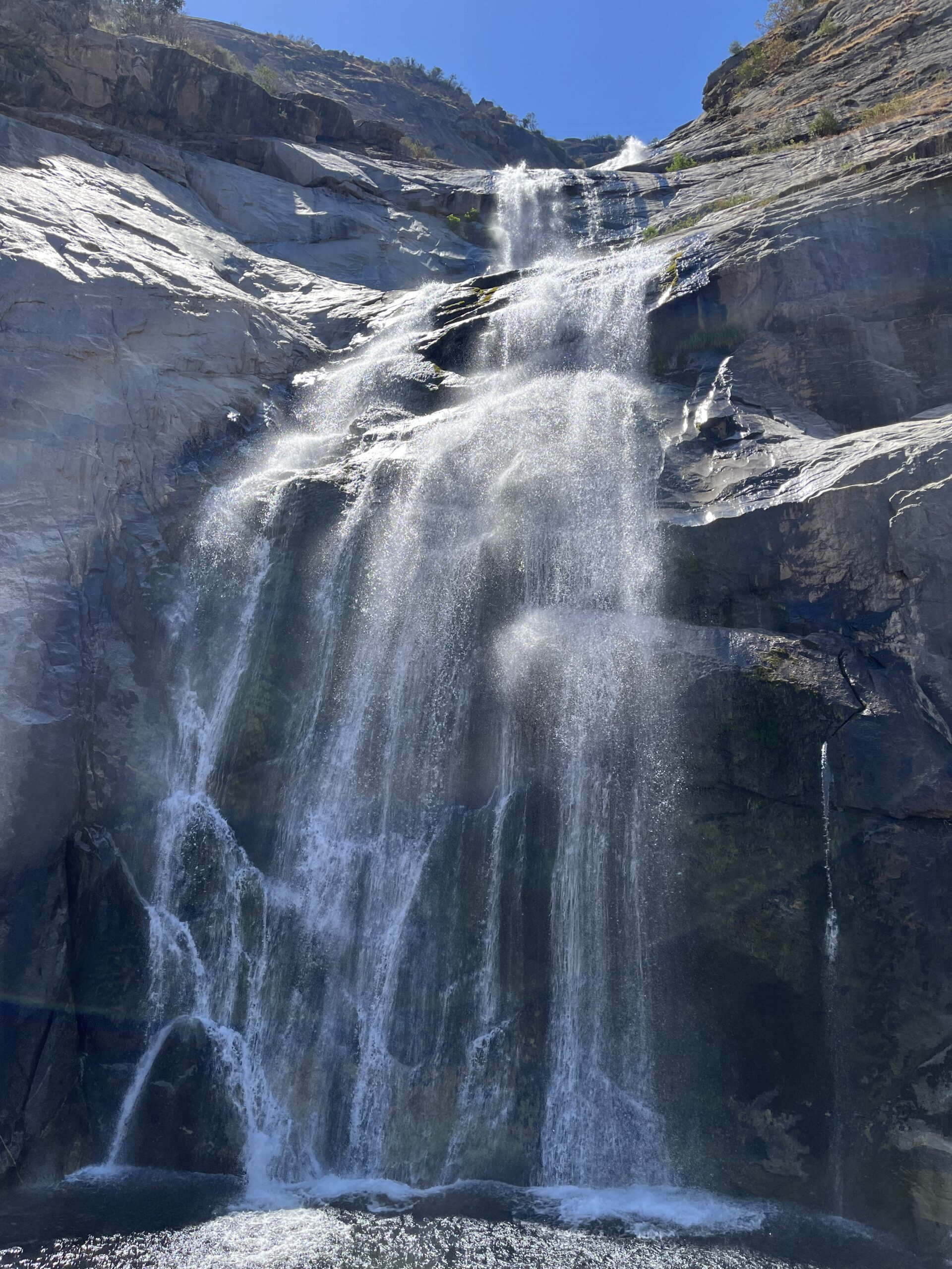
You can’t miss the falls—they’re big and beautiful and the road bisects them on a bridge. I did the ride in late July and there was plenty of water—a hiker told me in the spring when the waters are high they cover the road. So don’t do the ride then.
If you’re a fan of electric grids, there’s a large relay station on the banks of the river right when you start the ride—it’s easy to miss on the way out but clearly visible at the end of the return ride.
Shortening the ride: There’s no particular reason to, but you can turn around at the waterfall. The road is slightly steeper in the second half.
Adding Miles: Everything discussed in this section is riding I haven’t done.
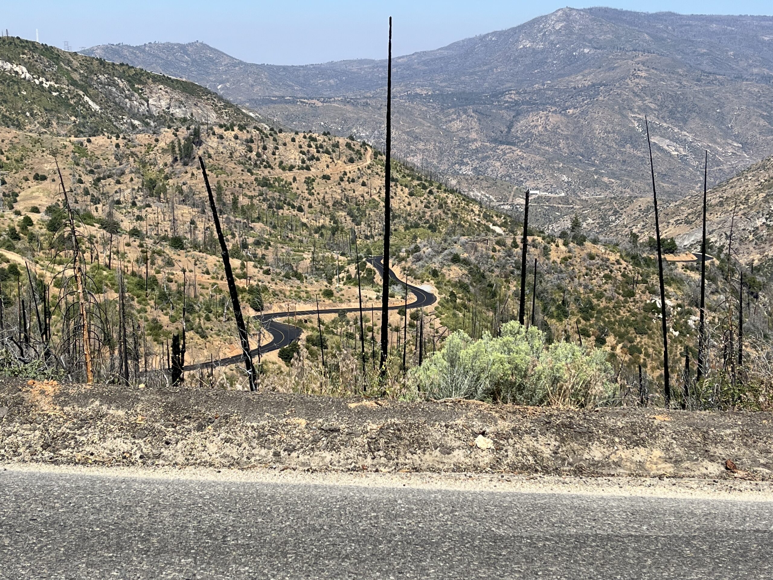
At the turn-around point of our ride you’re at the intersection with Canyon Rd., which runs east to Big Creek (hence the street sign reading “Big Creek Powerhouse”). It’s a 5.8-mile (one way) ride dead-ending at Big Creek Rd., the back road from Shaver Lake to Huntington Lake, a ride I’ll be recommending in a minute. Canyon is all seriously up heading east (2033 ft gain in 5.8 mi.) and it runs directly through the Creek Fire burn, so the landscape is devastated, but the road was recently repaved so the surface is impeccable, the road contour is delicious (very curvy), and the scenery is really rather awesome in an apocalyptic sort of way (see photo below).
You can turn L (the other way) on Canyon Rd. and continue up the river. I’m not sure what it’s like, thought it’s paved at least for a while.
You can make a loop that includes Million Dollar Rd., though it involves some rough or trafficky riding. You can start the loop anywhere, but I suggest you start in Auberry to get Jose Basin Rd. out of the way early. Ride from Auberry to Million Dollar Rd., up MDR, east on Canyon, then at the intersection with Big Creek Rd. take BCR (you’ll have to get through another intimidating gate like the one for MDR, closing off Canyon Rd. to the public) west to Shaver Lake. This leg is a demanding, splendid, constantly serpentining climb on a great road surface—one of the best stretches of road in the area, if you don’t mind the burn. Ride Hwy 168 along Shaver Lake and continue on it down toward the valley and back to Auberry. Hwy 168 is sometimes blessed with a great road contour and sometimes straight as a stick, but it’s always trafficky (trebly so on weekends) and I’d never choose to ride it unless I was keen to complete this loop. I’d map it for you but RWGDP won’t let me map MDR (because it’s gated and officially “private” I suppose). If you do this loop, you are almost entirely beyond the reach of water resupply, so plan accordingly.
If you want to explore the other riding in the area:
The best road in the area not in Bestrides is Big Creek Rd., part of the Million Dollar Rd. loop described above. Sometimes confusing called Huntington Lake Rd. on maps, it’s the backroad alternative to Hwy 168. About 10 miles long, it begins (west to east) with about 6 miles of delicious serpentine descending on excellent road surface, then, at the unexpectedly large community of Big Creek the road goes to rough-hewn one- lane and turns up—extremely, unforgivingly up, as in lots of 12-16%—for the remaining 4 miles to Huntington Lake. One of the hardest climbs I’ve ever seen. The country to the north is Creek Fire devastation, but you can see forever and the view is really quite magnificent (though admittedly not pretty). Ride it all (you could continue on along the lake shoreline, 6 miles of perfectly pleasant rollers, then ride our Kaiser Pass ride, or loop back on the trafficky Hwy 168), or skip the killer climb and just descend to Big Creek and turn around.
There are three long, medium-sized roads with good road contour in the area: Beasore, Minarets, and Dinkey Creek. Beasore Rd. has the bonus of Jones Store, a classic country store of some renown. It can be looped by taking the road that goes R just beyond the store and goes over to Minarets, Grizzly Meadows Rd., which I think is paved. It has the huge advantage over Minarets that it escaped the Creek Fire.
Minarets Rd. used to be a plumb ride, but it was devastated in the fire, and reports are that riding it is now a grim experience.
Dinkey Creek has a nice contour and is outside the Creek Fire burn area, and it has two bonuses: McKinley Grove, a small, blissfully uncrowded grove of giant sequoias (I went to see the giant sequoias in Sequoia National Park this summer and couldn’t get a parking space), and Courtright Way (not Road), a small, quirky little road that goes from the east end of Dinkey north to Courtright Reservoir. You can preview it on Streetview.
At the east end of Trimmer Springs Rd. is a road worthy of special mention: Black Rock Rd. (Vomac Rd. for its first few miles). Small and twisty, it passes through Balch Camp and proceeds to Black Rock Reservoir (12 mi.) on pavement, then continues on reportedly technical dirt northward all the way to the eastern end of Dinkey Rd. Word is, the canyon scenery is at first grand, then gets even better as the road passes through Granite Gorge. Ride as far as you are able. The Balch Camp area in 7/25 suffered a forest fire, and I don’t know how that impacted the riding conditions.
Most of the roads in this Added Miles section are snowed in in winter and sport a delicious 70-75% high temp in mid-summer. If you want to ride in the spring, the roads in the foothills (between the Clovis/Fresno valley and the mountains) are said to be lovely riding when everything is still green. Try Watts Valley Rd., Maxon Rd., Burrough Valley Rd., Toll House Rd., Lodge Rd., Millerton Rd., Pittman Hill Rd., Auberry Rd., Powerhouse Rd.—which is pretty much all of them.