Distance: 18.3 out and back Elevation gain: 2258 ft
This ride has no breath-taking features, but it’s a perfectly sweet, rolling romp through very pretty Sierra foothill scenery. It’s one of 4 rides Bestrides has out of Grass Valley/Nevada City, and it’s probably the easiest and most low-key of the 4, perfect for a light day. The elevation gain is slightly over our 100 ft/mile benchmark for workload, but it’s never super-steep and all the climbing is in the last 4 miles, so you can turn around after 5 miles if you want no work at all.
One caveat: this is the route to South Yuba River State Park, which is prime hiking and swimming territory for locals in the summer, so it gets trafficky, especially on weekends. Even at other times, the road is busier than you’d expect. I rode it on a beautiful weekday afternoon in October, when there was almost no one at the State Park, and it was lovely and quiet at 2 PM and hellishly busy at 3 PM. I suggest riding it early in the morning or in spring or fall (non-swimming season) before 3 PM.
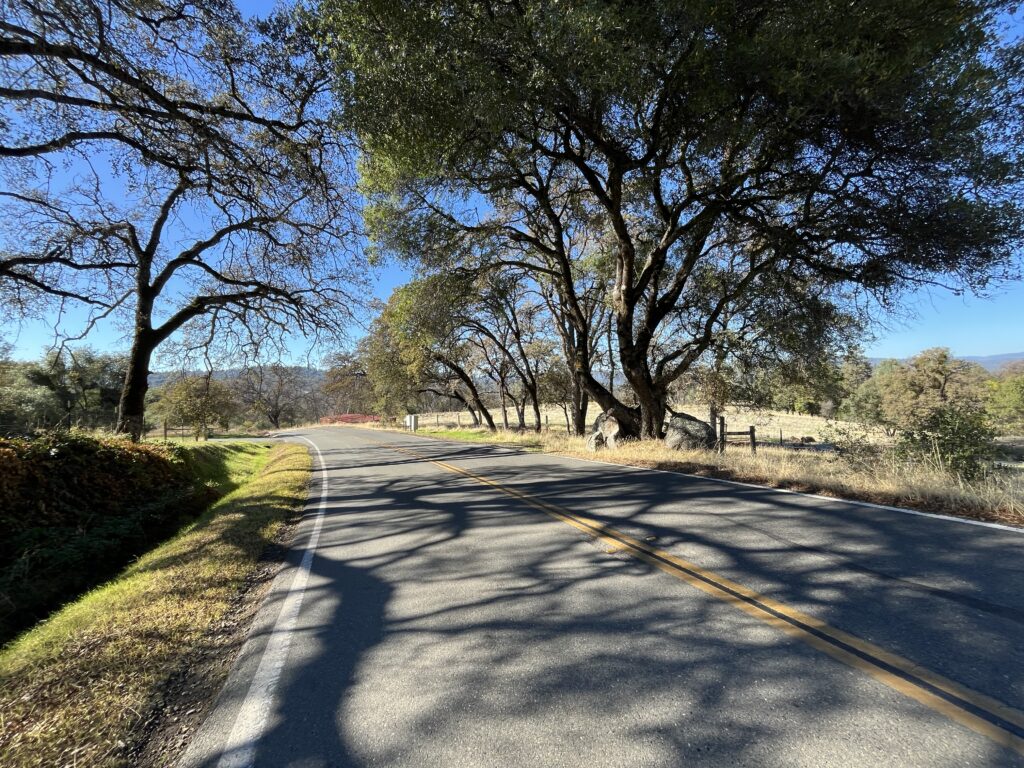
Begin at the intersection of Rough and Ready Highway and Bitney Springs Rd. (If you can refrain from saying “Leave Bitney alone!” to yourself throughout the ride, you have more willpower than I do). Ride down BSR. There’s a nice variety of foothill landscape—dense forest, open land, horse farms. The road tends downhill gently on excellent road surface.
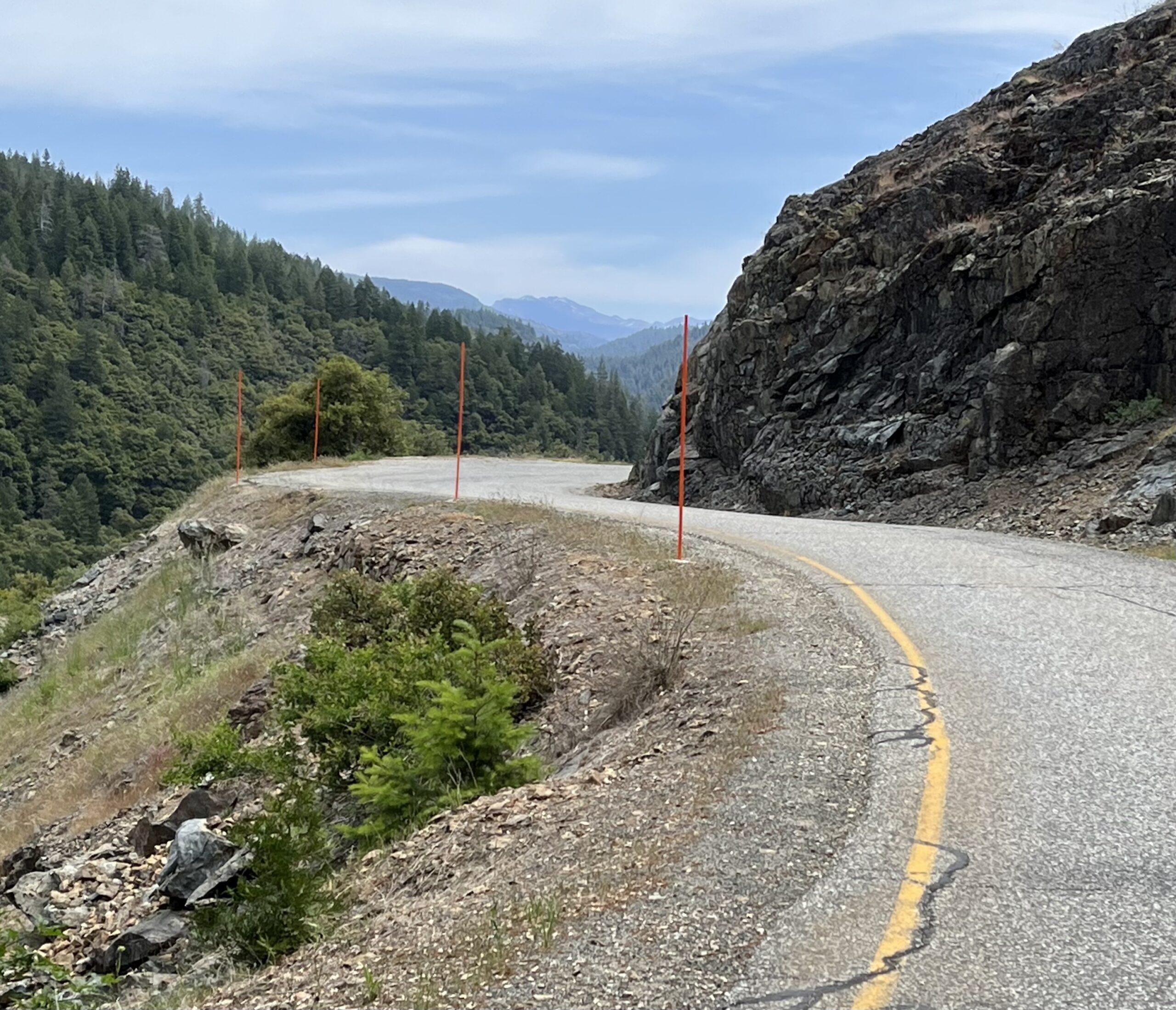
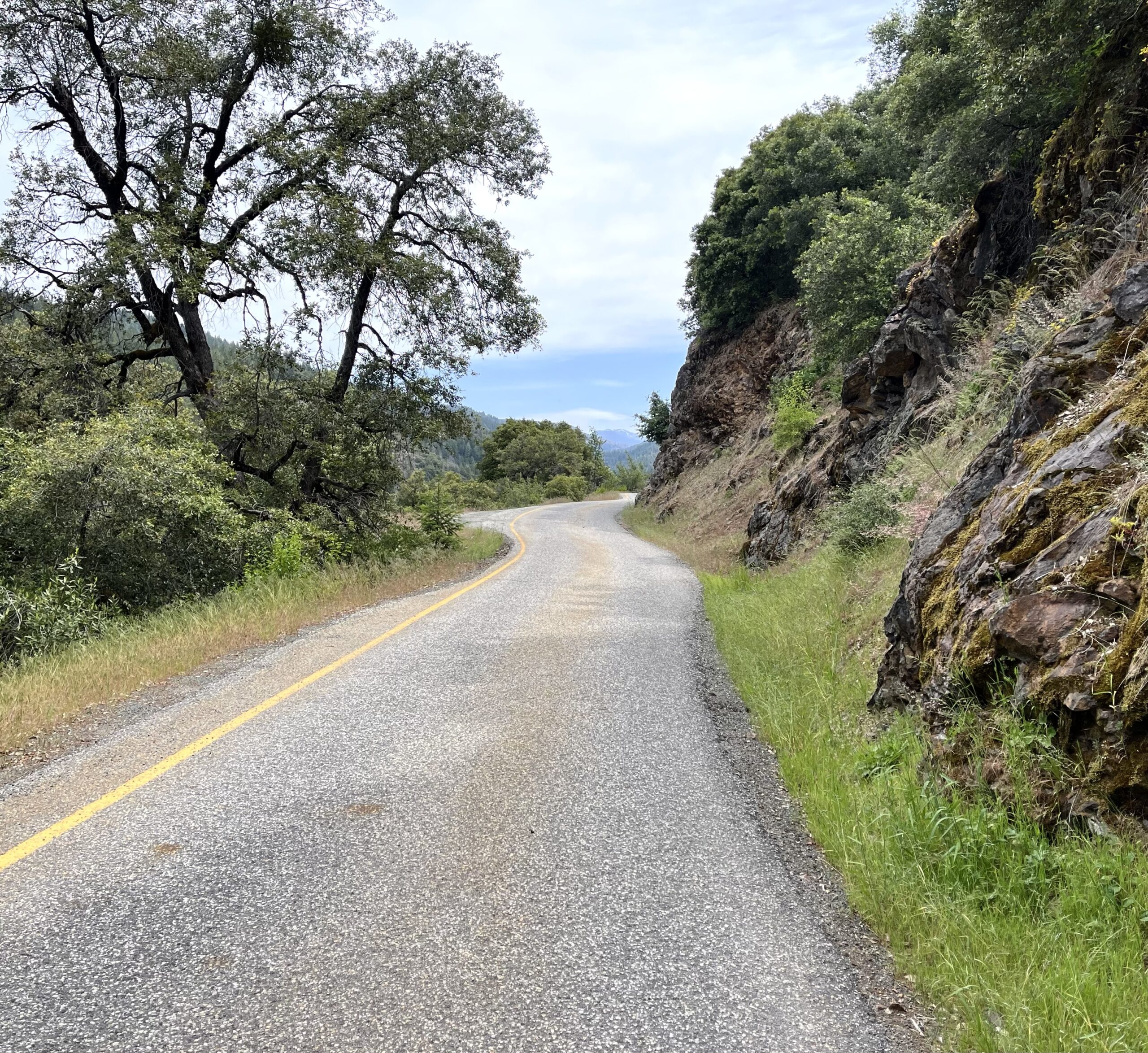
Bitney Springs Road
At 5 miles in the road turns down, and from there there’s a surprisingly fun 2-mile descent to the dead end at Pleasant Valley Rd. Take PVR to the R to South Yuba River State Park. PVR is steeper than what you just did (though the RWGPS profile says it’s the same), and the road surface is fairly rough, so it’s not a descent I love. We’re doing it to get to the state park, which is a cool place. There you’ll find the Bridgeport covered bridge, the longest covered bridge in the world (!). It’s a Wood bridge—that is, it was built by David Wood (sorry, couldn’t resist), and was completely restored and reopened in 2021, so it looks (and in fact is) brand new. You can ride your bike across/through it (or at least I did, and didn’t see any signs saying not to). Bridgeport, btw, looks on maps and sounds like a community, but it’s just the bridge and the state park.
Bitney Springs Road
The park has a large beach, good river swimming and good hiking. If you want a flat, open, effortless walk and spring wildflowers, take the Buttermilk Bend Trail upstream from the parking lot. If you want something gnarlier and more in the woods, take the Point Defiance Loop Trail heading downstream from the north end of the bridge.
Pleasant Valley Road
Ride back to your car. The return route begins with 4 miles of climbing you’ll notice.
Shortening the ride: turn around at Pleasant Valley Rd, or at the beginning of the descent to PLR.
Adding miles: Surprisingly, given that this area is prime cycling country, there isn’t good riding at either end of our route. From Bridgeport PVR continues, climbing steeply for 2 miles then mellowing out and intersecting Hwy 49, which you could take to Nevada City and on to Grass Valley if you simply must loop, but none of it is particularly good riding. PVR to the L at the PVR/Bitney Springs Rd. intersection looks inviting, but it soon turns to traffic hell as it approaches Lake Wildwood, an upscale faux country experience best avoided. Midway along BSR you pass Newton Rd., which will give you a few more merely pleasant miles before it runs into Hwy 49. Rough and Ready Hwy. is much busier than Bitney Springs Rd.—beyond unpleasant and truly dangerous.
A friend suggests adding miles by riding Newton Rd. > Sweetland Rd. > Oak Tree Rd. > Tyler Foote all the way to Malakoff Diggings. I haven’t done it, but it’s all on Streetview so you can preview it.
Distance: 13-mile out-and-back Elevation gain: 1015 ft
This is the easiest and perhaps the shortest ride in Bestrides. You will do next to no work. Not counting the small descent and climb at the beginning of the ride out and the somewhat more substantial drop at the end, it’s essentially flat. That’s because it’s a converted hydroelectric ditch.
So why is it in Bestrides? Because it’s pure bliss—gorgeous, tranquil, isolated, one-lane, with A-level pavement. As the friend who put me on to the ride said, ‘It would make anyone want to ride a bike.” So go do this ride. If you want more miles/work, Adding Miles below will show you how to do that easily.
Besides the fact that the ride is a joy, it has another selling point: despite it’s feeling deep in the outback, the start of the ride is only an incredible 0.6 mi. off Hi 80. So you can bag it in an hour on a break from driving to Tahoe or Reno.
Judging by the snowplow guidance poles lining the road, the area is under snow in the winter, so schedule your ride accordingly.
A mile or so from the beginning of the ride is Dutch Flat, a true, unspoiled, and charming Gold Rush town with a few buildings, a large and functioning hotel, and no tourists. Well worth a visit. If the museum is open, check it out—it’s a treat beyond your expectations. The hotel looks good on the website and says it’s working toward opening a restaurant (as of 5/25).
Park near the intersection of Drum Power House Rd. (named after a guy named Drum) and the oddly-named Main St. (it’s a continuation of the Main Street of Dutch Flat). There isn’t much room but you can squeeze onto the shoulder. After a few houses, the rest of the ride is through wilderness marked only by road signs on trees—lots of them: turn arrows, “blind curve,” “15 mph speed limit,” and the like. Given the fact that the road deadends at a power house of interest to perhaps 10 people in the state, you’ll have the road to yourself (I met two vehicles in the 13 miles, and wanted to ask each what they were doing there), which raises the question, Why are all these signs there? We’ve all ridden hundreds of back roads more hazardous than this one, but the signs imply your life is hanging by a thread at every turn. All I can figure is, there’s some government regulation requiring over-zealous signage on power house roads, or something. To kick off the ride on this note of caution, at the very start of the route you see 5 warning signs within 50 ft: road narrows, falling rocks, share the road, winding road, and ice. You also see a sign that reads (uniquely, in my experience), “Private Road. No 1-80 access. GPS is wrong! Dead end.” In other words, a general air of negativity. All this for a ride that’s about as risky and hair-raising as Disneyland’s Autopia.
The road serpentines sweetly along a steep sidehill in the Bear River canyon. The scenery is varied and all lovely: big canyon vistas, roadside oak canopies, conifer forests, dramatic rock cuts of white, grey, yellow, and black festooned with colonies of bleeding heart, succulents, and coral bells. In addition, there is much hydroelectric activity in the canyon. On the far canyon wall you’ll see a long flume supplying water to an invisible power plant and a giant pipeline carrying water over a ridge to the west. Ahead and far above you to your right you’ll see another giant pipeline bringing water over the southern ridge.
5.2 miles in, the road begins an unmissable descent, which continues almost to the end of the ride and takes you down to the powerhouse itself, which is without interest. The climb back out is substantial, so you should seriously consider turning around. If you want more work, there are better ways to get it (see Adding Miles below). Alexander (below) says the descent is now gated off anyway, so the decision may be made for you.
Shortening the ride: You won’t need to, but if you’re looking for effortless you can skip the climbs at either end.
Adding miles: This ride adds on to our Lower Colfax Rd/Rollins Lake Loop ride via a sweet 8.8-mile connector that goes from the eastern tip of our Rollins Lake loop along small roads paralleling Hi 80, through Dutch Flat, to our ride’s starting point. Doing the two rides plus the connector gives you 46 mi. of riding, and of course Lower Colfax’s northern end is near other good riding, as detailed in that ride’s Adding Miles section.
There are four Bestrides rides in the Grass Valley/Nevada City area—Dog Bar, Red Dog/Pasquale, Willow Valley Road, and Lower Colfax Road. They are all pleasant up-and-down strolls through nice woods—no grand vistas, no awe-inspiring crags, no waterfalls, nothing of the sort. Each route has its virtues. Dog Bar has the best descent (on Rattlesnake), but it’s also the most built up. Dog Bar goes to Grass Valley, a lovely town. Red Dog/Pasquale and Willow Valley begin and end in Nevada City, a very lovely town, and both go through the prettiest woods. Overall the best of the four is Willow Valley. Despite its lack of spectacle, it’s absolute bliss mile after mile. I’d do it first, then any of the others.
This slightly odd-shaped lollipop introduces you to the fine roads to the east of Nevada City. The woodland scenery is choice, the road surfaces are good to great, the road contour is consistently interesting, and there is a pretty lake and an off-road dirt adventure in the middle of it all. Almost all of the roads are centerline-less one-lane plus or small two-lane, traffic is close to nothing, and almost all the climbing is mellow (unless you don’t want it to be—see below).
RidewithGPS does a poor job of navigating you through the off-road segment, so I’m going to lead you through it step by step. I encourage you to read that segment carefully, if only that segment.
Start at the corner of Willow Valley Rd. and Nevada St. in Nevada City. There is no street parking on Willow Valley Road, but there is plenty along Nevada St. Starting here means the ride ends with a fairly fierce little climb up Nevada. You can put the climb at the start by beginning at the corner of Boulder St. and Nevada. It’s up to you.
Ride up Willow Valley Rd. At first it’s built up with friendly, small houses, but surprisingly soon you’re in woods, and the occasional house is set back from the road where it doesn’t interfere with the sense of being in the forest. The road also sheds some width, from a modest two-lane with dividing line to a sweet one-lane plus. Climb all the way to the end of the road at Hwy 20.
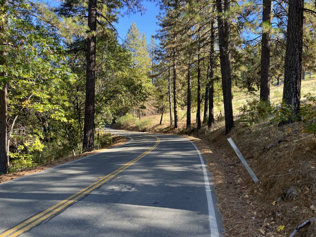
Scotts Flat Road
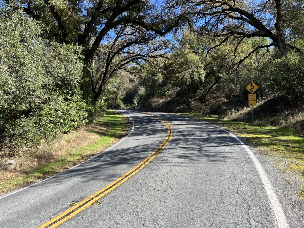
All this climbing is fairly mellow (you’ll see moments of 10%), and if that disappoints you you can opt for more difficulty, thusly: At the intersection of Willow Valley Rd. and Scotts Valley Rd. (not Scotts Flat Rd.), our route goes L and stays on WVR. If you want to test yourself, go R onto SVR. The next mile+ is consistently 10+%, with plenty of 13%, and it’s hard. If you go that way, you’ll lop off the descent down Scotts Flat Rd. (see below), so I suggest that when you reach the intersection of SVR and SFR you turn L, ride up SFR, turn around at Hwy 20, and descend SFR, because it’s really sweet. But if the rigors of SVR have slaked your thirst for climbing, go R on SFR and continue on our route.
Assuming you stayed on Willow Valley Rd., as our map does, you deadend at Hwy 20. All the extended climbing is over—the rest is downhill or rollers. Go R onto 20 and ride the short stretch to the intersection with Scotts Flat Rd. Hwy 20 Is straight and busy but there’s plenty of shoulder so it’s no problem.
Scotts Valley Road (which we’re skipping)
At the intersection of 20 and SFR, there’s a lot going on. You’re at a hub where many mountain bike trails meet, so you should see lots of MTB activity. There’s a famous little store that’s been there forever and caters to riders (mostly mountain bikers), the Harmony Ridge Market. They have good freshly-made sandwiches, along with the other usual stuff. Across the street is a new, snazzy resort, and in the parking lot is posted prominently a large map of the trail system in the area, which will inspire you to return if you’re a MTB-er.
Ride down Scotts Flat Rd. It’s a mellow and sweet descent on another small road in pretty woods and with houses set back discreetly among the trees. SFR is the main route from Hwy 20 to Scotts Flat Lake, so it may see a lot of recreational and boat traffic on summer weekends—I don’t know. I was there on Tuesday and Wednesday after Labor Day, and the road, campground, and marina were deserted.
Casci Road
Stay on SFR past the first of two recreational areas with campgrounds (signed with a small “Gate #1” sign and an arrow pointing you down the road toward Gate 2), ride past most of Scotts Flat Lake, and when you get to Gate #2—the marina and day use area—find Casci Rd. heading off on the L (clearly signed) and take it.
Casci Rd. is an odd duck that I really like. It hugs the shoreline, so you get lovely views of the lake through the shoreline trees, it looks manicured, and it’s absolutely barren of houses (except for one mansion). It’s lined with signs prohibiting parking, so it’s pretty quiet, but it’s also the downhill terminus for mountain biking trails coming down from Harmony Market, so on a summer weekend you’ll meet lots of MTB shuttle vans and pickups. They aren’t a problem.
Scotts Flat Lake Dam
Casci continues for several miles, but after it clears the lake it turns from flat to very steep and immediately turns to gravel, so at the unmistakable steepening our route turns around.
You may notice as you ride Casci that between you and the lake is a prominent parking lot. It’s the day use area for the lake, and you can access it by riding into the marina parking lot, riding through the campground via an unsigned, tiny road, and out the other side. It’s pleasant and adds perhaps a mile to your route. It’s one way to get your feet wet in the lake, but you don’t go there because Casci has lots of lakefront stretches that make getting to the water easy—you’ll see lots of umbrellas and cabanas.
hike-a-bike
Ride back to Gate # 1, a large and imposing campground with a large sign reading “Scotts Flat Recreation Area, Deer Creek Campground,” a very stout gate across the road, a guard station in the center of the gate, a large trailer for the campground host, and a lot of signage telling you you aren’t welcome. Believe it or not, you want to go in there.
Here begins our adventure. RidewithGPS glibly tells you to turn onto “Dam Rd.” There is no such thing. Instead, ride around the gate (There’s a little dirt path around the L end)., through the large campground and out the other end, continuing south and downhill toward the water. There is no signage to guide you, but common sense tells you where the dam has to be. Very soon you end up at a formidable gate across the lake’s dam. Here’s a map.
Pasquale Road
On the gate is the following remarkable statement: “Permission is granted for pedestrian or bicycle use for recreational purposes.” Thank you very much. Despite that spirit of accommodation, getting through or over the gate (you can’t go around) is difficult. There are two more gates like this one, so if you really hate lifting your bike over a gate, turn around.
Once over or through, ride across the dam on the rideable dirt dam top, enjoying the view of the lake. On the other side, several dirt roads set forth. Take the one uphill and directly in front of you (it’s rideable), and in 1/10 mile you’re at dam #2, the spillway dam. This one has fencing on the sides and a paved surface. On the other side, clamber over Gate #2 and take the dirt road, to the L. and along the shoreline. Eventually this road dead-ends at paved Pasquale Rd., but first you have to climb, at a pitch, for about 1/4 mile. On a gravel bike, it’s a sweet little burst of effort. On a road bike, it’s probably a walk. Either way, It isn’t painful—the woods are exquisitely beautiful in there, and the silence is delicious. At the end of the dirt road, climb over Gate #3 with another “Permission to pass…” sign and go R on Pasquale Rd.
We’re on the route of the Red Dog/Pasquale ride. Follow Pasquale to Red Dog, Red Dog (which turns into Boulder) to Nevada, and Nevada back to your car. Pasquale’s praises are sung in the other ride description. It’s one of my favorite bike rides anywhere, a uniquely charming contour through uniquely gorgeous woods. Red Dog, more developed, bigger, faster, is splendid in its own way, a 30mph+ ripper that’s the most exhilarating descending on the route.
As mentioned, Nevada St. is a stiff little climb, and if you want to ride around it just continue past it, cross the bridge into Nevada City proper, immediately go R onto Coyote St. and L on Washington St., which runs you back into Nevada after the tough climbing is over.
If you’ve already ridden the Red Dog/Pasquale ride and don’t want to repeat yourself (which I frankly cannot imagine), when you get back to Gate #1 don’t turn into the campground, continue west on Scotts Flat Rd., ride either down Scotts Valley Rd. (short and steep) or up Scotts Flat Rd. and down Willow Valley (longer, mellower, with climbing), and back on Willow Valley Rd. to your car.
Shortening the route: 1) Omit Casci Rd. 2) Ride the Scotts Valley Rd. cut-off instead of upper Willow Valley and upper Scotts Flat. 3) Ride to the Willow Valley Rd./Hwy 20 intersection and turn around. You can skip the Pasquale half of the route and ride back the way you came out, but I don’t think it reduces the mileage total. You can save a few miles by taking Scotts Valley Rd. on the return trip, but it’s a steep, fairly straight, and rather bumpy plunge I don’t enjoy.
Adding miles: You can add the other half of the Red Dog/Pasquale route. For other options, see the Adding Miles section of Red Dog/Pasquale. From Nevada City it’s about 3 miles to Grass Valley and the turn-around for our Dog Bar ride and the trailhead for our Lower Colfax Road ride.
I am not a big fan of cycling in the region north of Placerville. The roads look great on a map—Lotus, Greenwood, Wentworth Springs, Georgetown, Gold Hill, Marshall, Cold Springs, and the rest of them—but they’re all bigger, straighter, more built-up, and busier than the roads in the southern Gold Country, and the landscape is tamer. Don’t get me wrong—most of the roads in this area are pleasant enough, just not Bestrides-special. Thus there are only two Bestrides rides in this area, this one and Mosquito Road.
And this one has its drawbacks. The big climb is a grind, two of the five roads on the route are busy with traffic, and the big descent is too steep to be fun unless you have disc brakes. It’s also short, though I will show you one way to extend the route in Adding Miles below, and it links up easily with our Mosquito Road loop, which is a better ride.
Still, it’s in Bestrides, so it obviously has merits, namely two small, deserted roads, one sweet wooded meander, a great swimming hole, proximity to a pleasant, under-the-radar Gold Country town (Garden Valley), and an interesting preserved 49er village at the heart of California’s history as a starting/stopping place. Also, the two unpleasantly busy legs are both very short.
The numbers suggest the ride is a moderate climbing effort, just over the 100-ft-gain-per-mile benchmark, but it’s harder than that, because almost all of the 2000 ft of gain is in one 2.3-mile pitch.
You could ride this route backwards. You’d replace a 8-12% climb with a 12-16% one, and replace a 12-16% descent with an 8-12% one. Your call.
Start in the tiny town of Coloma, famous for being the site of Sutter’s Mill, where gold was discovered in California. Almost the entire town is the Marshall Gold Discovery Historical Park, with a recreation of the lumber mill in which gold was found, a blacksmith shop with chatty blacksmith (note the Acme anvil, a nod to Roadrunner cartoons), several preserved 1850’s buildings, a visitor center, a museum, a old-timey theatre, and gold panning lessons. So you won’t be bored after your ride. There is ample parking at the Historical Park, but it costs $10 and there is plenty of free parking along both sides of the Main Street.
Prospectors Road: pretty much all like this
Beginning here has the advantage of ending here, but it also has the drawback of giving you almost no time to warm up before the killer climb, so I do the 10-mile Thompson Hill Rd. loop described in Adding Miles to get loose.
Ride northwest on Hwy 49 briefly, take Marshall Rd. to the R, and take the almost-immediate L onto Prospectors (no apostrophe) Rd. Prospectors is a very small road paralleling Marshall, often so close to it you’ll think the cars on Marshall are behind you, and it’s steep, 8-12% without a break for 2.3 miles. There is no reason for vehicles to be on it, so you should have it to yourself. The scenery is fairly stark—dry scrub—and the contour is fairly straight, so the rewards are mainly the isolation and the sense of accomplishment.
Prospectors runs back into Marshall. Go L for a brief, forgettable stretch and take Garden Valley Rd. to the R. You’ll pass an seductive turn-off for Mt. Murphy Road, but last I heard it was largely dirt. At the GVR intersection you’re yards from the village of Garden Valley, well worth a detour, with a nice plant nursery if you’re of a mind to do the rest of the ride with a potted plant in your jersey.
Garden Valley Road
Garden Valley Rd. is delightful, pleasantly rolling without making you work through some very pretty foliage and light traffic.
GVR dead-ends at Hwy 193. Go R and suffer the steady traffic briefly until you reach Bayne Rd., which users of RidewithGPS insist on calling “Bane”—search for it that way if you want to see longer routes that incorporate it. Take it to the R.
Bayne Road
Bayne Road is short, but it’s the stuff dreams are made on—tiny, isolated, pretty, and with an interesting contour. From east to west, it’s mostly down—at first gently, so it’s a roller-coaster through nice woods, then ferociously, 1.5 miles of nail-biting plummet that reaches 16% and is sometimes on the edge of a harrowing drop-off down to the South Fork of the American River. It’s bucket-list stuff if you have disc brakes—without them, the descent is so steep that stopping is almost impossible, and one dares not build up any head of steam. I was often doing 9 mph. Still, memorable.
One wonders what riding Bayne west to east is like. Most ridewithGPS routes go that way. It must be a pip of a climb.
At the bottom of the descent, Bayne runs along the river, and you can see some awesome swimming holes and rapids. There is no obvious way to get to the water from Bayne, but the map suggests that Serenity Lane on the north side or Johnson Ranch Road on the south might get you close.
Bayne bails out on Mt. Murphy Rd—go L, cross a historic bridge exactly as wide as an RV and no wider, and you’re back in Coloma. They have plans to replace the relic with a modern bridge without character, so do this ride soon.
Shortening the route: Since the sweetest parts of the route are Garden Valley Rd. and Bayne, you could ride both as an out-and-back, starting in either Coloma or Garden Valley, riding to the other, and returning. Of course in one direction you’re going to have to go up the Bayne wall.
Adding miles: As I said in the beginning, almost all of the roads around Coloma are too straight, big, and busy to be fun. But there is one short, very pretty little back road nearby, Thompson Hill Rd., and there’s a loop that incorporates it: from Coloma, take Lotus Rd > Thomson Hill Rd > Cold Springs Rd. Both Lotus and Cold Springs are large and busy, but the Cold Springs leg is almost entirely down, so it’s painless. Lotus, on the other hand, is a burden—a long, featureless big-road climb amidst noticeable traffic. It’s the price you pay.
At the intersection of Hwy 193 and Bayne on our route, you are just 3 miles down 193 from where 193 intersects our Mosquito Road loop, so it’s easy to do one ride that does them both as a rough figure-eight and turns two moderate rides into one big one.
Just east of our Hwy 193 leg lies a warren of small to very small roads, all worth riding: Shoo Fly Rd., Transverse Creek Rd., Bear Creek Rd., Spanish Flat Rd., Meadow Brook Rd., Balderston Rd., and the amazingly narrow Darling Ridge Rd. They’re all inter-connected—feel free to wander.
Distance: 26.5-mile lollipop Elevation gain: 2800 ft
The area around Grass Valley and Nevada City is a warren of pleasant, quiet, unflat, thickly wooded back roads, none life-changing but all worth riding and all pretty much the same. Bestrides has four routes in the area: Dog Bar Rd., Red Dog/Pasquale, Willow Valley, and this one. None of the four has any striking vistas or unique geological features—just nice quiet riding through pretty country. Of the four, my favorite is Willow Valley, and I’d do it first, then any of the others.
One of my favorite kinds of road is one that is paralleled by a newer, bigger road that has the same starting and stopping points. The newer, bigger road has all the traffic, the commerce, and the noise, and you’re left with the old, skinny, meandering, isolated track . This route has 3 such back roads, so you get a lot of tranquil riding—except for the two short stretches of Hwy 174, you pass nothing but occasional houses and ranches, and few of those. It also has a lovely road contour in its opening miles: not too steep, sweetly meandering, easy ups and downs through really pretty woods. This ride is at its best in the first 30 minutes, so if you don’t love it then, go ride something else, because it isn’t going to get better.
There are no long hills and only a couple of little steep grades on this route, but you do exceed the 100 ft/mile elevation gain threshold for difficulty, so you’ll be going up and down, albeit moderately, all the time.
There is no particular reason to begin this route at any particular spot. I begin near Grass Valley, because that’s where I am most likely to be housed. Begin at the intersection of Rattlesnake and Lower Colfax Road, which you ride through on our Dog Bar Road ride. Parking is a bit scarce, in small dirt turn-outs. Ride SE on LCR, the first of our parallel back roads. It parallels Hwy 174, so all the traffic is on the highway and you should have the place to yourself. For the first miles, it’s a lovely meander up and down on a sidehill of a small canyon, among trees that are lush and pristine—enjoy them now, because I’m sure the State of California will soon go in there and clear out all the underbrush and 2/3 of the trees in the interest of forest fire suppression. You’re gently descending overall, which means that the return ride is a mellow climb.
Lower Colfax Road
After a while LCR gets larger, wider, and more built up with houses, but it’s still nice. It dead-ends at Hwy 174, in an area called Chicago Park apparently. I know because there’s a charming, iconic corner mercantile there called Chicago Park Store. You’re probably not ready for ice cream yet, but it will be a sweet oasis on the return ride. I think it’s the only re-supply spot on our route.
Turn R on 174 for the short descent to Bear Creek. 174 is busy and straight, but the scenery is actually quite pleasant (see accompanying photo), and anyway it’s short. You’ll see a prominent sign pointing towards Rollins Lake to your L and encouraging you to take the side road, but don’t—it’s Rollins Lake Road we want, and that’s not it.
Lower Colfax Road
After crossing the large, unmissable bridge across Bear Creek, we’re going to do our second parallel back road: Old Grass Valley Road, paralleling 174. Don’t take the unsigned turn-off immediately after the bridge—continue uphill for perhaps a quarter mile and take the next exit to the L. It’s clearly signed.
Old Grass Valley Road is a tiny ribbon of pavement through dense forest. It’s quite steep in places, and the pavement is imperfect, as you’d expect on a road no one should be using. In other words, it’s a blast. Don’t fret the steepness—the road you’re avoiding by doing OGVR, Hwy 174, has exactly the same elevation gain, and it’s a lot less fun.
Hwy 174 has its moments
Immediate- ly after OGVR debouches onto Hwy 174, 174 seems to T. Go L, following the signs to Rollins Lake. You’re now on Rollins Lake Road, the main artery, and for the third time we’re going to take a parallel back road. A short leg down RLR, take signed Norton Grade Road (spelled “Norton-Grade Rd.” in Google) to the R. NGR is ignored by most maps, and it’s weirdly sandwiched between Rollins Lake Road to its left and Hwy 80 to its right—they’re so close that you can often see first one road then another as you ride, and when you can’t see Hwy 80 you can sometimes hear it—but miraculously NGR has a great sense of isolation, with almost no traffic, almost no development, and in fact not much of anything except trees and a lot of vertical (as one would expect from any road named “Grade”). Once it starts up, it’s all up for 3 miles. It averages almost 7%, with occasional steeper pitches.
When NGR seems to T, go L for 150 ft and T again on Rollins Lake Road. Take RLR to the L.
Rollins Lake Road is in many ways the mirror image of NGR: it’s bigger, wider, straighter, smoother, and more manicured. The first few miles of the return are a dreamy, effortless descent, a constant 25-30 mph where you won’t push a pedal or touch your brakes. Once the descent is over, there’s a surprising amount of climbing back to Hwy 174, and, since the road is so domesticated, it isn’t much fun. By the way, despite the name, you get only one brief glimpse of the lake on either RLR or NGR.
There are at least two alternatives to riding the NGR/RLR loop as I’ve mapped it. If you prefer small/isolated/curvy/slow to the alternative, you can ride Norton Grade out and back and skip Rollins Lake Road entirely. Or, if you like small/curvy for climbing and larger/straighter for descending, do what the friend of Bestrides who suggested this route does, and ride the loop as a figure-eight: ride east (descending) on Rollins Lake Road to Glen Elder Road, which is a short connector between RLR and Norton Grade. Take Glen Elder to Norton Grade. Continue east (up) on NGR to the top of the loop, descend on RLR, cross over on Glen Elder, and return to 174 via Norton Grade. This way all the descending is on the bigger road and all the climbing on the smaller.
Old Grass Valley Road
If you’re like me you’re expecting the return ride on 174 to be boring traffic hell. Not so. The ride back to the Bear Creek bridge is actually grand, a fast, glassy-smooth slalom descent where the traffic won’t bother you because you’re going as fast as or faster than they are. So I don’t recommend Old Grass Valley Road on the return, but it’s there if you abhor highway riding of any sort. Once over the bridge, 174 is…yeah, pretty much boring traffic hell, and all up to boot, all the way back to the Lower Colfax Road turn-off.
Back at the Chicago Park Store, eating your ice cream, you have a choice. The beginning of Lower Colfax Road is also the beginning of Mt. Olive Road, a lovely, precious little connector between 174 and Dog Bar Rd. It’s mostly dirt, but if you’re set up for it, and you prefer loops to out and backs, I encourage you to take Mt. Olive to Dog Bar and up Dog Bar and Rattlesnake back to your starting point. See our Dog Bar ride for details.
Mt. Olive Road
Assuming we’re sticking with our mapped route, the ride back up Lower Colfax is delightful. In fact, once you clear the houses and ranches in the first miles, I like LCR as much going up as I do going down. It’s never work, and the slower speed lets you take in your surroundings. The last miles are nearly flat and especially pretty, so you return to your car in the best of moods.
Shortening the route: Ride Lower Colfax Road as an out and back, or ride the LCR/Mt.Olive/Dog Bar/Rattlesnake loop.
Adding Miles: The simplest way to extend this ride is to add Dog Bar/Rattlesnake to the route—instead of returning on 174 north when you get off Rollins Lake Road, take 174 south and work your way through Colfax and over to the southern end of Dog Bar and ride it north.
A shorter extension is the Tokayana Loop, a sweet 7.1 loop just SW of Colfax (thanks, Doug). Ride Tokayana to Milk Ranch Road, which turns into Plumtree Rd., to its deadend at Placer Hills Rd., then go L on PHR, which turns into Tokayana. It’s all sweet riding. Milk Ranch plunges fairly steeply down to the pretty Bear River, which I’ve never heard of before, follows it for a while, then climbs back out. MRR is a deliciously tiny back road, but Bear River is developed for recreation (campground, parking lot) so Plumtree sees a surprising amount of traffic later in the day on warm weekends. Early mornings or weekdays are advised. If you’re adding Dog Bar to the Lower Colfax ride, you can add Milk Ranch Road effortlessly, since you’re riding right past it.
At the eastern-most point in our ride you’re 8.8 miles via pleasant riding from our Drum Power Station Road ride. See that ride’s Adding Miles for details and connector map.
The Grass Valley/Nevada City area is a warren of back roads, all worth riding. See our Dog Bar and Red Dog/Pasquale rides’ Adding Miles sections for names of good roads, or just wander.
Distance: 69 miles out and back Elevation gain: 5018 ft
This ride goes through some of the prettiest scenery in the Sierra hill country. It’s 31 miles of climbing, but I promise it’s doable, typically 1-4% and only momentarily over 5%. If that’s still daunting, it’s an easy route to edit—see Shortening the Ride below.
One caveat up front: I strongly recommend you do this ride in October, for two reasons: 1. the leaves of the maples and aspens are changing, which jacks up the gorgeousness level about ten-fold. In spring and summer the forest is just, well, green. In winter you’ll hit snow. 2. Hwy 49 can be busy, and, while the road isn’t narrow so passing is possible, I find the traffic (fast, aggressive) noisome. Downieville is a zoo in the summer, thanks to its excellent mountain biking, and Indian Valley is a string of popular campgrounds. October, almost no one is up there. In October, this ride is A-level; any other time, I don’t think I’d do it at all.
Our route begins with some nice fir/pine forest, does a very sweet 3-mile descent, follows the north fork of the great Yuba River for 10 miles, sees some good rock, climbs easily to the charming mountain community of Downieville, then does 12 miles of easy-to-moderate climbing to the equally charming but less touristy town of Sierra City. The road is consistently shoulderless but wide two-lane, roomy enough to allow safe passing, with a good road surface, and varying from fairly straight to fairly curvy. The riding is never exhilarating—even the descending is mellow—but it’s continuously charming and gorgeous (in October).
Despite its whopping elevation total, this route has something that’s very rare among Sierra mountain rides: flatness. For 10 miles along the river (20 miles round-trip), there isn’t a single significant pitch. For most of those 10 miles the climbing is imperceptible, and the occasional short rise is never worse than 2-3%. If you keep finding mountain rides in Bestrides that sound delicious but have off-putting elevation gains, that ten-mile stretch is for you.
There is an endless amount of rideable road north of Placerville, but most of it is just-OK, generic green-wall riding. This route has some real drama. It’s a short, serious climbing route, the bulk of it on a small, energetic back road. You plunge down to the bottom of the American River canyon, cross the river, climb steeply back out the other side, roll up and down along the side of the canyon, do a fast drop on a moderately traveled mountain highway back down to the same river, and end with a challenging 1000-ft climb. Along the way you get some nice woods, some nice canyon vistas, and a lot of nice solitude. It’s 3540 feet of gain in 24 miles of riding (which means 12 miles of climbing), so you’ll work.
There’s a possible issue with car traffic. When I did the ride I saw no cars at all, but that was some years ago. Now there is an active community at the intersection of Mosquito Rd. and Rock Creek Rd., with a population somewhere between 1000 and 2000 folks, and they have to get in and out, so you may meet some traffic on RCR.
Begin in downtown Placerville. It’s a town well worth some checking-out time. Don’t miss the hardware store, one of the oldest in the West and a bit of living history guaranteed to delight tool fetishists and non-fetishists alike. Ride east out of town on the main street and when you’re almost out of town take the L turn under the highway onto Mosquito Road. Climb steadily and moderately for 2.5 miles, until you’re at the lip of the South Fork American River Canyon. From here to Hwy 193 there should be next to no traffic. Plunge 4 miles down through thick, pretty Sierra Nevada foothill woods to the river. The pitch is often too steep to be ideal descending, but it’s still exciting. The last 100 yards are very steep and can be wet and treacherous.
Crossing the American River
Cross the river on a charming little bridge and begin the grinding climb up the other side. It’s very steep for 1/2 a mile, then just steep for another 2 miles. You’ll feel some pride when you get to the summit at mile 9.0. At the intersection you encounter an unexpected cluster of mountain estate homes. This is the historic community of Mosquito (pop. 1000+), also known by the name of Mosquito’s most prominent housing development, Stansboro Country. Google “Mosquito CA” for some interesting background. Take the unmissable hard L onto Rock Creek Rd. and follow it as it rolls sweetly along the sidehill. Enjoy the striking vistas of the river canyon.
American River canyon from Mosquito Road
When you deadend at highway 193 (Georgetown Rd.), go L and delight in the all-too-short but smooth, fast, sweeping descent back down into the canyon. Cross the bridge and do a moderately challenging 2.5-mile climb back to town. You’re on the shoulder here, the traffic will be noticeable, and the pitch is unvaried, but you’re in pretty, dense forest so the scenery is good. On the outskirts of town you’ll merge with Hwy 49 (Coloma Rd.) but you won’t notice.
The route can be ridden in the other direction, but it will involve you in a 40-mph descent right off the bat, which I’d rather not do.
Adding Miles: The larger roads north of Placerville are merely good riding and all pretty much the same green-wall stuff. But just a stone’s throw north of our intersection with Hwy 193 lies a warren of small to very small roads, all very isolated and worth riding: Shoo Fly Rd., Transverse Creek Rd., Bear Creek Rd., Spanish Flat Rd., Meadow Brook Rd., Balderston Rd., and the amazingly narrow Darling Ridge Rd. They’re all inter-connected—feel free to wander. Mt. Murphy Rd., bisecting our route, is largely dirt.
Georgetown is a cute little village with a nice old general store and hotel, and Garden Valley has a wonderful plant nursery.
Apple Hill woods
If you’re looking for something mellow, ride the loop through Apple Hill (so-called because every fifty feet of road there’s an apple farm). Begin at the intersection of Union Ridge Road and Carson Rd. Go Hassler Rd > North Canyon Rd. > L on Larson > L on Cable > R on Mace, then R onto Carson and take Carson back to your car. Carson is bigger, flatter, faster, and more trafficked than all those back roads, so stick to it if you’re really looking to avoid up and down. This is not a ride to attempt during apple harvest, when the area is mobbed with tourists.
Where our route intersects Hwy 183 , you’re a mere 3 miles south on 183 from where our Prospectors Road to Bayne Road route turns onto Bayne. So it’s easy to do both routes as a single ride, a rough figure eight, thus turning two moderate rides into one big one.
(Note 9/22: In 9/22 the Mosquito Fire burned a large area with this ride at its very center. I haven’t seen the damage, but the flora must be devastated. Of course the rock formations and road contour will still be there. jr)
This is one of the prettiest mountain rides in Bestrides. For the first 22 miles, you’re treated to views of a large river canyon on one side of the road and stunning multi-colored rock walls on the other. If you’re a rock lover, this and the Kings Canyon ride will be your favorite rides, ever. And the road is one continuous lazy serpentine—downhill, it’s 25 miles of buttery-smooth slalom course. The only thing that keeps it from being the ride of your life is that it’s also 25 miles of almost unvaried, fairly monotonous 4-6% climbing—never difficult, but a bit tedious. Luckily you can take your mind off the monotony any time by looking at the scenery on either side of you. No distractions here—no inns, no houses, no waterfalls—just you, the road, and the canyon.
A reader tells me that the end of this route before the turn-around is unplowed in winter.
The route couldn’t be simpler: from downtown Foresthill, CA, a small ridge-top mountain town with all the amenities, ride down Mosquito Ridge Road to the turn-off to Big Trees Grove. Turn around and ride back.
Out of the gate you plunge into a joyous, easy 9-mile descent from the top of the ridge to the bottom of the American River canyon, with open views of the majestic canyon on your R and more and more colorful rock walls—red, blue, purple, yellow, gold, black—on your L. The scenery will steadily improve for the next 14 miles. The pitch is a consistent 4%, good for a descending speed of around 24 mph and mellow enough that you needn’t dread the climb back out.
Cross the big steel bridge over the river. Now you climb, without interruption, until the turn-around point, at a slightly steeper pitch than what you just came down—5-6%, which will give you a sweet 30-mph descent when you turn around. At 11 miles in, you reach a junction with a smaller road, named Blacksmith Flat Road (signed with a number, FR 23, but no name—there’s a sign on Mosquito Ridge Rd with the name after the turn-off, so you’ll see it when you’re returning), on the R. If you take the southern loop option discussed under Adding Miles, you close the loop here, or go R onto 23 if you’re going counterclockwise. But we aren’t doing that today.
Keep climbing up the south wall of the canyon, as the canyon vistas get grander and the rock walls get more varied and colorful. The best scenery is from around 12 miles in to 14 miles in, so if you’re out for a shorter day try to make it that far, or drive to the bridge and start there. At about 17 miles in, you reach the top of the ridge, swing R, cross the ridge into the canyon to the south, and ride along the northern wall of the new canyon. The varicolored rock displays are all behind you, but the new canyon is, if anything, grander than the first one.
About 21 miles in, you ride out of the canyon and into standard prime Sierra forest, no better or worse than any other pristine Northern California woods, and the pitch shallows to imperceptible climbing. Feel free to turn around—you won’t miss anything wonderful if you do. Pass the oddly named Interbay Rd on the R and in a few miles you’ll be at Big Trees Grove. The Grove has some nice giant sequoias, but you have to hike a 1/2-mile trail to see them, so unless you brought walking shoes there is little point in riding the 1/2-mile (paved) road to the picnic area, unless you need a drinking fountain or a bathroom—there’s one of each (but see Afterthoughts below).
Rock lover’s paradise
Turn around and ride home. Soon you will notice something about the road contour if you didn’t notice it on your descent to the bridge: you don’t need brakes. There are no hairpins. Every curve, with the exception of one obvious 180 at 11 miles in, is rounded and lazy, so you never need to scrub speed. You can ride from Big Trees to the bridge—15+ miles—and never drop much below 30 mph (minding that one corner). You don’t have to brake, you don’t have to pedal if you don’t want to, you never speed up or slow down much—you just sit there, leaning the bike from side to side, carving esses. Dreamy.
There’s a reason for this. The road was built for logging, so it’s wide (for a two-lane), smooth, gentle of pitch, and lacking tight corners that would slow a logging truck down. The downside of all this is that, while the road is almost without other traffic, you may meet loaded logging trucks and other large equipment. But the road is roomy, the sightlines are good, and you can hear the trucks coming, so they aren’t a problem here, though having one pass you on the 10-mile climb back to your car, where the road can be narrower, does elevate the heart rate a bit.
Back at the bridge, you’re looking at 9+ miles of climbing, and if you’re tired that can seem daunting. But it’s not bad. It’s never more than 4%, so you can maintain 6+ mph even with tired legs, there are no soul-crushing straightaways, the rock walls are a constantly entertaining distraction, and there’s a sweet 1-mile descent right where you need it most, halfway up. The whole thing won’t take more than 80 minutes of leisurely spinning.
Shortening the route: The best scenery is around 12-14 miles in, so plan to go that far or drive to the bridge and start there.
Photo by Brian
Adding miles: If you want to ride on past Big Trees there is no reason not to. Eleven miles further down the road is French Meadows Reservoir. You can ride there and turn around, or you can do either of two loops, both more challenging that the ride I’ve mapped out here. Loop 1 forks L a few miles after Big Trees Grove and takes Road 43, Robinson Flat Rd, which was or is largely dirt, until it runs back into Foresthill Rd, which you no doubt took to get to the town of Foresthill. Just go L and follow Foresthill Rd west back to town and your car.
Loop 2 is tougher. Ride to French Meadows Reservoir, cross the dam, and immediately turn R at the fork onto French Meadows Rd. Follow it through some name changes back to its intersection with Mosquito Ridge Rd (by which time it’s named Blacksmith Flat Road, or Rd 23), which you passed 11 miles into your ride. Go L and return on Mosquito Ridge Rd to your car. This is a long, demanding ride with some fierce climbing, and is often done counterclockwise to cash in on that 15-mile descent after Big Trees. The good folks of the Sierra Foothills Cycling Club have provided a detailed ride log.
You are a few car miles down the road from the back door to the Iowa Hill Road ride, and if you want more miles after any one of these three options, my hat’s off to you.
Afterthoughts: Plan your water carefully on this ride, especially if you’re doing one of the bigger loops. There are only two water sources, Big Trees Grove at our turn-around and French Meadows Reservoir 11 miles further on, and both taps are shut down off-season. I take a third water bottle and drop it at the bridge for the return climb, but even this would be inadequate on a hot summer day.
Distance: 27-mile lollipop Elevation gain: 1500 ft
If you look at a good map of the area east of Lincoln, north of Newcastle, and west of Hwy 49, you’ll see a little patch of squiggly lines. If you drive past the area on any of the highways (193, 80, or 49) you’d never guess there was any good riding there, but this is one of my favorite places to ride. It’s not a single road or route—it’s a cozy little network of crooked roads working their way through pretty, moderately hilly hobby farm country. The area is small enough that you can ride all the good stuff in an outing, and every road is fine. Just go explore. The joy is that the scale is so small—the riding is always changing, you’re constantly turning onto a new road, none of the climbs last too long, etc. You’ll see on the map that the roads to your west, just east of Lincoln, straighten out and scribe rectangles, which tells you the land has turned into flat, conventional ranch country. If you like flat and grassy, these roads are perfectly pleasant. But that’s not what brings me to the area, so I don’t go there.
Here’s a route that covers most of the good stuff: Start at the intersection of Virginiatown Rd. and Fowler Rd. Just park on any wide spot of shoulder. Riding counterclockwise, ride east on Virginiatown (pause to read the plaque on the Virginiatown historical monument), R. on Gold Hill, L. on Ridge, continue on Ridge until it ends at Taylor (no sign), L onto Taylor for 100 ft, L onto Ophir (signed), L on Lozanos (at the fueling station), R when Lozanos T’s, an immediate L onto Bald Hill, L. on Mt. Vernon, L. on Baxter Grade, continue onto Wise, then a hard R on Chili Hill Rd., which turns into Virginiatown and your car.
There are only two significant climbs in this area, Bald Hill Rd. and Baxter Grade, both uphill heading north. If you don’t feel like working, plan a route that avoids them. The other side of the coin is, Baxter Grade is the one whoop-and-holler descent in the area, so if you’re looking for that thrill, plan a route that takes you to the top of it, as my route does.
I was introduced to the Lincoln Hills by the Tour de Lincoln, a friendly, enjoyable metric century put on annually by the locals. But the century only spends about 1/3 of its time on our prime roads, and the other 2/3 riding through other, less-good roads. So you miss half the good stuff and spend a lot of time on the OK stuff. Which is the typical downfall of centuries, and which is why I don’t do many centuries.
Shortening the route: Skip the Virginiatown Road lollipop stick. Crater Hill Road, which isn’t on our route, is a short connector that lets you ride either the top half or the bottom half of our figure-eight as a loop. I see no reason to recommend one loop over the other.
Adding miles: From the Lincoln Loop you can easily and pleasantly ride to the Dog Bar Road ride and the Iowa Hills ride. Just ride north and east via the small roads of your choice, working your way to Placer Hills Road, which will take you to both rides. Dog Bar connects to our Lower Colfax/Rollins Lake Loop ride. By car you’re about 25 miles from the Mosquito Ridge Road ride. See Doug’s thoughts in the Comments section about adding the Indian Hill area just to the south of our routes.
Afterthoughts: For some reason a lot of paper maps don’t show some of the Lincoln Hills roads. Even Mapmyride pretends some of them don’t exist. Trust me, they’re all there, they’re standard two-lane country size, and all the road surfaces are good. The AAA map of the Gold Country shows the area well (as well as all the other Gold Country rides in our list).
There are no services in the network proper, but you’re a short ride from two tiny towns worth visiting, Newcastle and Penryn. Newcastle is a small spot of upscale charm where you least expect it: a nice deli and other amenities prettily ensconced in some restored old buildings. Penryn used to be regionally famous wth cyclists for Trailhead Coffee and Cycling Lounge, but it’s now closed—Yelp says Red Barn Roasting has moved in, but I can find no trace of them.
Distance: 45 miles out and back Elevation gain: 4290 ft
This ride, like all the riding in the Grass Valley/Nevada City area, has very little “wow” factor—no grand vistas, no towering monoliths. But it is an exceedingly pleasant bucolic stroll, gradually ascending through foothill woods, meadows, and horse farms, with lots of variety to the contour. The landscape is quite handsome, and particularly so in the spring when things are green. The level of traffic is more than I would wish, even on weekdays, but it’s hardly a deal-breaker. And you turn around in Grass Valley, a community I’m very fond of.
It’s 22 miles of almost uninterrupted up, but it’s all mellow—less than 100 ft per mile—and I don’t think of this ride as a lot of work. The descent coming back down Rattlesnake Road has wonderful, whoop-inducing moments and is almost good enough to make the Best of the Best list.
There are four Bestrides rides in the Grass Valley/Nevada City area—Dog Bar, Red Dog/Pasquale, Willow Valley, and Lower Colfax. They are all pleasant up-and-down strolls through nice woods. Dog Bar has the best descent (on Rattlesnake), but it’s also the most built up. Dog Bar goes to Grass Valley, which is a plus. Both Willow Valley and Red Dog/Pasquale begin and end in Nevada City, which is a plus, and both go through the prettiest woods. Of the four, Willow Valley is the best and I’d ride it first, then any of the others.
(5/17 update: I rerode the route on a Sunday, and was disappointed by the level of traffic.)
From Clipper Gap, CA, take Placer Hills Rd. north. This leg of the ride is more domesticated than Dog Bar—wider, busier, smoother (recently repaved)—but lovely, and, depending on your tastes, possibly your favorite part of the ride. Take Dog Bar Rd. when it takes off to the L. Almost immediately you will plummet for a mile down to a small bridge across the Bear River, the nearest thing to high drama on the ride. At the far end of the bridge is a small dirt turn-out, and from there a footpath goes upriver to a spectacular stretch of river strewn with big boulders, perfect for swimming in the summer—all of which is a strong argument for starting the ride here, so you can switch to hiking boots and hit the river after the ride.
Nothing fancy—just a really nice road
From the bridge Dog Bar climbs pretty steadily to the end, but not one foot of it is steep, and there are plenty of rollers to give the legs some respite. In fact, this may be the only ride in Bestrides.org where I feel like Mapmyride’s elevation gain total overestimates the work load (RWGPS says 3920 ft).
There are three options for the last miles into Grass Valley. If you’re keen to get to Grass Valley as soon as possible, stay on Dog Bar, which runs into La Barr Meadows Rd., which runs straight into downtown. But there are two better alternatives. The first: Two-thirds of the way up Dog Bar, Rattlesnake Rd. takes off to the R (clearly signed). Rattlesnake is much the better ride: smaller, windier, steeper, a bit less built up, and less trafficked. When Rattlesnake dead-ends at Hwy 174, take 174 to the L and into Grass Valley. That’s how I’ve mapped it. The second: If you want easy and charming, where Dog Bar runs into/turns into La Barr Meadows Road, take LMMR to the (hard) L and follow it over to Allison Ranch Rd. Take ARR north to Grass Valley.
For lunch in Grass Valley, you have lots of good choices, thanks to the town’s recent modest gentrification. If you want old school, have a pasty (pronounced PASS tee), the traditional lunch of the Cornish miners who dug the gold out of the nearby hills.
Turn around and ride home. Of our three route choices, Rattlesnake is by far the best, a really fine slaloming descent, so go back this way however you went out. If you like loops, ride to Grass Valley via Allison Ranch Rd and back on Rattlesnake. The ride back is almost entirely downhill and a piece of cake except for the mile of climbing on the far side of the Bear River. After the ride, drive back to that bridge on Dog Bar and go swimming.
Shortening the route: If you want tranquil, ride Dog Bar Rd. to Rattlesnake and return. If you want exciting, ride Rattlesnake out and back. If you want short, easy, and charming, ride Allison Ranch Rd. by itself.
Dog Bar Road
Adding miles: There is a lot of good riding around you on this ride. Our route takes you within a stone’s throw of the Iowa Hill Road ride. From Clipper Gap it’s a pleasant ride on side roads paralleling Hwy 80 heading south to the Lincoln Hills ride. From Grass Valley you’re only 3.5 miles from Nevada City, site of our Red Dog/Pasquale ride and everything in the Adding Miles section under it. To get to Nevada City, ride NE on Main St, which turns into Nevada City Hwy, which turns into Zion. It’s not a 3.5 miles I enjoy.
A mile or so past the Bear River bridge on our outbound route, Magnolia Rd. takes off to the L (clearly marked). It’s a manicured, picture-perfect road well worth riding until you near Lake of the Pines, when all sense of tranquility and isolation ends and you should turn around.
Where Rattlesnake Rd meets Lower Colfax Rd. you’re at the start of the Lower Colfax Rd/Rollins Lake Loop ride. You can follow it until it starts back north, and instead take 174 south to Colfax, then take Tokayana to Placer Hills Rd. and PHR back to Clipper Gap and your car. Of course you’d be giving up the lovely Rattlesnake Rd. descent. If this route sounds attractive but a bit much, drop the Rollins Lake loop, which will save you about 9 miles and 1000 ft of gain.
A shorter version of the Dog Bar/Rattlesnake/Lower Colfax/Rollins Lake loop goes up Dog Bar to Mt. Olive Rd. and takes MOR over to 174. But there are two downsides to this route: 1) it gives up the leg from the top of Lower Colfax to 174, which is one of the best stretches of road in the area; and 2) the western half of Mt. Olive is frankly a bitch—steep, loose, rutted, rocky dirt.