
Distance: 21 mi. lollipop
Elevation gain: 1875 ft
If you’r’e like me, you’ve driven past Clear Lake many times, but you’ve rarely gotten off the three highways that circumnavigate the lake: Hwy 20 on the north shore, Hwy 29 on the south shore, and Hwy 58 on the east shore. Now is the time, because on the peninsula that juts into the lake heading west from the town of Clearlake (no space) there is a lovely little network of roads crying out to be ridden.
Clear Lake has two outstanding rides: Clear Lake to Cobb and this one. The two rides couldn’t be more different. The ride to Cobb is a sweet steady climb through lush forest to a tiny mountain community and back. This one is a mix of riding conditions—some small-town streets, some flat shoreline, some short steep rollers, and some climbing through dry (though pretty) oak-and-grass landscapes with big vistas of the lake below you and in the distance. And there’s some history here as well—the eponymous Sulphur Banks, where Native Americans and later Europeans dug for Cinnebar, Sulphur, Borax, and Mercury, and one of the oldest archeological sites in the US, with signs of habitation dating back 12,000 years!
It all starts in the town of Clearlake. It’s a conventional little town, with a fresh spritely energy. It’s the kind of town that has several barbershops, all called something like Clearlake Barber Shop. You won’t find artisanal bakeries, and I’ll bet the locals don’t know what a “barista” is. I like it a lot. So I’ve started the ride in the center of town, at the unmissable Austin City Park, where there is plenty of parking, so I could include a few miles through downtown streets. If you’re not hot on riding busy streets, fear not—Shoreline Drive, the first leg of the route, gets quieter, prettier, more interesting topographically, and more isolated the farther west you go.
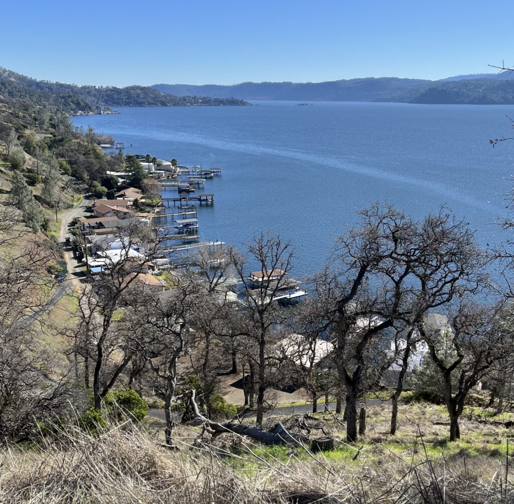
Throughout its length Shoreline alternates between hugging the waterline through enclaves of small lakefront vacation bungalows, each with its own ramshackle pier, and climbing up the hillside for nice views of the lake and the bungalows below you.
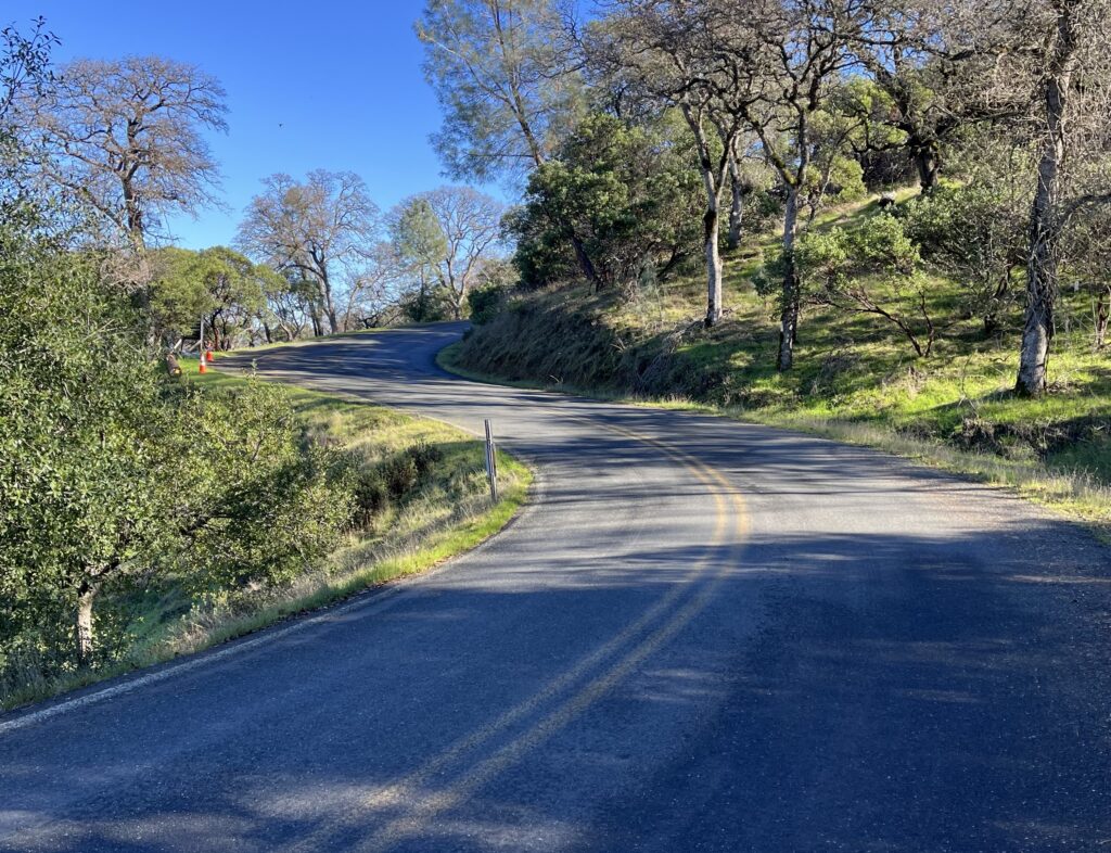
Shoreline ends at an intersection with North Rd., and we are eventually going R onto North, but not yet. An obviously secondary road continues westward (the direction you’ve been riding in up to this point). Signed as Crestview Rd., it’s short but choice and you should ride it. it’s a little narrower, a little steeper, and a little more meandering that what you’ve done, and the vistas of the lake are ideal. It ends at a gate and a “private community” sign. Speak a curse on the moneyed elitists and turn around..
Back at North Rd., take it. It’s very different from Shoreline, in that it’s not along the shore—it’s up the hill, so the shore, the bungalows, and the piers are well below you and usually out of sight. It’s almost completely untouched wilderness. Because it doesn’t have to follow the shore, it’s flatter than Shoreline, which means it meanders side to side more. It’s perfect riding, and I don’t think I saw a vehicle. It ends all too soon at Sulphur Bank Drive.
A word about ride scheduling: North, as its name implies, is on the north side of the ridge, which means it’s in shadow for most or all of the day. This is a lovely thing on a hot summer’s day, but in the winter it means it’s probably wet. On the January day when I rode it, with no rain at all in the recent weather systems, it was still soaking wet from dew at 2 pm and slippery as a result. On the other hand, in the winter the oaks have dropped their leaves (still gorgeous) and so the vistas on North Rd. and Sulphur Bank are superior.
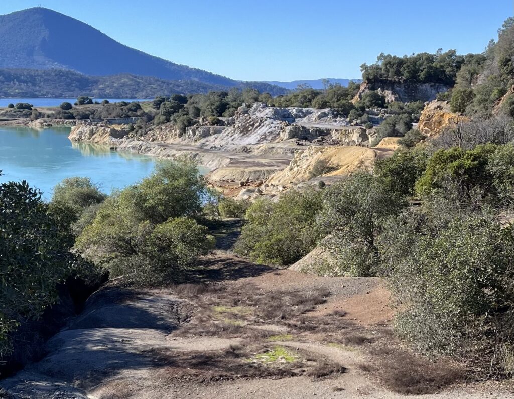
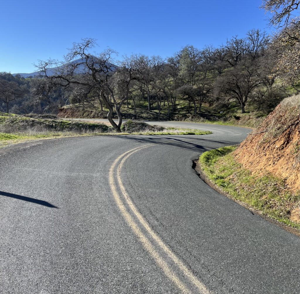
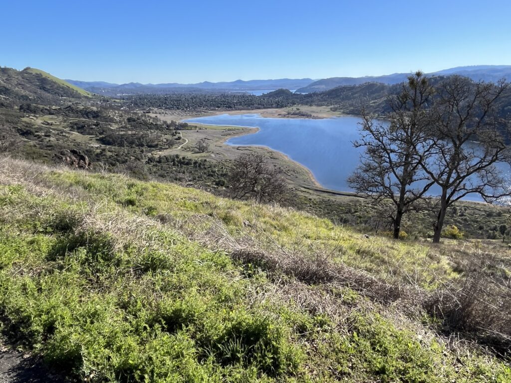
At the intersection of North and Sulphur Bank, you go L onto Sulphur Bank. You’re already near the summit of the SBD climb, but what remains is cherry, with great views of Borax Lake, the town of Clearlake, and the south arm of Clear Lake itself on your right and far below you. The back side of the hill is ideal riding, both climbing and descending—a little over a mile of 6-7%, with constant esses. As soon as you start down you get grand views of the north arm of Clear Lake, the community of Clearlake Oaks, and the Sulphur Bank between you and them. The bank, a shoreline hillside prominently dug away, is actually down a side road, Sulphur Bank Mine Road, signed with many protestations of privacy and promises of dire punishments meted out to trespassers, but the good views of the bank are a mere 1/8th of a mile down the road and you can easily pop down and poach a look-see. You can read about the history of the Bank here.
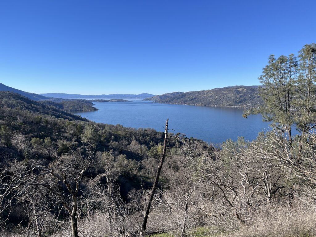
At the bottom of the hill you roll through pretty ranch land to a T at Hwy 20, and you turn around and climb back to the summit. The descent from the summit to Borax Lake is the stuff of dreams—1.6 mi. of serpentining so good I’d put it in Bestrides’ list of Best Descents if it were a bit longer. At Borax Lake you can look around for the archeological site but you won’t see it—you can read about it here. At least try to wrap your head around the idea of humans living their lives here 8,000 years before the early Egyptians.
Shortening the ride: You’ve got two excellent options. You can ride Sulphur Bank Drive alone as an out and back. You can ride the Shoreline/North loop by itself, which gives you much less climbing.
Adding miles: Along the spine of the peninsula runs Crestview Rd. It forks off from Shoreline a few miles into our ride and returns to Shoreline right at the North Rd. intersection. It’s mostly dirt, but it looks to be good dirt. It’s on my to-do list. Oddly (for dirt), it’s covered in Streetview, so you can preview it. I don’t know of other good riding in the immediate vicinity. The Clear Lake to Cobb ride discusses good riding further afield.
Our route cuts off 2/3 of the south-side Sulphur Bank Drive climb, and it’s a very sweet climb, so you might like to turn around when you get to Borax Lake, climb back up to North Rd., and turn around again. That way you’d get to do most of the grand Sulphur Bank descent twice.