Distance: 25-mile dumbbell
Elevation gain: 3340 ft
(A Best of the Best ride)
(A Best of the Best descent)
April 2025 note: sometimes road surface is everything. I’ve always liked this ride, but felt I had to apologize for the lousy tread of the descent down Howell Mountain Rd. to Pope Valley and the less obnoxious tread problems ascending Ink Grade. Happily I can now report that both roads have been gloriously resurfaced, are now glass, and are now both wonderful riding. That elevates the ride from good to great—hence the Best of the Best rating. Even better news: now that Ink Grade is glass, it’s become a top-tier descent—one of the best descents in Bestrides and one of the best I’ve ever done.
As with all the rides in the Wine Country and Marin County, try to do this ride in the spring, when the foliage is lush and green, the scotch broom is blooming, the vineyards are beginning to bud, and the temps are moderate. Of course it’s doable any time of the year, but in other seasons the scenery is merely pleasant, whereas in the spring it’s drop-dead gorgeous.
This ride is a bit of a grab bag. It strings together three climbs and three descents, each with its own character. Locals typically ride it as a one-way, from south to north, and continue on, as a part of pleasant longer routes we’ll discuss in Adding Miles. But I’m not crazy about those longer routes, so I’ve mapped it as an out and back dumbbell. The route includes Old Howell Mt. Rd., most of which is officially closed, to cars, bikes, and walkers, so if you like being naughty (as I do) this ride is for you. If you don’t crave wooly, off-piste riding, you might want to skip the entire western half of the route. There is also 1.6 miles of a nasty mix of heavy traffic and broken pavement which you must simply survive.
Because Old Howell Mt. Road is officially closed, many maps (including electronic ones) don’t acknowledge its existence. Also, various maps have various opinions about what it’s called. Just follow the route map and you’ll be fine.
Park just outside St. Helena at the intersection of Silverado Trail and Old Howell Mt. Road (which is also the intersection of ST and Pope St.). There’s a small dirt turn-out for parking at the end of Pope. At the intersection OHMR is signed simply Howell Mt. Road, but is signed Old Howell Mt. Rd. at its other end. RidewithGPS calls it “Howell Mountain Road South.” It climbs from the gun, so consider warming up on Silverado, the region’s primary recreational bicycle road, which is nearly flat and heavily trafficked but with an adequate-to-plentiful shoulder. It’s good, mellow riding in general and in the miles south of Pope is particularly sweet, so you may want to just keep riding ST, and I won’t think less of you for it, but we have bigger fish to fry.

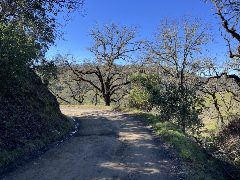
A short leg up OHMR brings you to the intersection of OHMR and Conn Valley Rd. CVR is serious vineyard country, as evinced by the 20 wineries whose names hang from the unmissable sign at the intersection. It’s a pleasant road by itself, and it goes all the way to Lake Hennessey, so it’s worth riding some other day. Go L to stay on OHMR, and very soon you see a permanent sign that reads, “Road closed ahead: no vehicles, no bicyclists, no pedestrians.” Indeed, shortly thereafter you reach a permanent and serious gate across the road and a sign that reads “road very closed.” Getting around the gate is easy, but immediately beyond it you’ll swear the signs are right because you’re looking at a giant mound of dirt and no road in sight. Fear not. The mound is about 40 ft up and 40 ft down the back side (ride it if you have a gravel bike, walk it if you don’t), and after the mound the road reappears and is in remarkably good shape—lots of small cracks, lots of weeds growing through the median, and a few fallen limbs to dodge, but absolutely no risk.

OHMR is a steady moderate climb through typical east Wine Country dry scrub. Watch for a nice open vista to the southeast, with Lake Hennessey in the distance. After 4 miles, OHMR dead-ends at a road that is Howell Mountain Rd. to the R and Deer Park Rd. to the L.
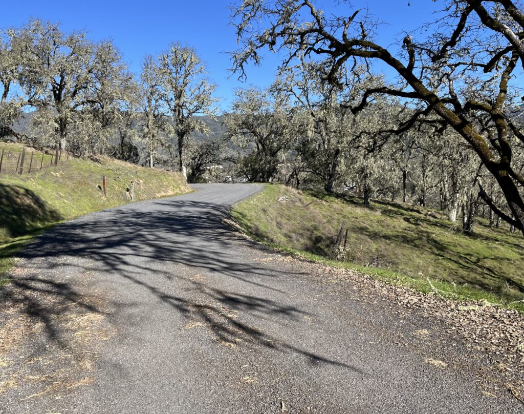
Here you have a choice. As I’ve routed it, you go straight across onto White Cottage Rd. and ride it for 4 miles to its end. White Cottage is a pleasant but not exciting steady climb through pretty, fairly developed terrain on a polished, wide two-lane road. The eponymous Cottage is nowhere in sight.
The alternative is to go R and take Howell Mountain Road through Angwin to the juncture of Ink Grade, White Cottage Rd., and HMR. The upside to HMR over White Cottage is, after Angwin the road contour is more interesting (curvier). The downside is, at least through Angwin, the traffic is heavier. Since you’re going to come back this way, I suggest you go up White Cottage and come down HMR.

Just before White Cottage dead-ends at Howell Mt. Rd., it crosses Ink Grade. Now you have one of the toughest decisions you’ll ever have on a bike. Do you descent Ink Grade (which used to be a no-no due to rough road surface but is now a superb ride), or do you continue on White Cottage to the intersection with Howell Mt. Rd. and do the descent of HMR, which is also a wonderful ride? Here are some things to consider:
Both descents are on glassy, perfect surface.
Both go to roughly the same place—Pope Valley Road..
HMR is much steeper (9-12%, compared to Ink Grade’s 4-8%).
HMR is curvier.
HMR is less varied—all pretty much the same pitch, the same amount of twistiness. Ink Grade is much more varied—no two corners are alike, lots of changes of pitch.
Ink Grade is much narrower—it’s a true wide one-lane, with no centerline. I’m not sure two cars meeting could pass each other. HMR is an obvious main route—two substantial lanes with centerline.
Because IG is narrower, it’s much less trafficked—seeing any cars at all is news-worthy—and it’s prettier (at least in the spring), because you’re more snugly in the woods.
I prefer Ink Grade, but I ‘m not a big fan of brake-burning plummets. I’ve mapped the route down HMR, but that was before the repaving.
At the bottom of HMR, at the tiny community of Pope Valley (which consists of a market in case you need ice cream, a garage with a sign that reads “since 1915,” an old barn advertising “blacksmith and wagonmaker,” and a vast automobile graveyard with some amazing old car bodies), go L on Pope Valley Rd., ride to Ink Grade on your L and go right on past it for 1/10 mi. to gawk at the spectacle that is Hubcap Ranch. Return to Ink Grade and ascent it. It’s a dream, as good as ascending gets—constantly reinventing itself, 4.1 miles of bliss through beautiful scenery, just hard enough to make you feel like you’re accomplishing something and with lots of changes in the pitch to vary the workload. With the new surface, I loved it so much I went back and did the climb the following day, something I never do. Don’t miss the tongue-in-cheek “Col de la Croix de Ink Grade” distance-and-elevation markers along the route.
At the top of Ink Grade, return to the White Cottage Rd./Howell Mt. Rd. intersection whichever way you didn’t ride up.

Now you are in for 1.7 miles of hell, the descent of Deer Park Rd. DPR is quite nice in places, but here it’s awful—lots of cars whizzing past you at 55 mph while you fight for control at 35 mph over steep, dangerously broken pavement and no shoulder. None too soon, bail out to the R onto Sanitarium Rd. (you’ll feel like checking in), which is heaven in comparison to what you’ve just done. Sanitarium used to be the best road surface on the route, but no more. Still, it’s pretty good, and it’s a fairly straight, very fast descent (40 mph if you want). It used to be almost car-free, but Siri has decided it’s a better route than Deer Park Rd. and is sending through traffic down it. And it’s built up, so the scenery is without interest. When it returns to Deer Park Rd, it’s a stone’s throw down DPR to Silverado Trail, which you take L back to your car.

At the bottom of Sanitarium, there are a couple of little detours you can take to the R to add 3-4 miles to the route and avoid the little leg of Deer Park Road at the bottom of Sanitarium—first, Crystal Springs Rd., which seems to be a local favorite, and second, Glass Mountain Rd., which is shorter and I think a bit prettier. Both go north and run into the Silverado Trail, which you take L back to your car.

Shortening the route: Do either loop by itself—I recommend the northern loop. Or ride Ink Grade as an out and back—8 total miles of perfect climbing and descending..
Adding miles: On Pope Valley Rd. you’re in the midst of eastern Wine Country cruising country. The roads in every direction are popular riding routes. Continuing W on Pope Valley Rd. from Ink Grade, the riding is easy and lovely until the road turns into Butts Canyon Rd., at which point the road surface deteriorates and the landscape turns into post-forest-fire dreary—rolling hills full of dead tree trunks emerging from a sea of scrub brush. Butts will take you all the way to Middletown (16.5 miles), but I wouldn’t do it. Turning R on PVR from Ink Grade,, you soon reach Pope Canyon Rd and Chiles-Pope Canyon Rd., both staples of regional touring. I like the ride from Pope Valley down Chiles-Pope Canyon to Hwy 128 a lot, especially the descent from Chiles to 128. Hwy 128 will return you to the Napa Valley (I wouldn’t go the other way on 128—the traffic can be deadly, though the road contour is good).
Pope Canyon connects with Berryessa Knoxville Rd., which runs for 37 miles all the way to Clear Lake (where it’s called Morgan Valley Rd.), and locals have told me they’re ridden it in previous years, but I drove (not rode) the miles from Berryessa to Knoxville and I’m here to tell you, do not ride this road. The road surface, as of 6/25, is beyond horrible—it’s life-threatening. Do not trust the Streetview images—the road has been torn to pieces since they were taken. Morgan Valley Rd. itself (Knoxville to Lower Lake) is totally rideable as an out and back from Lower Lake, and the contour is nicely varied, but the scenery is poor, thanks to major fire damage, and the sun exposure is intense in hot weather.

You’re 11.5 miles down Silverado Trail from the Old Lawley Toll Rd, a tiny gem of a climb I absolutely love but which stands in the midst of a cycling wasteland (since Hwy 29 is unrideably trafficky) and is only 4 miles long. You don’t want to drive any distance to do 4 miles, so you should go bag it now while you’re in the neighborhood.
Just on the other side of St. Helena is Spring Mountain Rd./St. Helena Rd., a road which on paper looks like a perfect ride—small, relatively untrafficked, curvy. It’s all up then all down across the ridge between the St. Helena valley and the Santa Rosa valley, and it’s a pretty good ride with a couple of drawbacks that keep me from recommending it: 1) the climb up from St. Helena is really steep, steeper than I find fun either going up or going down (like, lots of 12%+); and 2) the pavement on the Santa Rosa side is uniformly lousy, the kind of lousy I find really interferes with my pleasure. If they would repave the west side of the summit, riding just it as an out and back would be a dream. But this is Sonoma County after all.