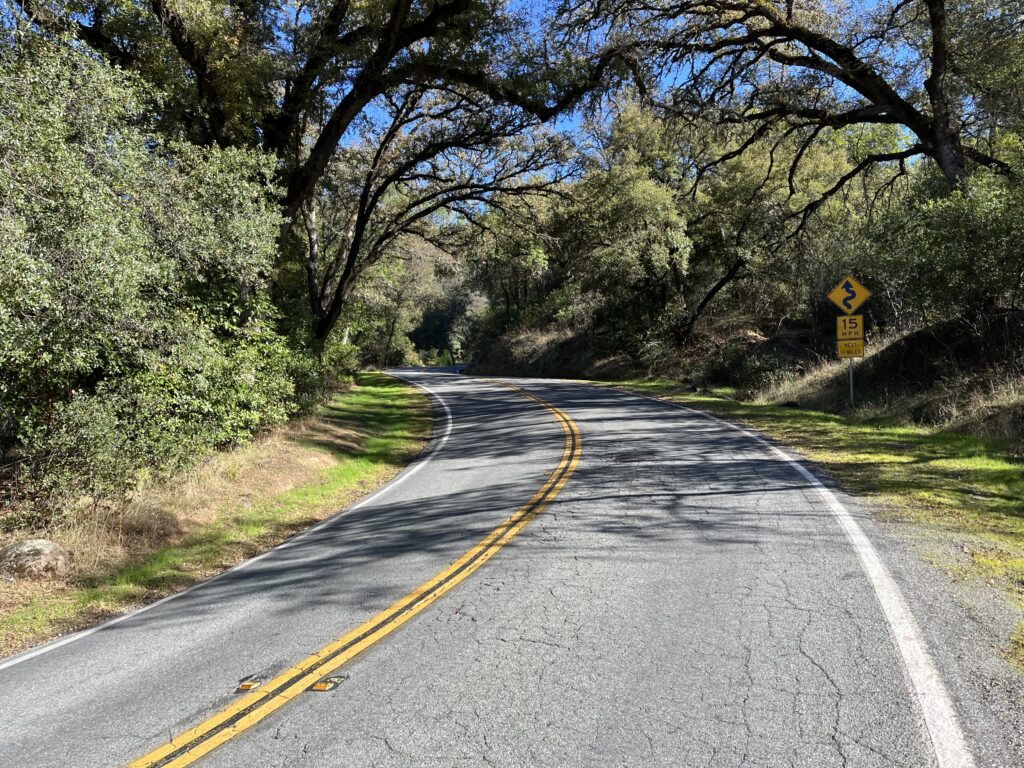
Distance: c. 11 miles, two out-and-back forks Elevation gain: 1049 ft
This is probably the shortest ride in Bestrides. It’s yet another out and back climb up from the Wine Country valley floor, and the climb itself is a whopping 2 miles, so why should you bother, when Bestrides has about 10 other longer similar Wine Country climbs? For a couple of reasons: 1) it’s off the radar—so far off that my treasured Sonoma County Bicycle Coalition cycling map, which has everything, doesn’t know it exists—there’s something sweet in that; and 2) it’s beautifully landscaped and has a delightful climbing contour. It’s just a little gem. So do it three times, or do it as an add-on to one of the longer climbs nearby (see Adding Miles), but I encourage you to do it.
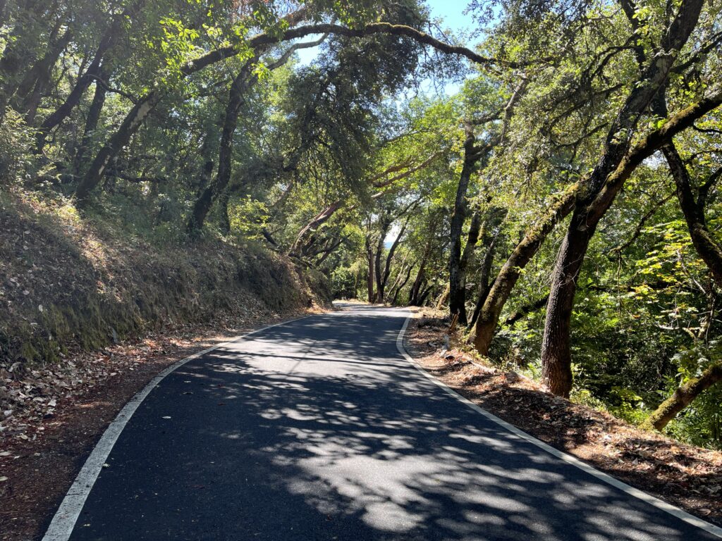
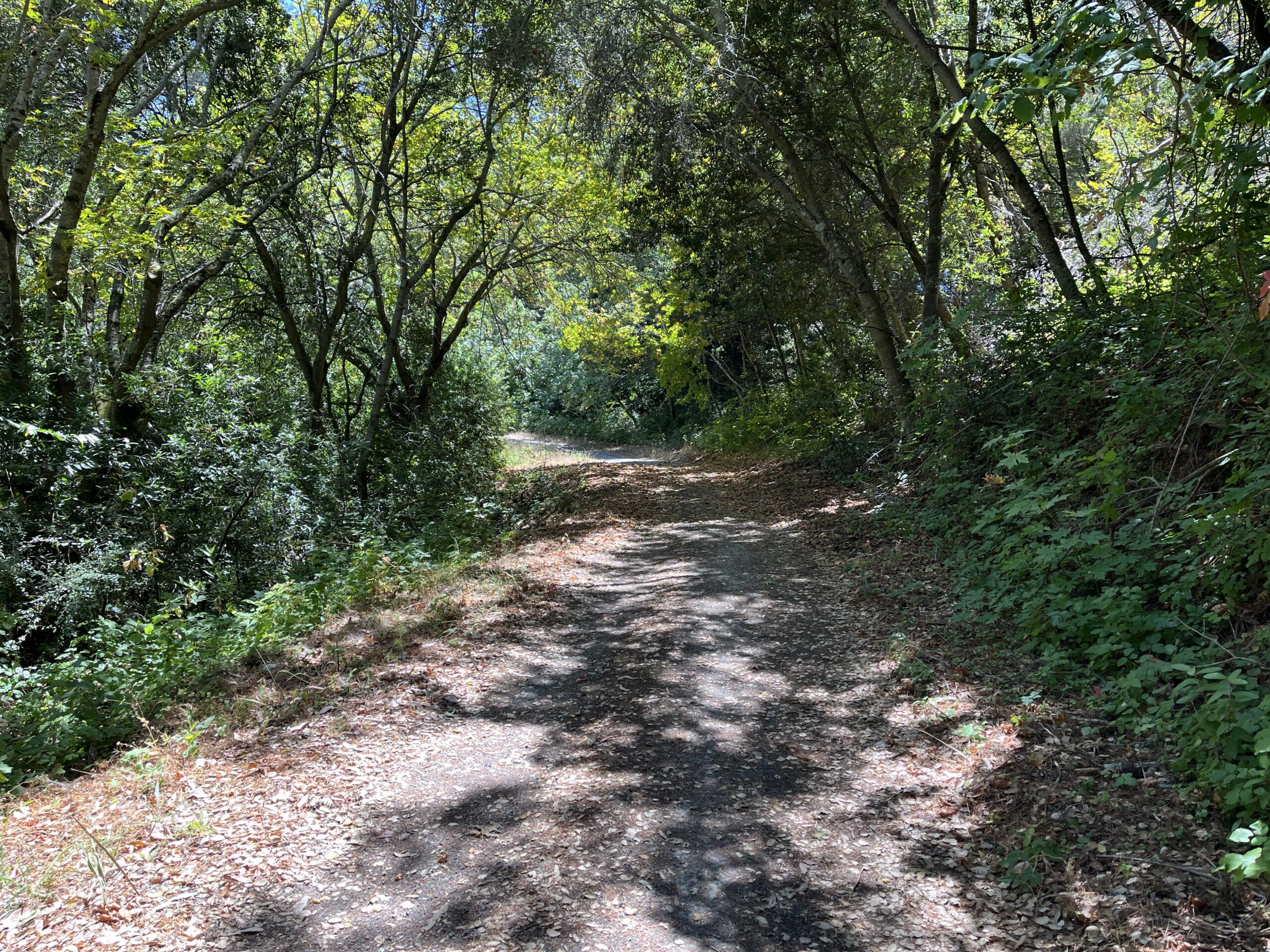
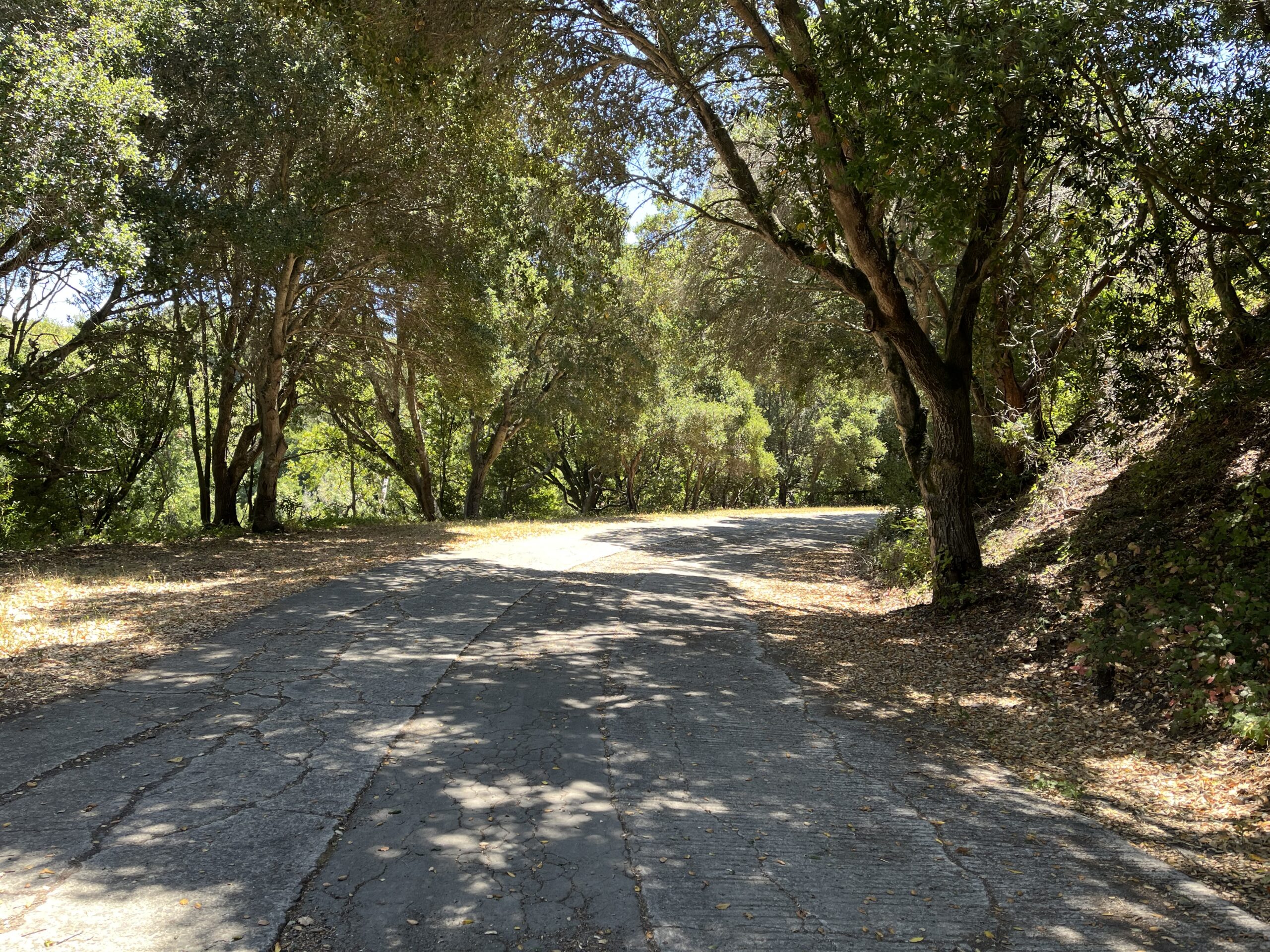
Start at the intersection of Nuns Canyon Rd. and Hwy 12, just north of Trinity Grade. There’s a perfect tiny one-car dirt pull-out just made for you a stone’s throw up Nuns. Ride up Nuns and take the L onto Nelligan Rd. Ride to the “summit” at 2.5 miles in. Enjoy your surroundings—it will be over all too soon. You’ve got a pretty riparian creek’s woods on one side of you and vineyards on the other, but some genius preserved the thin row of woods shielding you from the vines, so you’re in lovely oak forest on both sides. The road is a generous one-lane, which adds to the coziness. At the summit the road does a three-way fork and each fork immediately dead-ends in someone’s yard. Turn around and enjoy the descent back to the Nelligan/Nuns intersection. If you aren’t exhausted from your climb, go L onto NCR and ride it as far as you’d like.
Nelligan Road
Nuns Canyon Rd. is the mirror opposite of Nelligan. It’s essentially flat, with redwood forest in place of Nelligan’s oak canopies. It soon turns to very rideable dirt. I don’t know how far it goes—I did a couple of miles and turned around. Feel free to explore further. There seems to be nothing in there but driveways to invisible vacation houses, often with gates. I passed at least two gates on the main road—whether they’re ever closed, I don’t know. But it’s nice, easy riding through pretty forest. If you ride it to the end, let me know what it’s like.
Nelligan Road
Shortening the ride: You’re kidding.
Adding miles: As I mentioned, there are several climbs that take off from Hwy 12 nearby: Adobe Canyon Rd., Los Alamos Canyon Rd., Trinity Grade, Cavedale Rd., Sonoma Mountain Rd. (all in Bestrides—use the search window for some of them), so you could do any one of them, throw the bike in the car, and drive to Nelligan as a cool-down.
Distance: 10.8 miles one way Elevation gain: 1372 ft
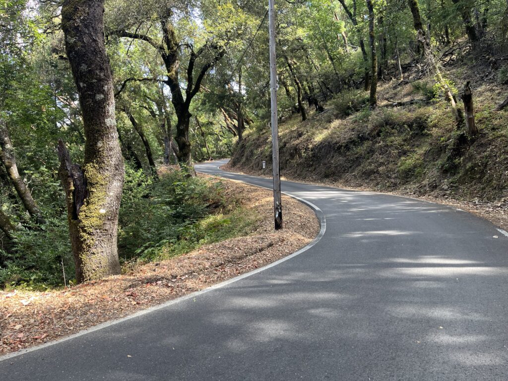
This is a backcountry road that is well-known as an alternative route from Hwy 1 to Occidental (the other two options being Bohemian Highway and Coleman Valley Rd., both in Bestrides). Almost half of it is dirt, and almost half is gated off to cars, so we’re talking some serious solitude here. You’ll probably see some birders at the southwest end and some hikers on the dirt side of both of the gates. Otherwise you should be alone. And that’s the ride’s selling point. The scenery is excellent, but no better than other coastal forest rides. I loved the tranquility of the first 5 miles. After that the climbing started and the ride turned into work—still rewarding, but not peaceful. All the elevation gain (1372 ft) is in one unrelenting 4-mi. climb in the middle. And remember, rocky dirt makes climbing twice as hard as the numbers suggest.
Normally with routes that traverse a single road I plot them as out and backs, and you can certainly do Willow Creek Rd. that way, but because this dirt isn’t an “Ooh I want to do that again” sort of thing and because our ride leaves you just outside Occidental, which is both the top of the lovely Bohemian Highway descent and the beginning of the Coleman Valley Rd. ride, both praised elsewhere in Bestrides, I fully expect you to ride this as part of a loop, Willow Creek > Bohemian Highway > Hwy 116 or Willow Creek > Hwy 1 > Coleman Valley Rd.
With any route with substantial dirt, two questions arise: 1. can you do it on a road bike, and 2. which way should you go, up or down? My answers: 1. I wouldn’t. The first mile of dirt (as I’ve mapped it) is smooth and flat, but the next 4 miles are a constant and substantial climb, and, because weather wears down pitches much more than it does flats, that climb is often rocky, eroded, and jarring. 2. I don’t like rough rocky descents. They kill my hands, my neck, and my spine. I always prefer to climb them at 5 mph instead of bounce down them at 10 mph clutching my brakes with cramping fingers. So I’ve mapped it uphill. Also, riding this way gives you Bohemian Highway as a descent if you’re looping it that way, which is the (vastly) preferable direction. Whichever way you go, as with all dirt, after rain I‘d wait until the trail had dried out before riding.
As with most roads through back country, mapping sites like RWGPS make the area look like a warren of roads, so you might worry that navigation is treacherous. Not so—there is only one noticeable road and it’s impossible to get lost.
Park at the intersection of Willow Creek Rd. (totally unsigned) and Hwy 1 just a few feet south of the Russian River Bridge, right by Jilly’s Real Food Roadhouse (which is quite good, I’m told). You will immediately see a formidable sign reading “Road closed 4 miles ahead—no through traffic to Occidental.” This is great news, because it means you won’t see cars.
The first 4 miles of the route are flat, good-quality pavement oddly interspersed with short stretches of rideable dirt—look carefully at the RWGPS map and you’ll see they got it exactly right. Early in the ride you pass a gigantic, magnificent stand of alders. One can only assume that the name “Alder Creek Road” was already taken. Appreciate these trees—you won’t see alders again on the ride. As you ride among the alders you should see serious people in tweeds and bucket hats staring up into the sky. Those are the birders, who come for the birds, who come for the alders. One birder told me she had seen 49 species of birds by 11 AM—that’s impressive.
Four miles in there’s a large gate preventing car traffic from continuing, so the traffic drops to zero. The next mile is smooth dirt, doable on 25mm tires. Once the climbing starts, it continues for 4 miles. It’s mostly moderate in pitch (I did see a memorable bit of 12-15%, but it’s more like 4-6%), but because it’s rocky and often deeply rivened it’s work. A lot of the scenery is redwood-and-poison-oak—very pretty.
Near the end of the climb you meet a gate like the one earlier. The pavement returns, and after a bit more climbing you do a patchwork-surfaced descent to the T at Coleman Valley Rd. and you decide if and how you want to loop the ride.
The easy dirt, before the climb
Shortening the ride: Ride the first 4 miles and turn around at the gate, or continue for one more mile of easy dirt and turn around at the start of the climb.
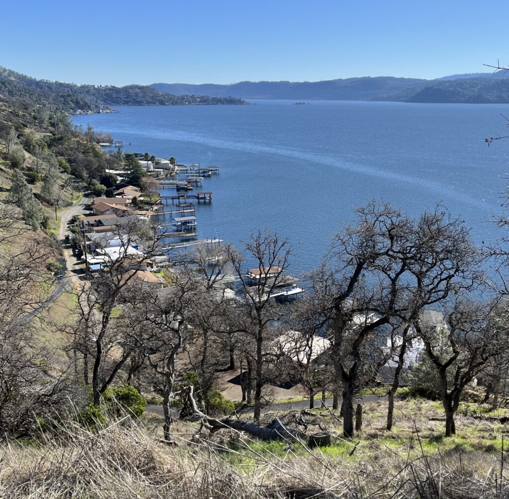
If you’r’e like me, you’ve driven past Clear Lake many times, but you’ve rarely gotten off the three highways that circumnavigate the lake: Hwy 20 on the north shore, Hwy 29 on the south shore, and Hwy 58 on the east shore. Now is the time, because on the peninsula that juts into the lake heading west from the town of Clearlake (no space) there is a lovely little network of roads crying out to be ridden.
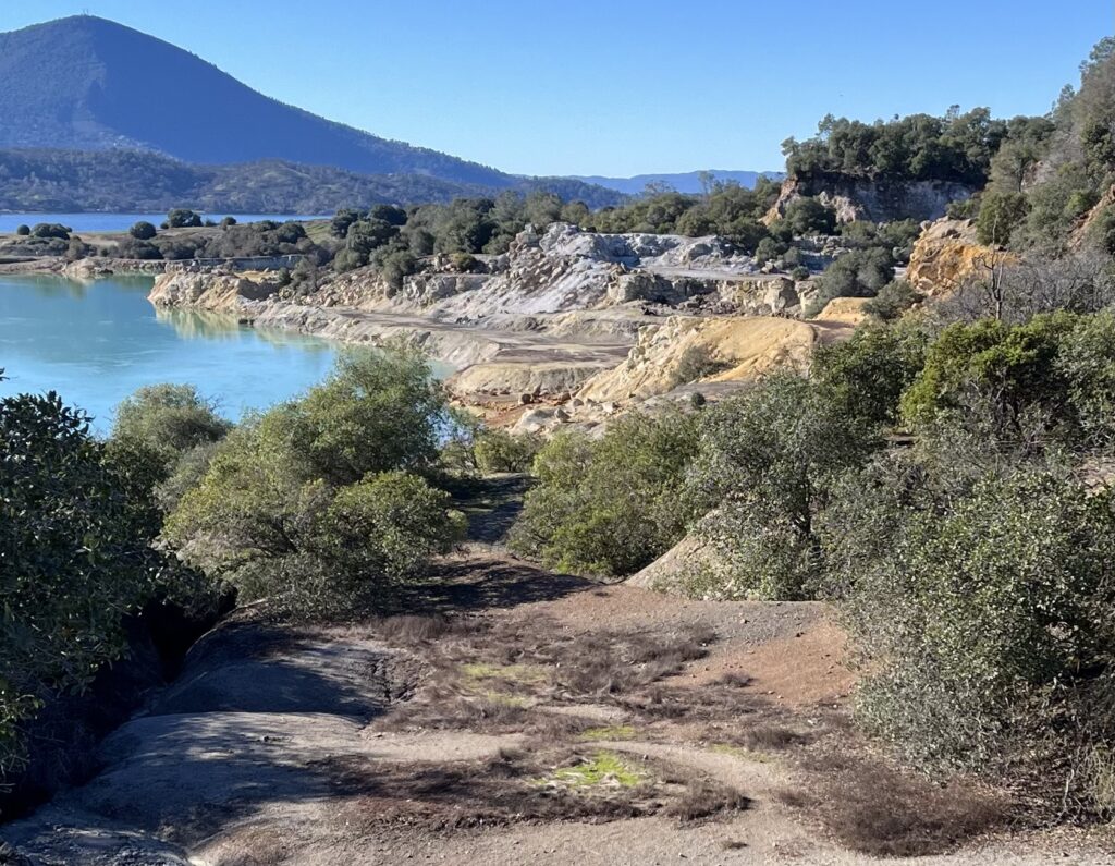
Clear Lake has two outstanding rides: Clear Lake to Cobb and this one. The two rides couldn’t be more different. The ride to Cobb is a sweet steady climb through lush forest to a tiny mountain community and back. This one is a mix of riding conditions—some small-town streets, some flat shoreline, some short steep rollers, and some climbing through dry (though pretty) oak-and-grass landscapes with big vistas of the lake below you and in the distance. And there’s some history here as well—the eponymous Sulphur Banks, where Native Americans and later Europeans dug for Cinnebar, Sulphur, Borax, and Mercury, and one of the oldest archeological sites in the US, with signs of habitation dating back 12,000 years!
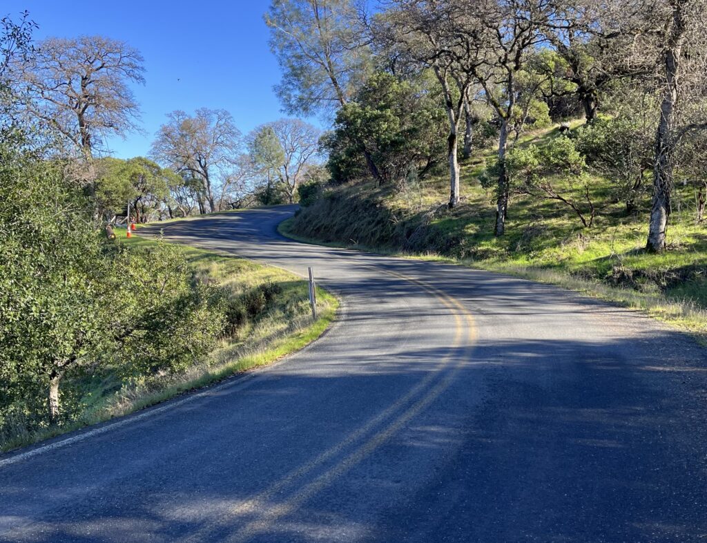
It all starts in the town of Clearlake. It’s a conventional little town, with a fresh spritely energy. It’s the kind of town that has several barbershops, all called something like Clearlake Barber Shop. You won’t find artisanal bakeries, and I’ll bet the locals don’t know what a “barista” is. I like it a lot. So I’ve started the ride in the center of town, at the unmissable Austin City Park, where there is plenty of parking, so I could include a few miles through downtown streets. If you’re not hot on riding busy streets, fear not—Lakeshore Drive, the first leg of the route, gets quieter, prettier, more interesting topographically, and more isolated the farther west you go.
Lakeshore Drive
Throughout its length Lakeshore alternates between hugging the waterline through enclaves of small lakefront vacation bungalows, each with its own ramshackle pier, and climbing up the hillside for nice views of the lake and the bungalows below you.
North Road
Lakeshore ends at an intersection with North Rd., and we are eventually going R onto North, but not yet. An obviously secondary road continues westward (the direction you’ve been riding in up to this point). Signed as Crestview Rd., it’s short but choice and you should ride it. it’s a little narrower, a little steeper, and a little more meandering that what you’ve done, and the vistas of the lake are ideal. It ends at a gate and a “private community” sign. Speak a curse on the moneyed elitists and turn around.
Sulphur Bank Drive
Back at North Rd., take it. It’s very different from Lakeshore, in that it’s not along the shore—it’s up the hill, so the shore, the bungalows, and the piers are well below you and usually out of sight. It’s almost completely untouched wilderness. Because it doesn’t have to follow the shore, it’s flatter than Lakeshore, which means it meanders side to side more. It’s perfect riding, and I don’t think I saw a vehicle. It ends all too soon at Sulphur Bank Drive.
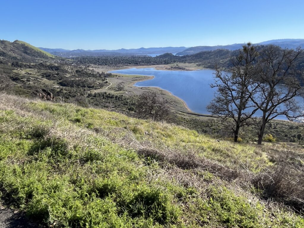
Sulphur Bank Drive looking south, with Borax Lake in foreground, Clearlake in the middle distance, and the SE tip of Clear Lake in far distance
A word about ride scheduling: North, as its name implies, is on the north side of the ridge, which means it’s in shadow for most or all of the day. This is a lovely thing on a hot summer’s day, but in the winter it means it’s probably wet. On the January day when I rode it, with no rain at all in the recent weather systems, it was still soaking wet from dew at 2 pm and slippery as a result. On the other hand, in the winter the oaks have dropped their leaves (still gorgeous) and so the vistas on North Rd. and Sulphur Bank are superior.
The sulphur bank
At the intersection of North and Sulphur Bank, you go L onto Sulphur Bank. You’re already near the summit of the SBD climb, but what remains is cherry, with great views of Borax Lake, the town of Clearlake, and the south arm of Clear Lake itself on your right and far below you. The back side of the hill is ideal riding, both climbing and descending—a little over a mile of 6-7%, with constant esses. As soon as you start down you get grand views of the north arm of Clear Lake, the community of Clearlake Oaks, and the Sulphur Bank between you and them. The bank, a shoreline hillside prominently dug away, is actually down a side road, Sulphur Bank Mine Road, signed with many protestations of privacy and promises of dire punishments meted out to trespassers, but the good views of the bank are a mere 1/8th of a mile down the road and you can easily pop down and poach a look-see. You can read about the history of the Bank here.
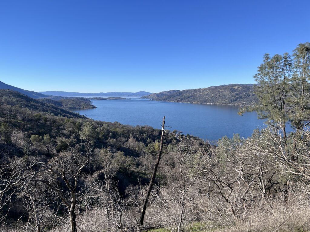
From summit of Sulphur Bank Drive looking north over Clear Lake
At the bottom of the hill you roll through pretty ranch land to a T at Hwy 20, and you turn around and climb back to the summit. The descent from the summit to Borax Lake is the stuff of dreams—1.6 mi. of serpentining so good I’d put it in Bestrides’ list of Best Descents if it were a bit longer. At Borax Lake you can look around for the archeological site but you won’t see it—you can read about it here. At least try to wrap your head around the idea of humans living their lives here 8,000 years before the early Egyptians.
Shortening the ride: You’ve got two excellent options. You can ride Sulphur Bank Drive alone as an out and back. You can ride the Lakeshore/North loop by itself, which gives you much less climbing.
Adding miles: Along the spine of the peninsula runs Crestview Rd. It forks off from Lakeshore a few miles into our ride and returns to Lakeshore right at the North Rd. intersection. It’s mostly dirt, but it looks to be good dirt. It’s on my to-do list. Oddly (for dirt), it’s covered in Streetview, so you can preview it. I don’t know of other good riding in the immediate vicinity. The Clear Lake to Cobb ride discusses good riding further afield.
Our route cuts off 2/3 of the south-side Sulphur Bank Drive climb, and it’s a very sweet climb, so you might like to turn around when you get to Borax Lake, climb back up to North Rd., and turn around again. That way you’d get to do most of the grand Sulphur Bank descent twice.
Distance: 18.3 out and back Elevation gain: 2258 ft
This ride has no breath-taking features, but it’s a perfectly sweet, rolling romp through very pretty Sierra foothill scenery. It’s one of 4 rides Bestrides has out of Grass Valley/Nevada City, and it’s probably the easiest and most low-key of the 4, perfect for a light day. The elevation gain is slightly over our 100 ft/mile benchmark for workload, but it’s never super-steep and all the climbing is in the last 4 miles, so you can turn around after 5 miles if you want no work at all.
One caveat: this is the route to South Yuba River State Park, which is prime hiking and swimming territory for locals in the summer, so it gets trafficky, especially on weekends. Even at other times, the road is busier than you’d expect. I rode it on a beautiful weekday afternoon in October, when there was almost no one at the State Park, and it was lovely and quiet at 2 PM and hellishly busy at 3 PM. I suggest riding it early in the morning or in spring or fall (non-swimming season) before 3 PM.
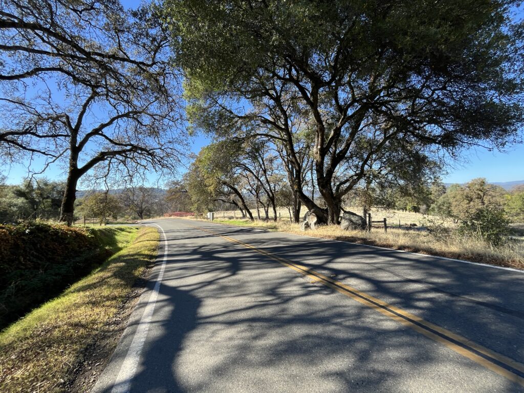
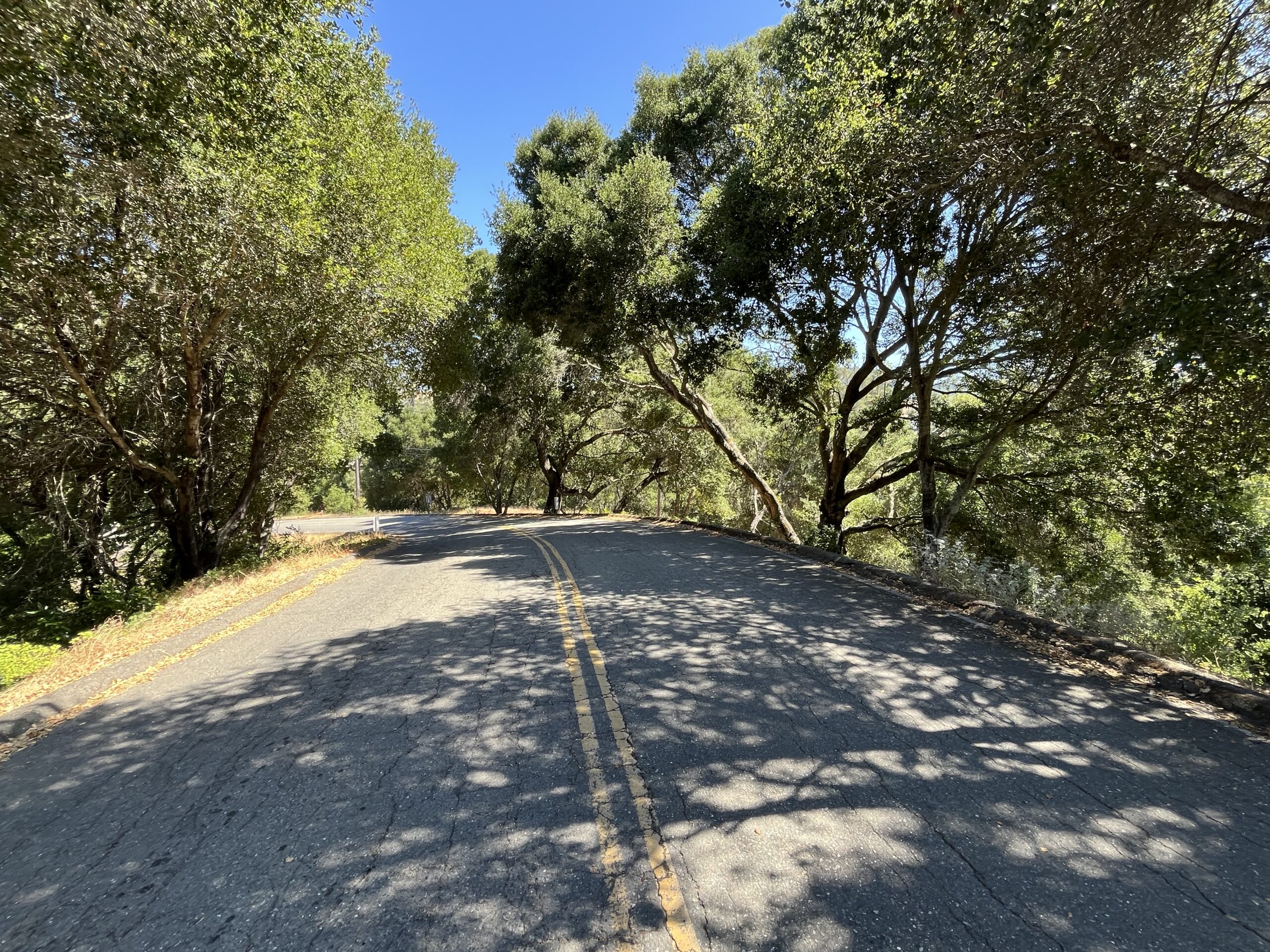
Begin at the intersection of Rough and Ready Highway and Bitney Springs Rd. (If you can refrain from saying “Leave Bitney alone!” to yourself throughout the ride, you have more willpower than I do). Ride down BSR. There’s a nice variety of foothill landscape—dense forest, open land, horse farms. The road tends downhill gently on excellent road surface.
Bitney Springs Road
At 5 miles in the road turns down, and from there there’s a surprisingly fun 2-mile descent to the dead end at Pleasant Valley Rd. Take PVR to the R to South Yuba River State Park. PVR is steeper than what you just did (though the RWGPS profile says it’s the same), and the road surface is fairly rough, so it’s not a descent I love. We’re doing it to get to the state park, which is a cool place. There you’ll find the Bridgeport covered bridge, the longest covered bridge in the world (!). It’s a Wood bridge—that is, it was built by David Wood (sorry, couldn’t resist), and was completely restored and reopened in 2021, so it looks (and in fact is) brand new. You can ride your bike across/through it (or at least I did, and didn’t see any signs saying not to). Bridgeport, btw, looks on maps and sounds like a community, but it’s just the bridge and the state park.
Bitney Springs Road
The park has a large beach, good river swimming and good hiking. If you want a flat, open, effortless walk and spring wildflowers, take the Buttermilk Bend Trail upstream from the parking lot. If you want something gnarlier and more in the woods, take the Point Defiance Loop Trail heading downstream from the north end of the bridge.
Pleasant Valley Road
Ride back to your car. The return route begins with 4 miles of climbing you’ll notice.
Shortening the ride: turn around at Pleasant Valley Rd, or at the beginning of the descent to PLR.
Adding miles: Surprisingly, given that this area is prime cycling country, there isn’t good riding at either end of our route. From Bridgeport PVR continues, climbing steeply for 2 miles then mellowing out and intersecting Hwy 49, which you could take to Nevada City and on to Grass Valley if you simply must loop, but none of it is particularly good riding. PVR to the L at the PVR/Bitney Springs Rd. intersection looks inviting, but it soon turns to traffic hell as it approaches Lake Wildwood, an upscale faux country experience best avoided. Midway along BSR you pass Newton Rd., which will give you a few more merely pleasant miles before it runs into Hwy 49. Rough and Ready Hwy. is much busier than Bitney Springs Rd.—beyond unpleasant and truly dangerous.
A friend suggests adding miles by riding Newton Rd. > Sweetland Rd. > Oak Tree Rd. > Tyler Foote all the way to Malakoff Diggings. I haven’t done it, but it’s all on Streetview so you can preview it.
Distance: 23-mile out and back Elevation gain: 2780 ft
I owe Skyline Boulevard an apology.
Skyline is much hated by cyclists for its heavy traffic and lack of shoulder. Several riders have commented in Bestrides that they consider it a deathtrap, and up to now I’ve only ridden it as an unavoidable connector.
But at its southern end, Skyline turns idyllic. At Saratoga Gap most of the car traffic turns off, and the last ten miles are bliss—next to no traffic, glassy road surface, lazy climbing and descending through pretty woods, grand vistas to the west. Then it gets better. The southernmost 2.5 miles are simply magical—a car-free, almost-one-lane up and down back and forth ramble through drop-dead gorgeous miniature forest. I loved it so much, on the return ride I tried to pedal as little as possible, just to prolong my time in the magic.
As a cherry on this sundae, there’s an add-on that gives you 1-2 miles of killer climbing through typical Santa Cruz redwoods. The total elevation gain for the ride is substantially above our 100-ft-per-mile benchmark, but almost all the work is in these 4 miles, so you can skip them if you’re out for an easy day.
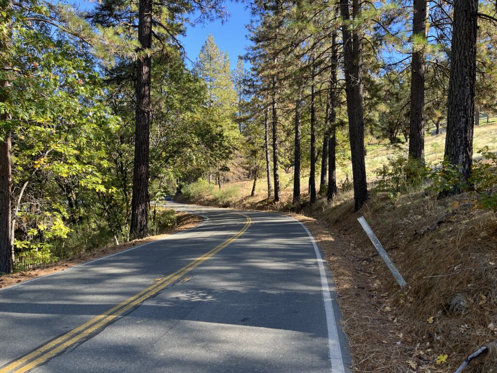
Park at the intersection of Bear Creek Rd. and Skyline. There’s a big dirt parking lot for you. Head north on Skyline. The road is instantly fabulous. There is no reason for any vehicle to be in there—anyone heading toward Boulder Creek should be on Hwy 9 and anyone heading toward Santa Cruz or Scotts Valley should be on Black Rd.—but for some reason the road surface is absolutely pristine. The road is essentially one lane, the contour is all little ups and downs and sweet little turns, and the landscape is fairy-tale pretty. Savor these first 2.5 miles—nothing else on the ride can match them.
At mile 2.5 you hit the intersection of Skyline and Gist Rd. (clearly signed), and you have two decisions to make: 1) do you want to take the Gist/Black detour at all? Doing so commits you to 1-2 miles of serious climbing (10-14%), plus 1-2 miles of steep descending, but it’s splendid scenery, and the only redwood forest on the route; and 2) if you take it, do you want to do it on the outbound or return leg? Outbound gives you 1.2 miles of descending and 1.7 miles of climbing; return reverses the numbers. Black has prettier woods than Gist, which might be an argument for doing it at 4 mph instead of 20.
After the Gist/Black detour, Skyline changes—wider, straighter, slightly less car-free, and with more ordinary woods. The contour is moderate, relatively unvaried climbing almost all the way to Saratoga Gap. But it’s still lovely riding, the road surface remains pristine, and you’re treated to some good views of the country off your L shoulder. Midway you pass Castle Rock State Park and the traffic might pick up a little—turn around there if you are determined to remain car-free.
Saratoga Gap is just a large intersection with a parking lot. I’ve stopped the route here because the traffic to the north should be considerably more intense. Turn around and ride home. If you’re doing Black/Gist on this leg, note that Black, while a fairly large and noticeable turn-off to the L, is (oddly) unsigned.
Shortening the route: The jewel in this crown is obviously the first/last 2.5 miles—ride it out and back for the best 5-mile ride of your life. If you want short and intense, ride those 5 miles plus Gist/Black.
Adding miles: Our ride takes off from Bear Creek Rd., a road I don’t recommend riding to the west from our starting point because, while on a map it looks like any other pretty, winding Santa Cruz back road, it’s actually the main artery for all the traffic between the Los Gatos area and the bedroom communities of Boulder Creek, Felton, Ben Lomond, and others, so it’s usually constant traffic. East of our starting point, Bear Creek Rd. to Summit Rd. is brief, has a lovely contour and gives you some great westerly vistas (better than Skyline’s). Summit Rd., between BCR and Hwy 17 is fairly built up but is delightful riding and takes you past the turn-around of our East Zayante Road ride. Continuing on down Summit past Hwy 17 takes you to our Bean Creek/Mountain Charlie ride and/or our Eureka Canyon Rd. ride.. I wouldn’t continue on Bear Creek Rd. past Summit—it’s rough and unpleasantly steep, with the usual BCR traffic.
Looking westward from Skyline near Castle Rock State Park
Distance: 13.5-mile out and back (with a spur) Elevation gain: 2700 ft.
This ride is in Bestrides for one reason: the view. The climb/descent is worth doing, but not spectacular. But the vista…
The ride begins with a classic, straightforward 5.3-mi. climb with pleasant oak scenery and an elevation gain of 2340 ft—in other words, work. This is followed by a return descent that for me is too steep and too rough to be tons of fun. But midway up the climb you pass Weaver Rd., and the views from Weaver Rd. make the whole ride memorable.
Park somewhere along Alma Bridge Rd.—there are frequent dirt pull-outs. Ride as much of ABR as you need to get warmed up (it’s lovely riding—see our Alma Bridge Rd./Old Santa Cruz Hwy Plus ride for details), because Soda Springs Rd. climbs from the gun and never stops. We’re talking just under a 10% average here.
Soda Springs Road
Climb for 5.3 mi. at a consistent pitch (8-11%) through constant serpentine turns. You’re climbing up the side of a canyon wall, and at first you’ll think you’re in for good vistas of the canyon beside and behind you, but in fact the vast majority of the ride is through oak forest. It’s not the lush rainforest around Felton, but it’s pretty in its way, and it blocks any and all distant views. There’s nothing along the road except a sprinkling of houses, and they’re all down driveways so all you see is the occasional driveway, often with a pretentious gate. That’s it—small oaks and driveways, for an hour. I did ride by a sign that read “Soda Springs Resort—no vacancy,” but I think it’s a joke. At 3.7 mi. in you pass Weaver Rd. going off to the R—make a note so you don’t miss it on the descent.
At the top you hit a serious gate across the road and “No Trespassing—Private Property” signs and you turn around. The following descent is not my cup of tea. The pitch is so steep I had to brake constantly, the corners are typically blind so corner-cutting is potentially fatal (traffic is next to nothing, but you will meet at least one car, you won’t see it coming, and it will be using the entire road), and the road surface, while no problem at climbing speeds, is a bit rough at 20 mph. Maybe a better descender than me would find it thrilling.
Soda Springs Road
When you get back to Weaver Rd., don’t skip it—that’s why we’re here. Weaver is on the other side of the ridge, and it couldn’t be more different than Soda Springs. It’s flat or mildly pitched, it’s short (1.5 mi.), it’s undeveloped (no driveways), and—most importantly—it’s open. You can see forever, in three directions. You can see Lexington Reservoir, where you started your ride, far below you to the west. You can see the South Bay spread out to the north like a map (I think you can see Mt. Diablo). And most wonderfully, you can see 50 miles to the south, across Santa Cruz, across Monterey Bay, to the city of Monterey, the Monterey Peninsula, and, to the west of the peninsula, the Pacific Ocean. Or you can see a lot of fog, depending on weather conditions. But it’s grand. Photos don’t do it justice. About 1 mi. in, you pass a mighty oak tree on your L with a gorgeous view of Monterey under its overarching branches. World-class photo op. (Truth in advertising requires that I tell you you can get similar views with much less climbing along Bear Creek Rd.)
Weaver Road, with Monterey Bay and Monterey in the distance
A mere 1.5 mi. in you hit a gate and the usual “Private Property—No Trespassing” signs and you turn around, return to Soda Springs Rd., and finish the descent.
Shortening the ride: Ride to Weaver Rd., ride it, and return. Of course you could drive to Weaver Rd., and just bag the vista, but we are cyclists and that thought wouldn’t occur to us…
Adding Miles: This ride takes off from the route of our Alma Bridge Rd./Old Santa Cruz Hwy Plus ride. Do it all, or if you just want a few more miles do Alma Bridge Rd. and Old Santa Cruz Hwy—those miles are without significant climbing penalty.
Weaver Road, with Los Gatos in the distance…and is that Mt. Diablo?
Distance: 10.6-mile out and back (with a spur) Elevation gain: 1215 ft
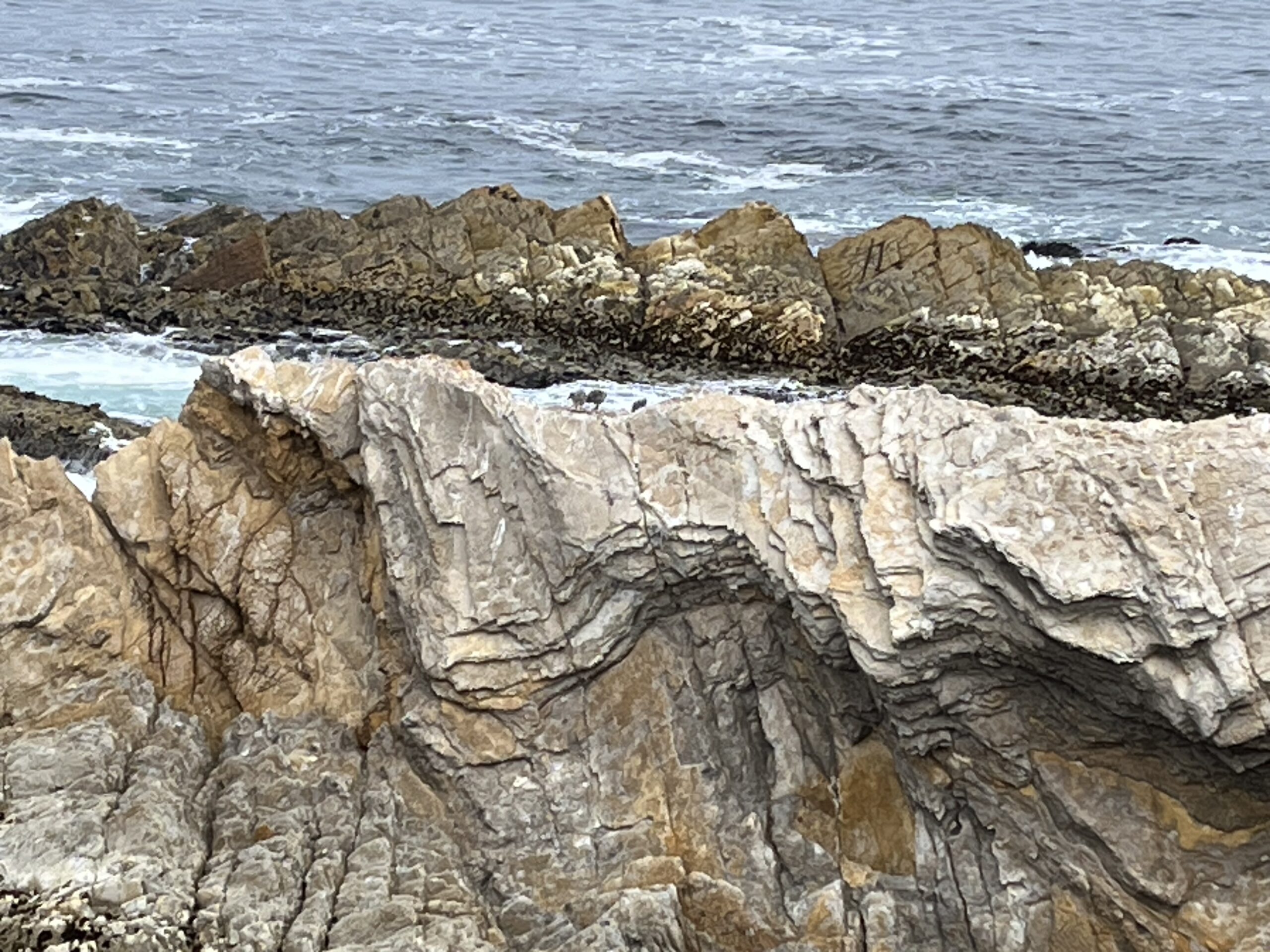
This is a short, charming ride through an enormous stand of eucalyptus trees and then along the stark, treeless headlands of the State Park. Most of the time you are well back from the shoreline (only dropping down to the beach once), so if you want to see breaking waves and eroding rock cliffs you’ll have to get off the bike and hike a trail (the Bluff Trail being the obvious choice). Which I strongly encourage you to do. At the Park visitor center there is the preserved house of the Spooners, the ranching family that worked the land in the 19th Century, well worth a visit. The lone beach, Spooner Cove, is across the street from the house, and it’s a nice one.
The road is actually called Pecho Valley Road, but I’ve never heard it called that, and any valley on the route is negligible. (While we’re on the subject, you won’t be riding any “montañas” either.) The road has a nice contour, never really flat or straight. The map profile suggests it’s fairly hilly, but it doesn’t feel that way. Most of the work is in the short climb from our starting point to the Park entrance, a straight, fairly featureless climb I’ve included largely to give you some work.
The eucalyptus grove
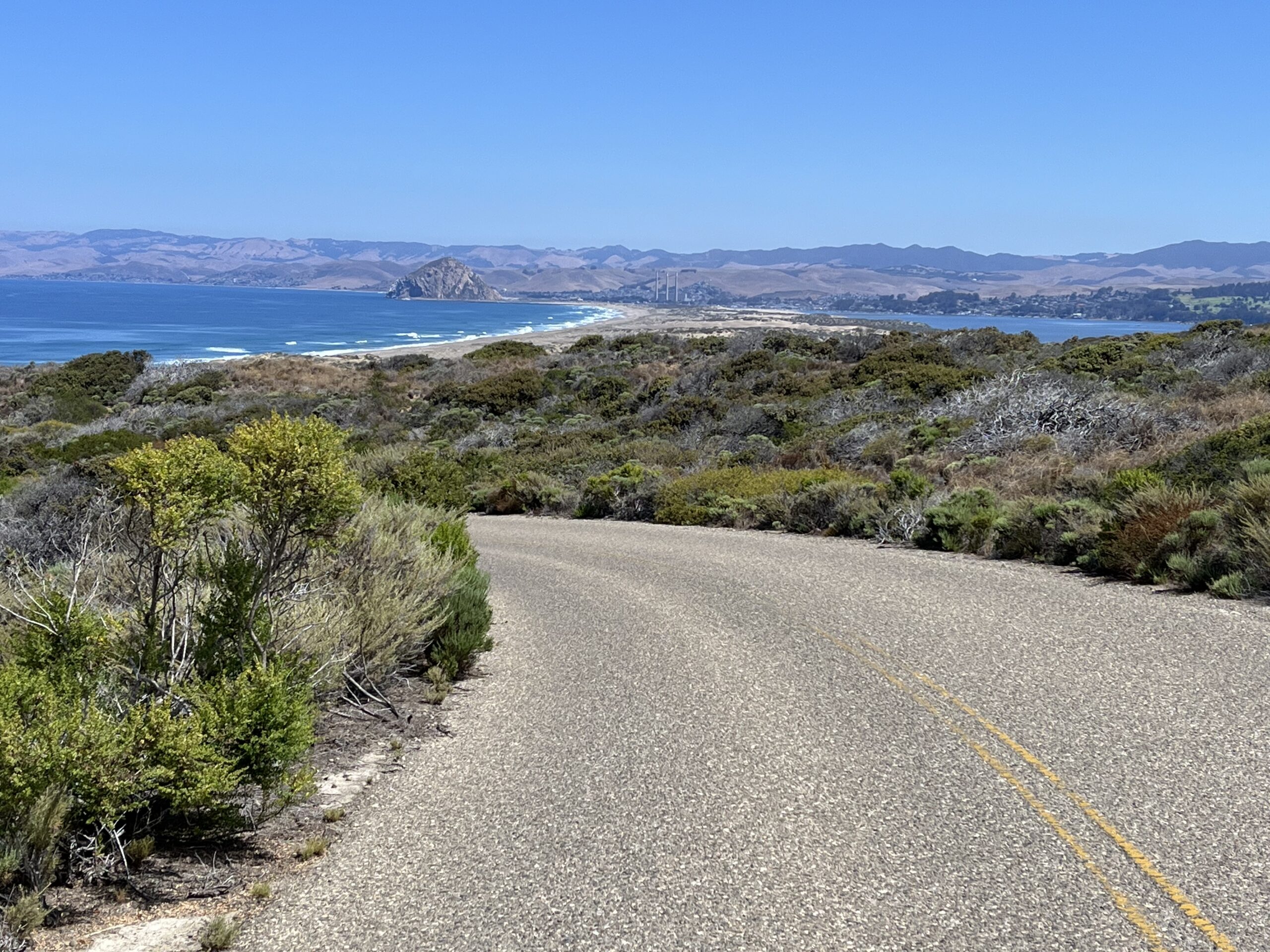
The views of the ocean from the headlands are pretty pedestrian as views of the ocean go, but there is a wonderful vista of Morro Bay, Morro Rock, and the sand spit separating the bay from the ocean, behind you as you finish that first hill—it’s easy to miss if you don’t turn around. Good as that view is, there’s a better one (same subject matter) from Sand Spit Rd., which is why I’ve had you take the short side trip onto it. Sand Spit Rd., despite all appearances, dead-ends at a parking lot far from the beach, leaving you a substantial hike to the water, so once you’ve seen the view you don’t have to ride the rest of it if you don’t want to.
You have to walk to see this
The drawbacks of the ride are that it’s short, it connects with no other good riding (Los Osos Valley Road is mostly straight flat shoulder riding through ag country, abundantly ridden by locals but without much interest), it is often plagued by motorists, and there is no shoulder and little passing room. In other words, a classic early morning beat-the-traffic ride.
Note the two new-born seagulls on the top of the rock
The park is a birder’s paradise, and you’ll probably see gulls, oystercatchers, guillemots, and owls if you walk the Bluff Trail. It’s also a haven for rattlesnakes.
There’s little to say about the ride itself. Ride to the gate blocking the road; turn around and ride back. Check out Sand Spit Rd. either on the ride out or the ride back. The main road actually continues on the other side of the dead-end gate, but it’s Diablo Canyon nuclear power plant land and for once I don’t suggest ignoring the No Trespassing signs.
From Sandy Spit Rd.: Morro Rock, with the town of Morro Bay just to its right, Morror Bay to the R of the spit and the Pacific Ocean to the L
Shortening the ride: Ride to Spooner’s Cove (the visitor center) and return. Those first miles are by far the most rewarding, both in scenery and in road contour.
Adding miles: Ours is the only paved road in Montaña de Oro, but the park is very friendly toward bike riders and welcomes them on many of their trails, so consider getting off-road. Islay Creek Trail is a good first choice, a meticulously maintained dirt road that’s easy on gravel bikes. The park is so supportive of bikers that they have loaner bells at the trailheads, so you can borrow one and warn hikers of your coming.
As I said, there is no other rewarding road riding in the Morro Bay area.
This ride is a bit of a miracle: 6 miles of wilderness adventure riding in the heart of the East Bay. Bestrides Friend Carl told me about it, bless him. It seems to be off most other locals’ maps. And it’s certainly not for everyone, especially not for those whose image of cycling is rolling down a wide, smooth road chatting with a buddy at your side. This is about as close to mountain biking as road riding can get—in fact I don’t recommend it unless you’re on a gravel bike. It’s a wooly, Jeremiah Johnson sort of experience, and a moderate navigation challenge to boot. I loved it, but I love it when the road begins to feel like a trail.
Beyond the virtues mentioned above, there are at least two others: 1. the landscape is lush and gorgeous. If you look at the eastern shoreline of San Pablo Reservoir, you’d swear that a ride along the lake would be largely barren grassland with a thin scattering of trees. But, incredibly, this ride is mostly in dense woods, and glimpses of the lake are few. 2. The isolation is mind-boggling. The route takes you past 3 recreational sites along the shore—there you may see some signs of life. Everywhere else, you should see no one. I did this ride on a lovely sunny Wednesday afternoon in July (2025), and I saw 1 human being. Round trip.
How can the place be so isolated, when it’s the access road to the shoreline of a large recreational lake?, you ask. The answer seems to be, the lake has been largely mothballed for recreation. The lake is closed to boats in an attempt to control the mussel infestation, and the water is closed to swimmers because it’s the region’s drinking water. Most of our route is gated off (so you have the road to yourself). The 2 fully developed boat launching facilities you pass are closed, and it looks long-term.
You might also look at the map and conclude that San Pablo Dam Rd., which is big, wide, busy, and smack on your L shoulder all the way out, would destroy your tranquility with its racket. Why it doesn’t, I don’t know, but it doesn’t. I was conscious of traffic noise a brief time or two during the ride—the rest of the time, I could have been in the Yolla Bolly wilderness.
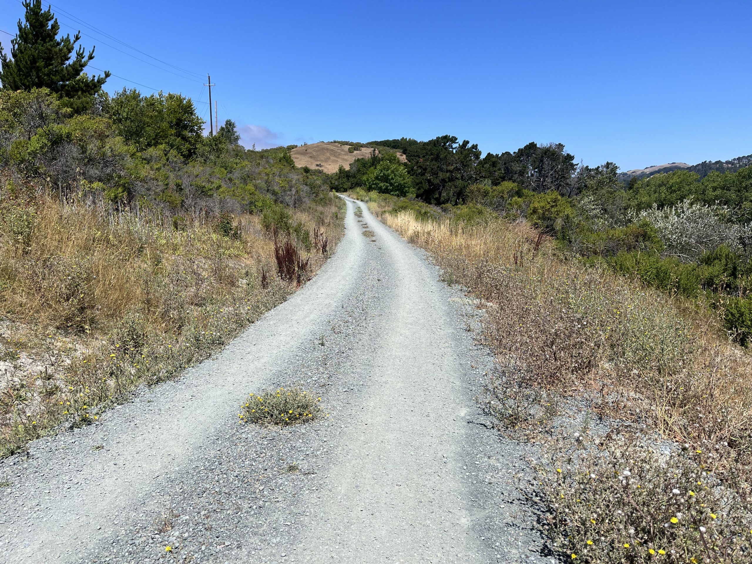
This is a ride for people who like variety of road surface. It’s constantly changing, and ranges from smooth wide two-lane to rough two-lane to on-and-off pavement to gravel to double-track to a really nasty 1/4 mile of single track you can walk. Most of it is delightful, almost all of it is pleasant. But it’s riding that demands your attention—you can’t faze out and rack miles.
Navigation, as I say, is tricky. There are innumerable gates, turns, and apparent dead-ends. You ride through a couple of parking lots. RWGPS’s map below is, I think, accurate. Googlemaps, less so. Ignore what RWGPS says about road surface. There is some confusion about names. RWGPS calls the second leg of the ride, after the first launch ramp, “Old San Pablo Dam Trail.” Googlemaps continues to call it “Old San Pablo Dam Road.” Some sources say you spend some time on the Bay Area Rim Trail; some don’t. RWGPS says you spend time on “the Kennedy Grove Connector Trail”; Google refuses to acknowledge that leg of the route exists. You may get momentarily lost a few times. That’s part of the adventure. I will talk you through it. If you keep heading NW, refusing to turn L back onto San Pablo Dam Road on your L or R into the lake, you should be good. Luckily, the GPS signal is strong on the route and my Garmin “you are here” map was fully informative throughout.
Since this ride parallels San Pablo Dam Road, which is a leg of the infamous Three Bears Ride, which I have badmouthed elsewhere in Bestrides, if you’re riding that loop you could use this route as a way to avoid the tedious slog that is SPDR. I’ve mapped it to turn around at Patra Dr., which is a suburban street 1/4 mile from the Three Bears route. But frankly if you like riding the Three Bears, which is the classic roll-and-chat slog, I don’t think this ride is your cup of tea. If for no other reason, this ride is slow, and you’ll probably want to get the Three Bears loop over as soon as possible.
Old San Pablo Dam Rd. takes off from San Pablo Dam Rd. 1/4 mi. west of the Bear Creek Rd./Wildcat Canyon Rd. intersection. There’s no place to park, but I assume you’lll be riding in from somewhere—might I suggest Inspiration Point? At the OSPDR intersection there’s a large sign reading “Orinda Watershed Headquarters.” Ride 1/10 mi past the headquarters buildings to the first of several gates. Go around the gate, minding the mass of poison oak on your shoulder, and ride on cracked pavement to the huge, eerily deserted boat launch facility. The pavement goes R down to the water—you stay straight onto gravel double-track.
Pavement comes and goes. At the next large gate you enter the San Pablo Reservoir Recreation Area, where you may see some picnickers and traffic may return. At the northern end of the complex there’s a large “EXIT” sign pointing you L onto a steep little climb that returns to San Pablo Dam Rd. Don’t take it—instead, go straight ahead onto the paved road. Go around another gate. After you see the reservoir’s dirt dam on your R, the main road again swings L and climbs back up to SPDR, and again you don’t take it—instead, take the unprepossessing single-track heading north from the curve. Suffer the very rough single track descent to a massive, apparently impassable black fence. The trail leads you to a large unlocked gate in the fence. Unlatch it and go through to the polished road on the other side. Note that according to the signs on the back side of the fence, you have just exited the San Pablo Reservoir Hypolimnetic Oxygenation System Project and you needed a trail permit to do that single track.
Ride 100 ft to the big curve in front of you. Going L again takes you back via a short climb to SPDR and again you want to go R, to the Kennedy Grove Regional Recreation Area. Ride through the parking lot to the large gate across the access road. The gate has signs reading “Pedestrian Access” and “No vehicles,” but I rode through without opposition. There is a sign saying that the gate may be closed “due to absence of visitors,” and (incredibly) that the gate is closed on weekends and holidays. If that’s true, turn around (you’d 100 ft from the end of the ride anyway) or ride back to that curve and take that L up to San Pablo Dam Rd.
100 feet beyond the gate is Patra Dr., and 1/2 mile beyond that is Castro Ranch Rd. and access to the Three Bears loop.
Shortening the ride: in general, the road surface gets sketchier the further you go, so ride until it isn’t fun any more. Note, I’ve identified 2 places where the route offers you a bail-out to return to the comforts of San Pablo Dam Rd.
Adding miles: You’re in Bicycle Central for the East Bay east of Tilden Park. There is the Three Bears, but more interestingly there is our Wildcat Canyon Etc. ride 4/10 mi. away. Other nearby possibilities are detailed in the Adding Miles section of that ride.
Distance: 14.6 mi. out and back Elevation gain: 2225 ft
Kaiser Pass is not my favorite ride in the area. In fact, I’d say it’s only pretty good. But when I was preparing to ride in the area, everyone I talked to said it was the premiere ride east of Fresno. So, because it’s likely that you’ll hear the same, I’m going to describe it so you know what you’re getting into.
Kaiser Pass Road is a 7.3-mile climb from the east end of Huntington Lake to the summit. Its consummate virtue, in this area, is that it isn’t burned. The maps of the Creek Fire show it burning all around Huntington Lake, and in fact the south shore is largely burned once you get away from the shoreline, but KPR itself is entirely, sweetly lined with healthy conifers. Still, the bulk of the ride I find slightly monotonous Green Wall riding. On the return, the descent is long, straight, and fast, so if you like such things this might be the ride for you.
Start at the intersection of Hwy 168 and Kaiser Pass Rd. The climbing begins immediately—if you want to warm up, the 6 miles of Huntington Lake Rd. along the north shore are easy rollers and totally pleasant riding.
The lower miles—note the road surface
Tthe first 5 miles of KPS I find tedious—Unvaried moderate climbing on a big, wide, relatively straight road without distinguishing feature or variety. About 2 miles from the summit, the road completely changes character—from big to small, from straight to meandering, from an unvaried pitch to up and down, from smooth road surface to sketchy. The landscape improves, because you get above the green wall and start seeing some nice granite. Now you’re IN the Sierra instead of riding past it. I like those last 2 miles a lot. Near the end of the ride there are some nice vistas looking westward over the terrain you’ve just traversed, all unburned forest.
The upper miles
The pass itself is easy to miss. There is a false summit and some signs for turn-offs to Badger Flat just before it, but there is no signage at the summit itself—only two outhouses, a dirt parking area, and a slight downhill to the east. Of course Kaiser Pass Rd. continues on, but the road surface becomes even sketchier (see Adding Miles below).
Once back to the wide, smooth road, the return ride is that sort of thing you may love and I don’t: a 35-45 mph rocket-sled descent without much to do except sit there, in a straight line or on the occasional curve so gentle it might as well be straight. The road surface consists mostly of those little vertical grooves cut into the pavement to aid car traction in the snow, and it’s just disruptive enough to be a slight flea in the ear.
From near the top looking westward
Shortening the ride: Depending on your taste, you might prefer the first 5 miles or the second 2.
Adding miles: As I mentioned, the miles along the north shore of Huntington Lake (Huntington Lake Rd.) are a pleasant, pretty way to add 12 miles (out and back), with some classic, unpretentious Sierra mountain lake resorts along the route. Fire damage is nil until the very west end.
You can continue riding east past the Pass. The road runs for c. 17 more miles, mostly moderate descending, and becomes rougher and smaller, until it’s little more than a track. It takes you to Mono Hot Springs, a locale of considerable interest, and then on to Edison Lake, where it dead-ends just past the Vermilion Valley Resort, which offers you the possibility of overnighting before the ride out. I hear good things about it. Streetview will let you preview almost the entire route.
You can continue riding west from our starting point, but both alternatives have their drawbacks, Hwy 168 has some nice contour but can be very trafficky (especially on weekends), and Big Creek Rd. (discussed at length in the Million Dollar Road ride) is a dauntingly steep descent.
Distance: 25.3 mi. out and back Elevation gain: 2988 ft
This is one of the many good foothill rides in the area between Fresno/Clovis and Shaver Lake. This short out-and-back has two features that make it stand out from the others:
1. A killer descent. It’s 9 miles of 30-45-mph rocket sled ride on near-perfect road surface through short straights and wide, lazy turns. Pretty much bliss.
2. The vista. For much of the climb, you can see forever to the west and north. A lot of it was hit by the great Creek Fire burn of 2020, and it’s pretty scrubby landscape anyway, but it’s big.
Of course that descent means the ride out is 9 miles of uninterrupted moderate climbing through the local roadside scenery, which, thanks to the Creek Fire, is nothing special—scrub, with the occasional low-rent ranch—and were it not for that descent and the view, it would be a fairly generic ride.
The Clovis valley sees 100-degree temps in the summer. This ride is just out of the valley, so expect summer temps well into the 90’s. Thanks to the fire, there is little shade. Ride in the spring or the morning.
Begin in the town of Auberry, which miraculously contains two automotive garages and a fine mom-and-pop grocery store, and almost nothing else. Ride to the end of Auberry Rd., then ride back.
Kinda generic going up, swell coming down
If you’re looking for food after the ride, I recommend Velasco’s in nearby Prather.
Shortening the ride: Turn around anywhere on the climb. The further you ride, the longer the descent.
Adding miles: You can loop this ride by riding from the town of Auberry on Lodge Rd. to Toll House Rd. to the east end of Auberry Rd. back to Auberry. There’s an even bigger loop consisting of Auberry Rd. heading westward from Auberry to Millerton Rd. to Toll House Rd. to the east end of Auberry Rd. and back to Auberry. Just remember to ride any loop counter-clockwise, so you get the Auberry Rd. downhill.
From the town of Auberry, Power House Rd. is also worth riding.
For a more extensive discussion of riding the region’s foothill roads, see the Adding Miles section of the Million Dollar Road ride. For details on the unpleasantness of Jose Basin Rd., see the Million Dollar Road ride write-up itself.