
This ride is a bit of a miracle: 6 miles of wilderness adventure riding in the heart of the East Bay. Bestrides Friend Carl told me about it, bless him. It seems to be off most other locals’ maps. And it’s certainly not for everyone, especially not for those whose image of cycling is rolling down a wide, smooth road chatting with a buddy at your side. This is about as close to mountain biking as road riding can get—in fact I don’t recommend it unless you’re on a gravel bike. It’s a wooly, Jeremiah Johnson sort of experience, and a moderate navigation challenge to boot. I loved it, but I love it when the road begins to feel like a trail.
Beyond the virtues mentioned above, there are at least two others: 1. the landscape is lush and gorgeous. If you look at the eastern shoreline of San Pablo Reservoir, you’d swear that a ride along the lake would be largely barren grassland with a thin scattering of trees. But, incredibly, this ride is mostly in dense woods, and glimpses of the lake are few. 2. The isolation is mind-boggling. The route takes you past 3 recreational sites along the shore—there you may see some signs of life. Everywhere else, you should see no one. I did this ride on a lovely sunny Wednesday afternoon in July (2025), and I saw 1 human being. Round trip.
How can the place be so isolated, when it’s the access road to the shoreline of a large recreational lake?, you ask. The answer seems to be, the lake has been largely mothballed for recreation. The lake is closed to boats in an attempt to control the mussel infestation, and the water is closed to swimmers because it’s the region’s drinking water. Most of our route is gated off (so you have the road to yourself). The 2 fully developed boat launching facilities you pass are closed, and it looks long-term.
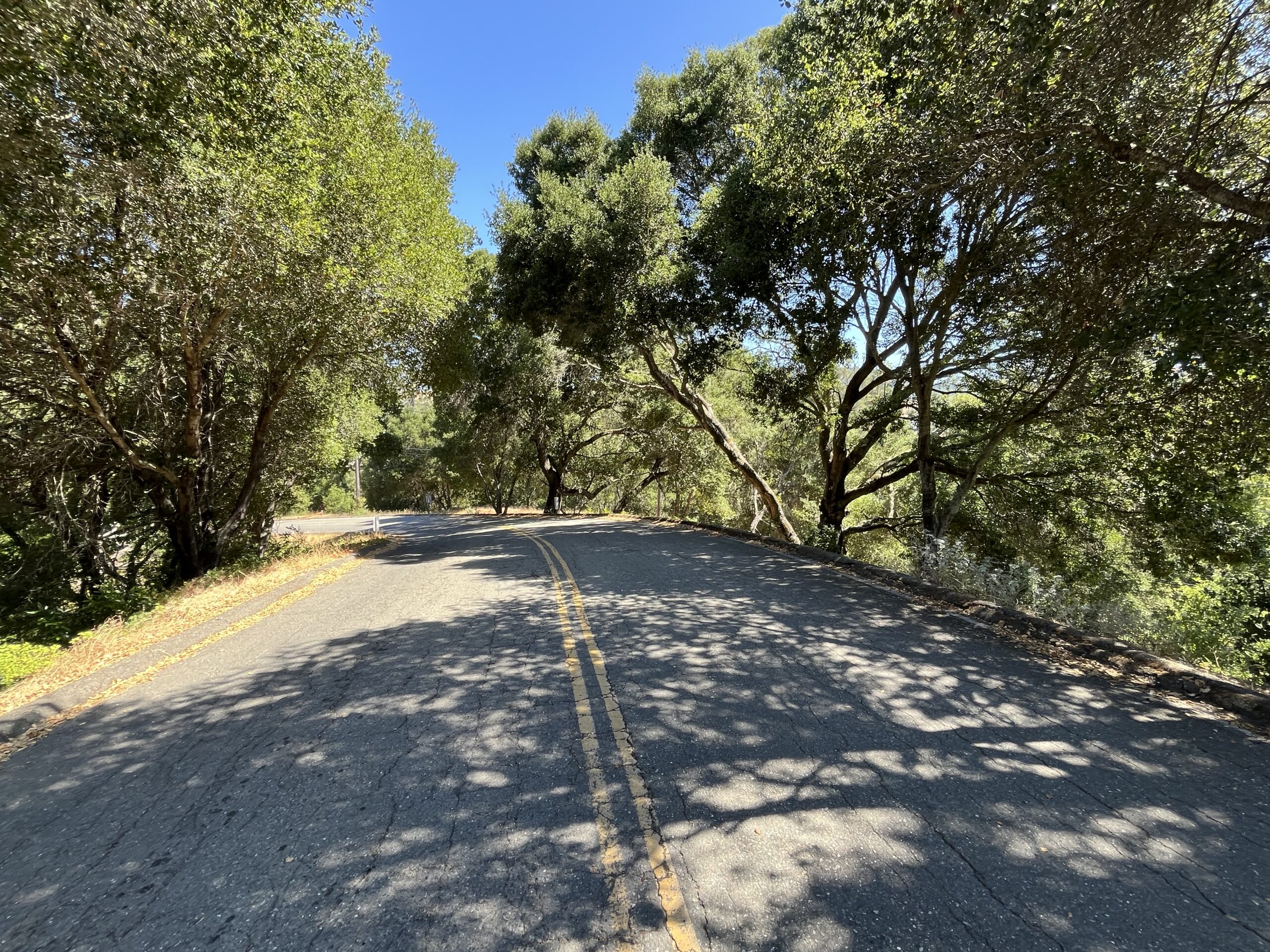
You might also look at the map and conclude that San Pablo Dam Rd., which is big, wide, busy, and smack on your L shoulder all the way out, would destroy your tranquility with its racket. Why it doesn’t, I don’t know, but it doesn’t. I was conscious of traffic noise a brief time or two during the ride—the rest of the time, I could have been in the Yolla Bolly wilderness.
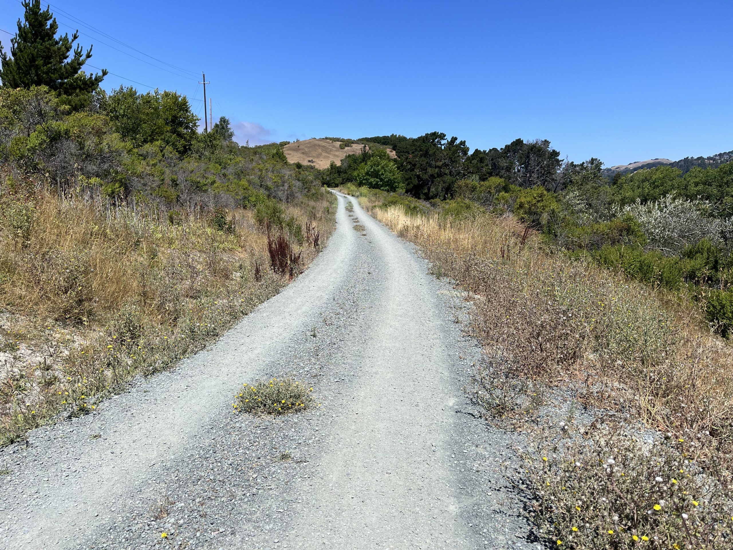
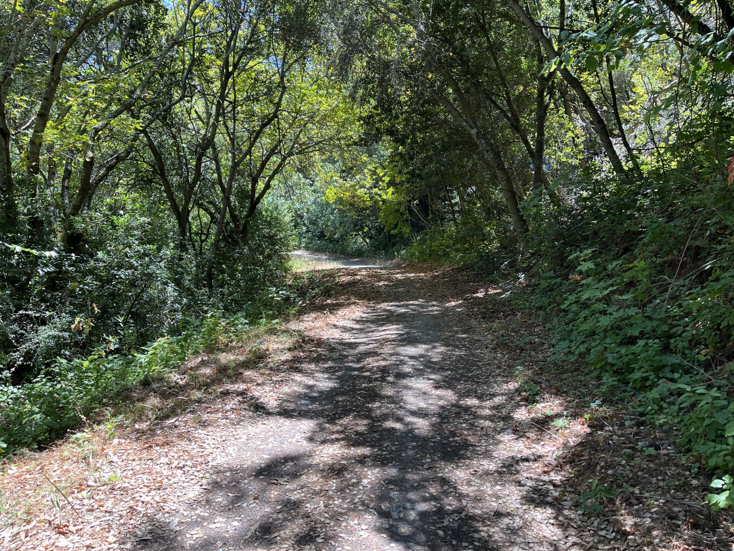
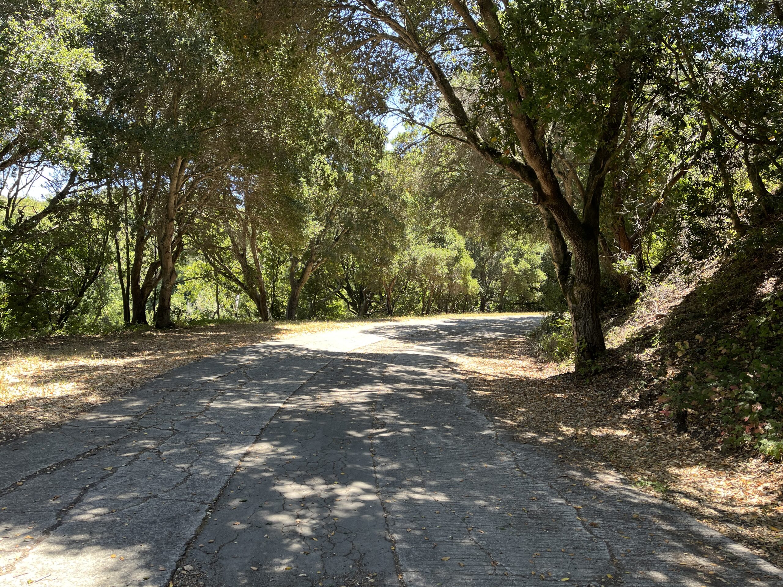
This is a ride for people who like variety of road surface. It’s constantly changing, and ranges from smooth wide two-lane to rough two-lane to on-and-off pavement to gravel to double-track to a really nasty 1/4 mile of single track you can walk. Most of it is delightful, almost all of it is pleasant. But it’s riding that demands your attention—you can’t faze out and rack miles.
Navigation, as I say, is tricky. There are innumerable gates, turns, and apparent dead-ends. You ride through a couple of parking lots. RWGPS’s map below is, I think, accurate. Googlemaps, less so. Ignore what RWGPS says about road surface. There is some confusion about names. RWGPS calls the second leg of the ride, after the first launch ramp, “Old San Pablo Dam Trail.” Googlemaps continues to call it “Old San Pablo Dam Road.” Some sources say you spend some time on the Bay Area Rim Trail; some don’t. RWGPS says you spend time on “the Kennedy Grove Connector Trail”; Google refuses to acknowledge that leg of the route exists. You may get momentarily lost a few times. That’s part of the adventure. I will talk you through it. If you keep heading NW, refusing to turn L back onto San Pablo Dam Road on your L or R into the lake, you should be good. Luckily, the GPS signal is strong on the route and my Garmin “you are here” map was fully informative throughout.
Since this ride parallels San Pablo Dam Road, which is a leg of the infamous Three Bears Ride, which I have badmouthed elsewhere in Bestrides, if you’re riding that loop you could use this route as a way to avoid the tedious slog that is SPDR. I’ve mapped it to turn around at Patra Dr., which is a suburban street 1/4 mile from the Three Bears route. But frankly if you like riding the Three Bears, which is the classic roll-and-chat slog, I don’t think this ride is your cup of tea. If for no other reason, this ride is slow, and you’ll probably want to get the Three Bears loop over as soon as possible.
Old San Pablo Dam Rd. takes off from San Pablo Dam Rd. 1/4 mi. west of the Bear Creek Rd./Wildcat Canyon Rd. intersection. There’s no place to park, but I assume you’lll be riding in from somewhere—might I suggest Inspiration Point? At the OSPDR intersection there’s a large sign reading “Orinda Watershed Headquarters.” Ride 1/10 mi past the headquarters buildings to the first of several gates. Go around the gate, minding the mass of poison oak on your shoulder, and ride on cracked pavement to the huge, eerily deserted boat launch facility. The pavement goes R down to the water—you stay straight onto gravel double-track.
Pavement comes and goes. At the next large gate you enter the San Pablo Reservoir Recreation Area, where you may see some picnickers and traffic may return. At the northern end of the complex there’s a large “EXIT” sign pointing you L onto a steep little climb that returns to San Pablo Dam Rd. Don’t take it—instead, go straight ahead onto the paved road. Go around another gate. After you see the reservoir’s dirt dam on your R, the main road again swings L and climbs back up to SPDR, and again you don’t take it—instead, take the unprepossessing single-track heading north from the curve. Suffer the very rough single track descent to a massive, apparently impassable black fence. The trail leads you to a large unlocked gate in the fence. Unlatch it and go through to the polished road on the other side. Note that according to the signs on the back side of the fence, you have just exited the San Pablo Reservoir Hypolimnetic Oxygenation System Project and you needed a trail permit to do that single track.
Ride 100 ft to the big curve in front of you. Going L again takes you back via a short climb to SPDR and again you want to go R, to the Kennedy Grove Regional Recreation Area. Ride through the parking lot to the large gate across the access road. The gate has signs reading “Pedestrian Access” and “No vehicles,” but I rode through without opposition. There is a sign saying that the gate may be closed “due to absence of visitors,” and (incredibly) that the gate is closed on weekends and holidays. If that’s true, turn around (you’d 100 ft from the end of the ride anyway) or ride back to that curve and take that L up to San Pablo Dam Rd.
100 feet beyond the gate is Patra Dr., and 1/2 mile beyond that is Castro Ranch Rd. and access to the Three Bears loop.
Shortening the ride: in general, the road surface gets sketchier the further you go, so ride until it isn’t fun any more. Note, I’ve identified 2 places where the route offers you a bail-out to return to the comforts of San Pablo Dam Rd.
Adding miles: You’re in Bicycle Central for the East Bay east of Tilden Park. There is the Three Bears, but more interestingly there is our Wildcat Canyon Etc. ride 4/10 mi. away. Other nearby possibilities are detailed in the Adding Miles section of that ride.
Jay your site is a treasure and an inspiration. Thanks for adding this one, and for using RWGPS now, I use it on my phone to keep me going in the right direction (now if they would only add climb profiles).
Y
Is it permissible to ride OSPDR during the off season, Nov-Jan?
Yes and no. Berkeley doesn’t really do winter, so weather isn’t a problem. The gravel stretch has a hard surface. But I would be reluctant to rude ANY dirt road right after rain, and the short single-track would be even more unpleasant when wet.