
Distance: 10.6-mile out and back (with a spur)
Elevation gain: 1215 ft
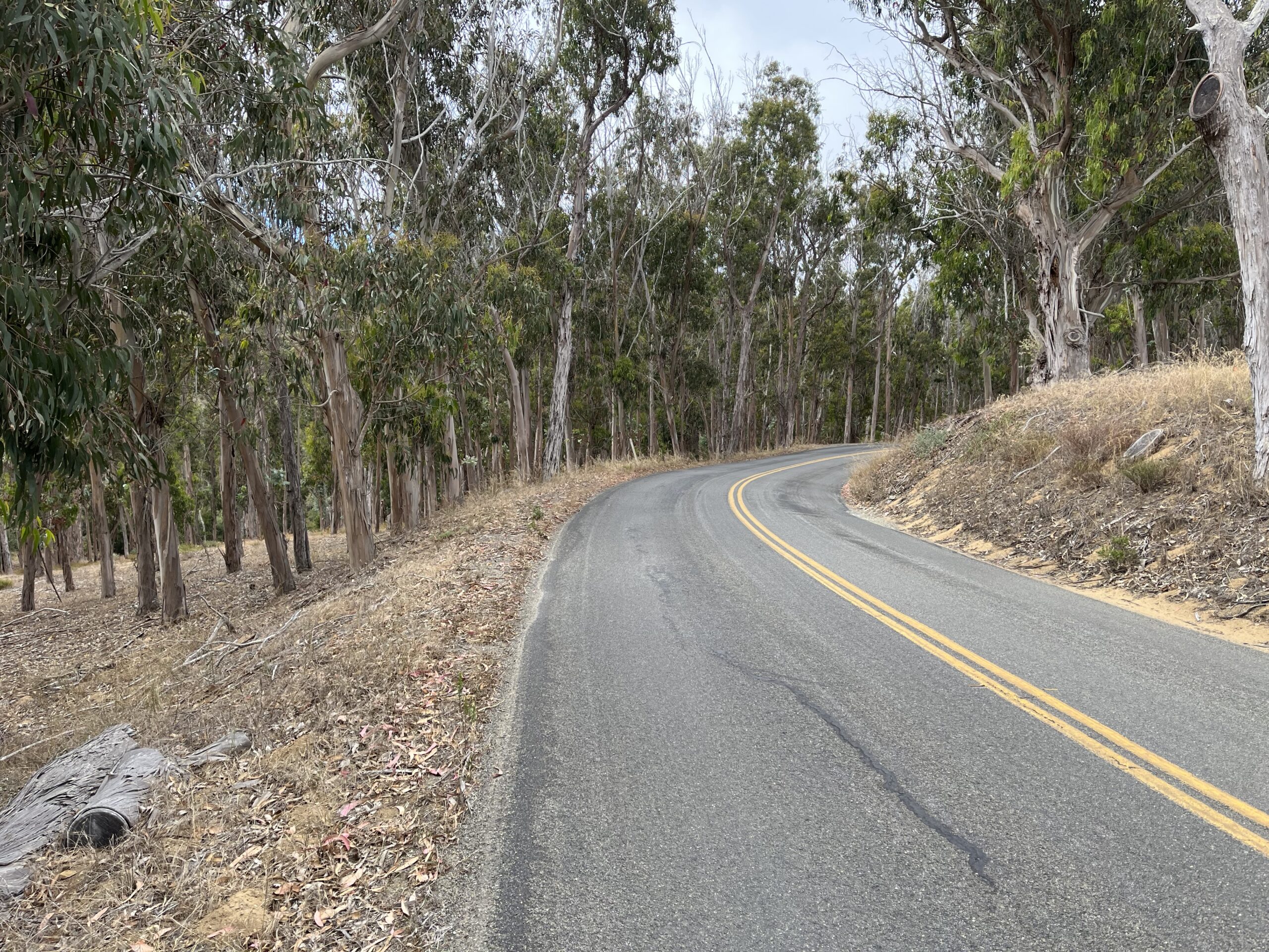
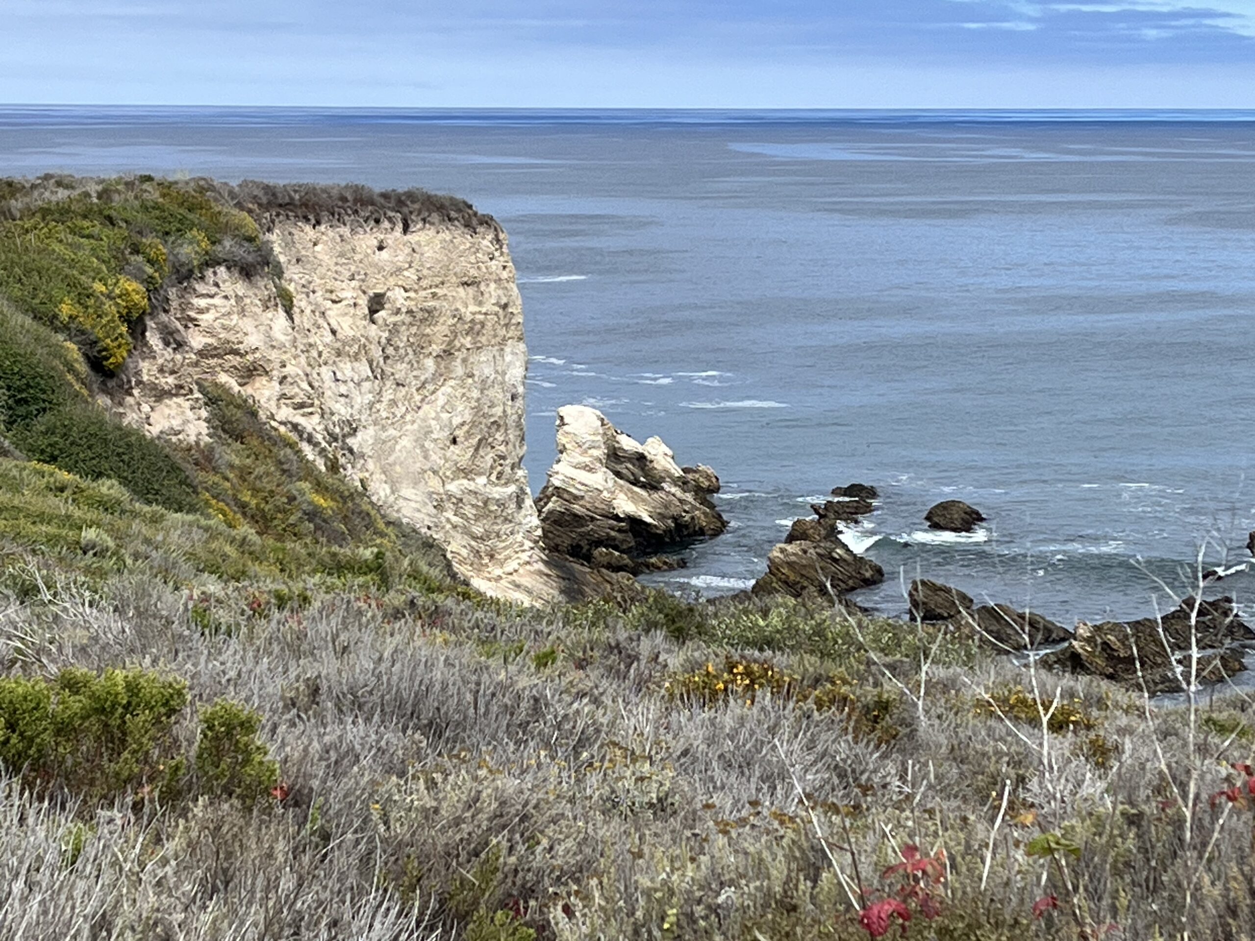
This is a short, charming ride through an enormous stand of eucalyptus trees and then along the stark, treeless headlands of the State Park. Most of the time you are well back from the shoreline (only dropping down to the beach once), so if you want to see breaking waves and eroding rock cliffs you’ll have to get off the bike and hike a trail (the Bluff Trail being the obvious choice). Which I strongly encourage you to do. At the Park visitor center there is the preserved house of the Spooners, the ranching family that worked the land in the 19th Century, well worth a visit. The lone beach, Spooner Cove, is across the street from the house, and it’s a nice one.
The road is actually called Pecho Valley Road, but I’ve never heard it called that, and any valley on the route is negligible. (While we’re on the subject, you won’t be riding any “montañas” either.) The road has a nice contour, never really flat or straight. The map profile suggests it’s fairly hilly, but it doesn’t feel that way. Most of the work is in the short climb from our starting point to the Park entrance, a straight, fairly featureless climb I’ve included largely to give you some work.
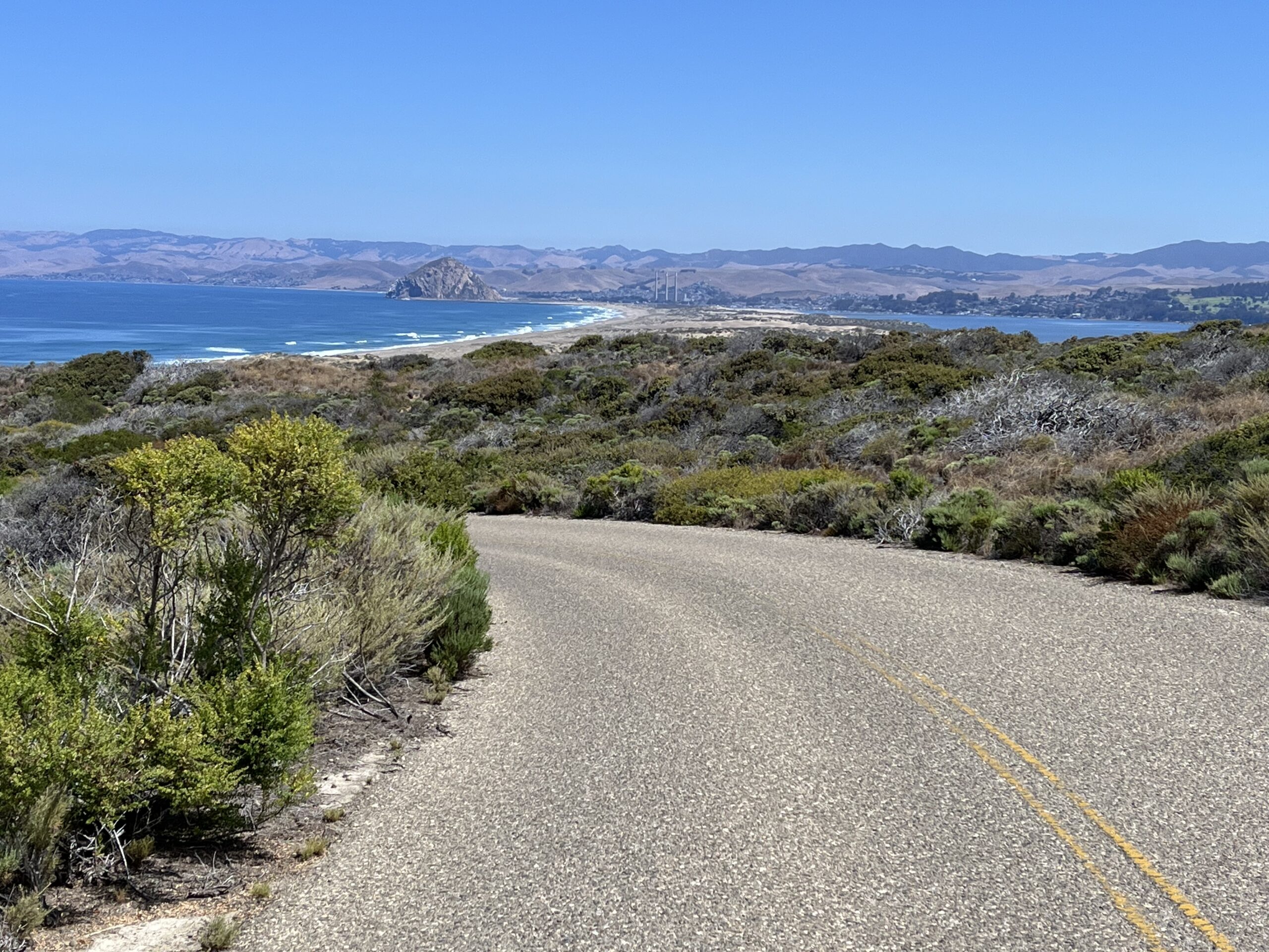
The views of the ocean from the headlands are pretty pedestrian as views of the ocean go, but there is a wonderful vista of Morro Bay, Morro Rock, and the sand spit separating the bay from the ocean, behind you as you finish that first hill—it’s easy to miss if you don’t turn around. Good as that view is, there’s a better one (same subject matter) from Sand Spit Rd., which is why I’ve had you take the short side trip onto it. Sand Spit Rd., despite all appearances, dead-ends at a parking lot far from the beach, leaving you a substantial hike to the water, so once you’ve seen the view you don’t have to ride the rest of it if you don’t want to.
The drawbacks of the ride are that it’s short, it connects with no other good riding (Los Osos Valley Road is mostly straight flat shoulder riding through ag country, abundantly ridden by locals but without much interest), it is often plagued by motorists, and there is no shoulder and little passing room. In other words, a classic early morning beat-the-traffic ride.
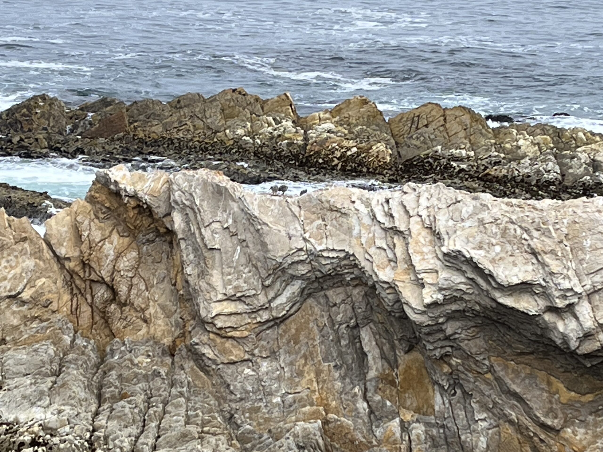
The park is a birder’s paradise, and you’ll probably see gulls, oystercatchers, guillemots, and owls if you walk the Bluff Trail. It’s also a haven for rattlesnakes.
There’s little to say about the ride itself. Ride to the gate blocking the road; turn around and ride back. Check out Sand Spit Rd. either on the ride out or the ride back. The main road actually continues on the other side of the dead-end gate, but it’s Diablo Canyon nuclear power plant land and for once I don’t suggest ignoring the No Trespassing signs.
Shortening the ride: Ride to Spooner’s Cove (the visitor center) and return. Those first miles are by far the most rewarding, both in scenery and in road contour.
Adding miles: Ours is the only paved road in Montaña de Oro, but the park is very friendly toward bike riders and welcomes them on many of their trails, so consider getting off-road. Islay Creek Trail is a good first choice, a meticulously maintained dirt road that’s easy on gravel bikes. The park is so supportive of bikers that they have loaner bells at the trailheads, so you can borrow one and warn hikers of your coming.
As I said, there is no other rewarding road riding in the Morro Bay area.