Distance: 35 miles out and back Elevation gain: 3925 ft
(A Best of the Best descent)
This is one of seven rides (all detailed in the Adding Miles section of the Mountain View Road post) that are worth doing around Boonville, a charming little town with good food and an interesting history, so I encourage you to find a place to stay in the area, make a cycling holiday out of it, and do all of them.
This ride has its drawbacks. The road is a little too trafficky, a little too wide, and a little too monotonous of pitch and a little too long climbing. But the pros outweigh the cons. The road contour is continuous mellow serpentining, the road surface is immaculate, the vistas in either direction are outstanding (Russian River Valley to the west, Clear Lake to the east), and the descents, on either side of the summit, are superb. I’ll put the descent on the east side up against any descent in Bestrides. It’s that good.
Which brings us to a dilemma: how do you ride a hill with a great descent on both sides? I’ve mapped it as an out and back, which is frankly asking a lot of your climbing legs and your patience. If you’re not up for that, you have three choices: a) arrange a shuttle and ride it one-way, and that way should be west to east; b) ride it as an out-and-back from base to summit, preferably on the east side; or c) do the loop I lay out in Adding Miles. Whatever you do, descending the east side should be your number-one priority.
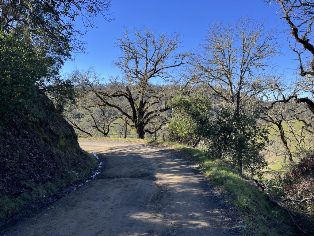
The first miles
Park on Hwy 175 out of Hopland. The route is very mild climbing for the first 5 miles, but if you want more warm-up you can ride Old River Rd., a perfectly pleasant flat ride, running north and south off 175 (clearly signed—the southern leg soon dead-ends at Hwy 101, the northern leg runs forever).
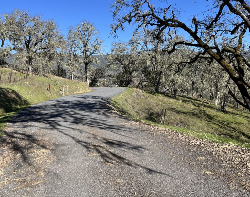
Back on 175, the vineyards in the first 5 miles are particularly picturesque. After 5 miles you run out of valley, you hit a 180 turn and climb for 5 more miles to the summit at a moderate pitch (6-7%) that hardly varies. Watch for the vistas of the Russian River Valley below you as you climb, but if you miss them the vistas on the east side are grander.
Miles of this
Just before the summit, you pass an “Entering Lake County” sign. If you’re planning on turning around at the summit, continue on a while because the vistas in the quarter-mile past the summit, of Clear Lake to the east and the ridges and canyons to the north, are magnificent. Much of the landscape was burned in the 2018 Mendocino Complex fire, but you’ll hardly notice now.
Just past summit, looking down on Clear Lake and fire damage—click to enlarge
Again, the descent from the summit heading east is simply perfect. Perfect pitch, perfect curves, grand vistas, open sight lines, lovely rock cuts. Notice I have no photos of the east side—I wasn’t about to interrupt my bliss by stopping to take photos.
If you’re following my route, turn around and ride back to the summit. Both climbs are about 5 miles of serious pitch, but RWGPS says the elevation gain on the east side is less because you’re starting higher. Be that as it may, I promise you’ll get your fill of work.
The eastside climb—your road is in center and at 10:30. Click to enlarge
Back at the summit, there’s a sign that reads “9% grade, next 4 miles.” Having already climbed it, you know that’s not true—it averages maybe 7% at the most—but it’s a lovely descent, all smooth, sweeping, banked curves where you can hold your speed easily, and the traffic becomes a non-issue because you’re going as fast as they are. At the bottom of the descent you have 5 miles of perfectly sweet 2% descending to make you feel like a god on the bike.
Shortening the ride: ride from either end to the summit, then return. Again, I recommend the east side.
Added miles: As I mentioned, Old River Rd. near the beginning of the ride is pleasant, easy riding in either direction. Old Toll Rd. takes off from 175 on the R a couple of miles into our route and gives you 2.7 miles of lovely rambling on good pavement before it turns to dirt.
Speaking of Old Toll Rd., after it turns to dirt it wends its way all the way to the eastern terminus of Hwy 175, changing its name midway to Highland Springs Rd. If you like dirt, consider looping the route, riding one way on 175 and the other on Old Toll/Highland Springs. Here’s a map:
I think RWGPS’s got the pavement/dirt proportions exactly right.
The good news is, once on this road it’s impossible to get lost—there are no forks or options, in either direction. The bad news is, the 10 miles of dirt range from OK to nasty. I did it once, on a gravel bike, and it beat my brains out. I feel no need to ever do it again. Don’t even think about it on skinny tires. However, I was riding clockwise, when most of the dirt is rocky downhill—if you do the loop counterclockwise, most of the rocky stuff is a moderate climb and much less jarring. But you give up the east-side descent on 175. It’s a tough call.
At the east end of our ride, 10 pleasant miles down Hwy 29 is our Clear Lake to Cobb route, which by some devil’s logic is also Hwy 175. See the Adding Miles section of Clear Lake to Cobb for more riding in that area. Five miles to the north on Hwy 29 is a short, easy gem, Scotts Valley Road, a pretty, mostly flat saunter through old pear orchards—perfect for a family spin.
(Note 11/12/20: Geysers Road was a victim of the Kincaide Fire. Richard (in his comment below) says the landscape is OK.)
For a comparison of 4 climbs in the Wine Country—Pine Flat Road, Geysers Road, Ida Clayton Road, and Cavedale Road—see the introduction to the Ida Clayton Road post.
Many areas have the “Big Ride,” the one you do on the day you want to put in some miles and do some work. In the Wine Country, the Big Ride is Geysers Road (when it isn’t Stewarts Point/Skaggs Springs Rd.).
When I reached the beginning of the Geysers Road climb, I was stopped by a group of road maintenance guys and we got to talking. Did I really want to do this?, one of them asked. Geysers, he said, was a mess. Long and steep, with a surface that was at its best broken pavement, at its worst full of gravel, rocks, and fallen plant material, with frequent stretches of dirt road and spots of minimally repaired earthquake damage where the road “just falls off.” Also no water or other reprovisioning opportunities, and little to no cell service.
As it turns out, he was absolutely right, but it’s a wonderful ride nonetheless and nothing to be feared. Except for one hard mile of 14-15% climbing, all the elevation gain (c. 4000 ft) is thoroughly manageable, and the scenery is stunning. As with all Wine Country riding, the road surface is indeed poor, varying from sorta OK to wretched, but the worst of it is on the ascent, when you’re doing 5-7 mph and it’s not an issue. I found the earthquake sections geologically fascinating. And the isolation is a large part of the appeal—after I passed the turn-off to the gravel pit 3 miles in I can’t remember seeing a single vehicle. (Mike below says 2021 saw a major patching of potholes and the road surface is now better.)
If you have everyone’s image of the Wine Country—vineyards, gently rolling hills, old farm houses, everything neat as a pin—forget it. Geysers is a wild and woolly climb up the side of a creek canyon, followed by a few ridge crossings and mad descents through more canyons, all barren of signs of humanity (one house, one thermal power plant). No wine tasting here. You do, however, get that stereotypical Wine Country riding experience on the Geysers Rd.-to-Cloverdale leg.
You want to ride Geysers from north to south. The road is in two halves with very different characters. The north side (up to the Geysers Resort Road turn-off) is narrow, mellow of pitch, rough, and winding. The south side is steep, wider, straighter, and smoother (though not smooth). So riding from south to north robs you of most of the road’s rewards: instead of a charming, curious, and mellow ascent and a speedy, relatively smooth descent, you get a steep, relatively featureless slog up to the summit, followed by an unpleasantly rough descent. You’ll see riders beginning at the south end, but I suspect they’re riding to the summit and back. This is fine if all you want is a workout, but the north side is by far the prettier and more dramatic.
By the way, you won’t see geysers. You’ll see some developed thermal activity in the distance to your L, but it isn’t pretty and the resort itself is closed.
I would avoid this ride on a hot summer day, since much of it is exposed and there is no water.
River Road
The route is in the shape of a D, with Geysers being the rounded part and the straight part being Hwy 28/Geyserville Rd./Asti Rd. The latter is all gently rolling valley riding, so you could start anywhere along it. I like to ride a while before climbing, so I start in Asti, which gives 6 miles of warm-up before Geysers, though in fact you could start in Geyserville if you wanted to get all the flat stuff out of the way.
Early miles of Geyser Road
Start at the intersection of Asti Rd. and unpretentious Washington School Rd. (there’s a small turn-out for parking). Ride down Washington School for a half-mile to River Rd…if you can. Washington School crosses a gully on a dirt bridge that is impassible in inclement weather, so WSR is gated off much of the year. (Note 6/2026: a reader comment below says the bridge is out of commission and looks to be so for some time.). Give it a try—consider walking the 100 yards of the bridge if it’s unrideable—because River Rd. is just perfect, an idyllic roll along the edge of the vineyards, with grapes on your L and woodlands on your R, on the only glassy road surface you’ll see today. It’s like the over-ridden Silverado Trail without the traffic and with more contour. If WSR is off limits, ride north on Asti Rd., which is merely OK. It will take you to the same place.
Leaving the creek
River Rd. runs into Geysers Rd. Geysers is narrow and rough at first as it follows beside and climbs high above Big Sulfur Creek, but the character of the road varies—from patchy one-lane to gravel to smooth two-lane with bright centerline. You will “climb” for the next 13 miles, to the Geysers Resort turn-off, but a lot of it is mild up and down and absolutely none of it is hard—mostly 4-5%, never more than 7%. This is the best scenery of the ride, particularly in the fall when the leaves are turning, and the road is constantly rising, falling, turning, so it keeps your interest. There are several short stretches of gravel, all easy to navigate on 23mm tires. Notice the earthquake damage—very short stretches of road where the surface has dropped a foot or so.
Much of the upper climb is nicely wooded
At the Geyser Resort intersection, everything changes. The road becomes a polished, wide two-lane with centerline, and the pitches are steeper. From here on the scenery is about big, open canyon vistas, and there are several places where the road skirts the lip of the drop-off vertiginously.
Typical south-half view: looking back from the summit (Geysers Rd. in upper right)
Immediately after the Resort Rd intersection, you will do the ride’s only real work, 1.5 miles of truly hard 14-15%. Then it’s an easy mile or two to the first of the ride’s two summits. Don’t expect to see the Hwy 101 valley when the view to the west opens up—there are canyons and ridges between you and it. Check out the perfect view of the next climb, a serpentining stretch laid out perfectly before you on the opposite hill. It looks like an utter bitch but isn’t bad.
Looking at the second climb, from the first summit
A steep 2-mile descent reminds you that no descending in Sonoma County is really much fun—too rough, and the possibility of potholes, frost heaves, or even gravel stretches is always there. Cross the bridge and do the last climb, 1.5 miles that at first threatens to be ugly but soon turns moderate. Then substantial descending, which would be great if they’d just pave the damned thing, until you re-enter the valley.
Hwy 128: nice if the traffic is light
Take Hwy 128, which is very pretty but a bit too trafficky, to Geyserville, then Geyserville Rd, which becomes Asti Rd., back to your car. This last stretch is on the very shoulder of Hwy 101 and thus is only OK riding, and it rolls more than your tired legs would like, so be prepared (or start your ride in Geyserville).
Shortening the route: I wouldn’t. You could ride to the first summit and turn around, but you wouldn’t save yourself much in the way of miles or work, and you’d miss some very good stuff.
Distance: 21 miles out and back Elevation gain: 2440 ft
Mt. Veeder Rd. is a text-book two-hour ride: a straight ride up and over a summit, down the back side, then return. The landscape is varied and always pretty, and the road contour is ever-changing. It’s a perfect, delightful ride, and the descent is my favorite descent in the Wine Country after Fort Ross Rd. Once it was cursed with the usual Sonoma County lousy road surface. But MVR was recently repaved (Thanks, Joel) and as of 2025 the one-obnoxious chipseal has worn down nicely, so it’s close to perfect.
MVR, like most of California, has been built up some since I started riding it, so it’s not quite the wilderness it once was, but it’s still lush and gorgeous. It’s paralleled by a much more car-friendly road, Dry Creek Road (more on that later), that goes to the same place, so logically it should be car-free. It isn’t. Expect a couple of cars a mile.
By the way, names are misleading here. You are not climbing a mountain, and, despite the fact that you begin on Redwood Road and follow Redwood Creek for miles, these are not redwood forests. If you look up the hillside to the west you can spot some scraggly redwoods, but that’s it. Still, the non-redwood woods are quite pretty. For redwoods, add on the Redwood Rd. fork (see Adding Miles below).
It’s very lush for the first miles
If you’re planning on returning via Dry Creek Rd., you can park among the housing tracts off Dry Creek Road’s east end and ride the easy mile to the start of Redwood Road, but you don’t have to—there is ample shoulder parking in the the first miles of Redwood/Mt. Veeder around Browns Valley Rd., and BVR itself offers endless tract housing parking. The first miles of the ride are a shallow enough climb that you can easily warm up on them. You ride along Redwood Creek, a pretty, heavily canopied stream. Soon Redwood Rd. goes L, and the road straight ahead becomes Mount Veeder Rd (it’s all signed). You’ll see numbers painted on the road—1100, 1200—which for a long time I thought were elevation markers, but I think they’re street addresses. The pitch goes from mild to moderate, then gets serious for the last 1.2 miles (9-11%) before the summit.
At the summit, a number of things happen: 1) you reach the intersection of Mt. Veeder and Lokoya Rd to the L; 2) you get the best vista on the ride of the land to the north; 3) you enter an area damaged by the Tubbs Fire, which burned 2800 homes in Santa Rosa in October of 2017, though it’s still pretty; and 4) you do not descent yet—you roll up and down for 2+ very pleasant miles. At 8.5 miles the real descent begins, and you drop for 2 miles, all the way to the T at Dry Creek Road.
It’s drier further up the hill
This descent is full of lovely moments and the scenery is gorgeous, which if you descend like me you won’t notice until you climb back up.
At the turn-around point you have a route choice: ride back on Mt. Veeder, or turn R and ride the half-mile to Dry Creek Road (not the famous Wine Trail road out of Healdsburg—this is another Dry Creek Road) and ride it back to Redwood Road. Both are very good options, and most local riders do the loop route. I don’t.
Here’s how to make up your mind: DCR has a much gentler pitch, and is wider, straighter, more open (sunnier), and much more developed. And it eliminates the 2-mile climb at the start of the Veeder return ride. As a result of all this, it’s easier, gentler, and less dramatic. It’s pretty, but not as pretty as MVR. Do it if you’re ready to relax on the ride home. The Mt. Veeder return is dramatic, exciting, and dodgy. Do it if you want to whoop and holler, and work a bit. I’ve mapped the ride as an out and back, because the MVR descent must be experienced at least once. The two-mile climb that starts the return ride is substantial but never daunting, and the scenery is excellent.
Dry Creek Road: slower, smoother, more open, blander
Shortening the route: Ride to the summit and turn around.
Adding miles: The easiest add-on is the 3+ miles of Redwood Rd. (one way) that forks off to the L on the ride up and gives the main road over to Mt. Veeder. It’s prime riding, much like Mt. Veeder, and a joy both climbing and descending. The descent is especially good, thanks to the immaculate road surface.
If you turn the other way at the far end of Mt. Veeder Rd and go L onto Dry Creek Rd, it will soon turn into Trinity Grade, a classic little up-and-down across a ridge separating Napa County from Sonoma County. It’s very steep, very twisty, and pretty busy, but it’s very pretty. It’s discussed at length in the Cavedale ride post.
Speaking of Cavedale Road, it takes off from Trinity to the L (southeast) at Trinity’s summit. See our Cavedale write-up for details and for info on looping Mt. Veeder and Cavedale.
If you go R at the Veeder/Dry Creek Rd intersection, then go straight instead of R again at the next intersection, you’re on Oakville Grade, a short stretch of road famous for its steepness. I haven’t ridden it.
Mt. Veeder Rd. is part of the Tour of the Napa Valley, a century with good folks, good food, good roads, and a great attitude. On the century, as you approach the summit of Mt. Veeder Rd, you hear bagpipes. The music is live and coming from the summit, and it’s meant to lift your flagging spirits. Boy, does it work. One of the great century perks of all time.
Distance: 22 miles out and back Elevation gain: 2600 ft
Occidental is an amazing cycling resource. Six roads head out of this little town, and each one of them is some degree of wonderful for riders. All 6 figure in a Bestrides route in one way or another. This route focuses on the roads to the west of town.
This ride has great variety of scenery and road contour in only 12 miles—dense deciduous woods, some redwoods, a meadowed valley, some open, rolling coastal uplands, the coast itself, and an iconic climb up from Hwy 1. It’s all really pretty. It’s more work than meets the eye—2600 ft in 20 miles, or well over our 100 ft/mile benchmark for climbing hardness, with several short pitches of 10% and three extended climbs you’ll definitely notice. And the road surface is consistently poor to dreadful (this is, after all, Sonoma County), so all descending is largely spoiled. Yet I’m very fond of this ride, and I think you will be too. A bonus is that it starts and ends in Occidental, one of California’s most charming villages. See Adding Miles below for other routes out of Occidental with much better road surface.
The climb up from the ocean after the turn-around tends to be mentioned in hushed tones by California cyclists, because it figures in the routes of a couple of famous rides, Levi’s Gran Fondo and the Marin Double Century. It’s a bit of a spirit-crusher after 70 hard miles, but you’re going to be fairly fresh, so it’s not a huge deal. You’ll climb about 700 ft in about 1.3 miles, roughly 10% average, with a stretch in the middle around 12%. About the time you start cursing, it’s over. And it’s at its steepest in the first half, so your spirit improves as you climb.
Begin in Occidental. See our Occidental Loop ride for details on the town itself. Ride west on Coleman Valley Rd. Instantly you’re into a short but steep (10%) climb that will kill your cold legs, so you might want to ride some flatter stuff to warm up. There are four other roads heading out of Occidental, and they’re all good riding, but none of them is flat. The nearest to flat is a very sweet little back road named (so it says on the sign) “Occidental CP MR RD,” which apparently stands for “Occidental Camp Meeker Road,” off Bohemian Highway just north of town on the R.
At the top of the climb, in a small saddle, there’s an intersection with two street signs telling you that Joy Rd. goes straight and Coleman Valley Rd. goes to the R. If you’re looking to minimize your climbing, start your ride here (though parking is hard to find—there’s a tiny dirt pull-out a stone’s throw down CVR).
The road climbs and drops through lovely, thick coastal forest into a charming, unpolished farming valley, the eponymous Coleman Valley. Note the old one-room schoolhouse preserved on your R. There is often a flock of wild turkeys in the area around the school.
A wee bit o’ Scotland
At the far end of the valley you climb, significantly, for a mile to a series of rollers through classic coastal headland. You’ll swear you’re in the Scottish highlands. Fog is common here on warm days, but it only adds to the Gaelic atmosphere, and almost always Hwy 1 is below the fog layer so you should get good views of the ocean and the coast. This is open range, so you’ll see cattle and sheep, sometimes on the road. The road is constantly and seriously up and down (in either direction), so you’ll burn more energy than you expect.
1.5 miles from the end, the road drops straight down to Hwy 1 and the ocean. The descent is a little too steep, too rough, and too tightly curved to be a lot of fun. There’s a bone-rattling cattle guard right in the middle of the descent, just where you don’t want it, at a spot where you’re tempted to get up some serious speed. There appears to be a second one, but it’s actually fake—just white lines painted on the road.
Coleman Beach State Park
At the CVR/Hwy 1 junction, go straight across the highway onto the unmissable little path that is Coleman Beach State Park (unsigned). You’re on top of typical coastal headland bluffs, and I saw no way down to the water, but the views are good in both directions. It’s a perfect place to have a little picnic and watch the waves crash on the rocks below. There’s a small interesting coastal community, Carmet, 1/2 mile north on Hwy 1 if you want civilization.
Climb back up the Wall. At the top, the climbing is by no means over—the route home has less climbing than the route out, but not by much.
Looking south along Hwy 1
When you get to the Joy/CVR intersection, you have a choice. You can go L and return to Occidental by way of the short, steep drop you rode up at the start of the ride. Nothing wrong with that. But our route goes R, onto Joy Rd. for a very sweet 1.3-mile descent. Take the first real L onto Bittner Rd. (it’s at the bottom of a steep saddle, so you’ll probably be doing about 35 mph when you reach it). Bittner would be a bucket-list descent if the road surface were pristine, which it isn’t. It’s still fun, and very pretty.
This ride is not car-less. Coleman Valley Road is anything but built up, but people do live there, and there’s Carmet at the end of it, so you will see traffic—perhaps 2 cars per mile.
Shortening the route: If you’re just out for an easy day, start after the Joy/CVR intersection, ride to the drop-off to Hwy 1, enjoy the vista, turn around and ride home.
Adding miles: Also leaving from Occidental, Graton Rd. is the first leg of our Occidental Loop ride. The Bohemian Highway is the first leg in our Bohemian Highway Loop. Both of these rides have very good or mostly very good road surfaces. Ride Bohemian to its northern end in Monte Rio and you’re a stone’s throw from our King’s Ridge Road ride and our Sweetwater Springs ride. Two readers (below) trumpet the merits of riding Bohemian, riding to Hwy 1, riding south to Colman Valley Rd., and riding east on CVR back to Occidental. Bohemian to the southeast takes you to Freestone, home of the locally famous Wild Flour Bakery, and the north end of all the fine riding in the Marin hills, represented in our list by the Chileno Valley Road/Tomales Bay Loop. You can turn our route into a loop by turning north up Hwy 1 when you reach the ocean and turning R on Willow Creek Rd., a very back-country back road with a long stretch of dirt in the middle I’ve been assured is rideable (Levi’s Gran Fondo has a route that includes it). You may want 28 mm tires for that one.
Fans of bike paths will want to know there is a flat, straight bike path from Santa Rosa to Sebastopol, the Joe Rodota Path, that parallels the highway (not too thrilling except as time trial training), and its continuation, the West County Regional Trail, from Sebastopol north to Forestville (somewhat less boring).
This ride is legendary. It’s the cornerstone of Levi Leipheimer’s King’s Ridge Gran Fondo, a ride that includes, in addition to most of this loop, our Coleman Valley Road ride, plus about 30 miles of very nice rolling farm and forest land riding out from Santa Rosa to Occidental and back. I don’t recommend Levi’s ride per se, because I think it’s unfriendly, but the entire route is well worth riding.
As is my method, I’m going to cut out Levi’s 30 miles of merely good riding and just tell you about the great stuff. It’s all pretty, challenging riding (5530 ft gain, and the poor road surfaces add to the effort). Perks include redwoods, a classic woodsy village, a Best of the Best descent, and the opportunity to detour to an overnight on the coast.
King’s Ridge Rd. (or King Ridge Rd.—you see it both ways) is a rough, centerline-less sorta-two-lane road that does a lot of climbing and then rolls along a ridge top through beautiful, wild country—rugged ranches and open space. Traffic is almost non-existent—the last time I rode the 47-mile loop, it was a beautiful holiday and I saw 8 vehicles, or 1 vehicle every 6 miles. The views from the ridgetop are grand. You can look north over a series of ridges untouched by Man and imagine that you’re the first human to see it. The odd thing is, you’re close to right. If you look at a map of California, you’ll see there’s nothing to the north of you for a hundred miles except a few small, sparsely-traveled roads. Breathe deeply. It’s a lonely, inspiring experience (another reason not to do it as part of Levi’s ride, when you have 7,000 riders for company). It’s not as wild as it used to be, thanks to some invasive vineyards, but it’s still epic.
The bad news is, the road surface varies from poor to lousy for most of the 50 miles. For some, the rough road surface becomes part of the adventure. And someone actually repaved 2.2 miles of it (see below), so it’s not as bad as it used to be.
(Note: if you read through the readers’ comments below, you’ll see that the state of the road surfaces on the climb to King’s Ridge is the subject of much debate. I haven’t seen it in a while, but I gather it’s much improved—by how much is unclear.)
Water is an issue on this ride, as it’s all in relatively unpeopled areas after Cazadero. There is a water bib just after the climb out of the Hauser Bridge canyon, provided for you by the thoughtful monks of the Ratna Ling Retreat Center—watch for it in a dirt turn-out on your R, just before the unmissable main gate. Still, you might want to dig out your camelbak for this one.
I’ve seen articles which call this ride “the greatest bike ride in America.” That’s absurd. It’s good. It’s in my Best Of the Best, but is actually one of my least favorite rides on that list.
(The 3-mile stretch of road marked as unpaved on RWGP’s map is wrong—the route is entirely paved.)
Start at the intersection of River Rd. and Cazadero Highway. Ride north up Cazadero Hwy to the town of Cazadero through lovely coastal forest. (If you’re dead set on back-road riding, you can ride up Austin Creek Rd., the smaller, rougher road just on the other side of the creek to the east. The turn-off from Hwy 116 is unsigned.) Cazadero Hwy has a glassy road surface, and it’s a barely perceptible climb all the way, perfect for warming up, and a treat when you’re ending the ride and you’re exhausted. It’s the last really good road surface you’ll see for 40 miles. Halfway to town, watch for the large, whimsical wooden sculpture of Babe Ruth on your R—if the nice man who does the sculpting is out and about, he might be willing to show you his other works.
King’s Ridge. Photo by Brian
Cazadero is a hardware store, a church, a firehouse, a general store, and (surprise!) some fairly heavy industry. Ride through Cazadero, make sure you go R at the Y just past town (there’s a clear sign pointing you the right way, and marking the other fork as Ft. Ross Rd., which is your return), and begin a leisurely climb. The road changes its name somewhere in here to King’s (or King) Ridge Rd. The climbing is easy until it isn’t—then it’s 1.2 miles of 10-14%, followed by an obvious “summit” that is the Father of all false summits. You’ll descend and roll and assume you’ve done the hard climbing, but the steep pitch comes back, and you do at least another mile of 10% stuff. From the beginning of the hard stuff to the end, including the rolling in between, is 4 miles. It’s all pretty country and the contour is never monotonous. Pop out onto the ridgetop and ride through miles of big, tiring rollers (you’ll see 14% pitch again, briefly), often along the very spine of the ridge, with the aforesaid grand views. There’s a great spot where crows ride the thermals coming up the slope to your L and they’re at exactly eye level. This is open range, so watch for several cattle guards.
Along the top of the ridge. Photo by Brian
At the end of the ridge, you come to a sloppy T where the road to the R (unsigned, I think) is Tin Barn Rd., which is also in Bestrides. The road to the L is signed “Hauser Bridge Road.” Go L (do some of our Tin Barn Rd. ride backwards) and plummet down a vicious 12-20% pitch with a rough surface to a steel bridge over a creek. This descent is zero fun, so ride it just to survive—on one wet Levi’s ride they helicoptered out a few people who went off the road into the crevasse below, and subsequent riders were required to dismount and walk down the hill and across the bridge. The road is covered with painted “SLOW!” signs to remind you.
On the other side of the creek the road turns up, as roads after bridges must, and you climb at a consistent 10% for 1.5 miles. When you see the cow on the sign, the hard work is over—you now roll up and down, mostly up, for several miles. From here on the road is clearly signed (you’re going to Cazadero, not Jenner, remember). You’ll ride past Timber Cove Rd. (there’s even a stop sign) and later Fort Ross Rd., both entering from the R. At the next fork go L, onto what is also called Fort Ross Rd. (clearly signed).
But before you do that, consider: do you want to add miles to the ride and go straight past Fort Ross Rd., descend Meyers Grade, and keep riding? The consequences of doing that are detailed in Adding Miles below.
Assuming you take FRR: At this point, 33 miles into the ride, you’re thinking, “OK, I climbed a ton up to King’s Ridge, descended to Hauser Bridge, climbed it all back, then rode 10 miles, mostly up, to here. So when do I get all that elevation gain back?” Answer: right now. Fort Ross Rd. is 10 miles consisting of a not-long-enough, perfect descent, a 2-mile climb, and a long, very rough descent back to that fork just north of Cazadero. It’s all gorgeous woods, as pretty as forest can get, but the first 3 miles are the prettiest, so enjoy the scenery if you can while navigating an exhilarating slalom. The first 2.2 miles (the entire first descent plus a bit) have recently been repaved and the road surface is perfect. The pitch is ideal (c. 7%), the serpentining is constant, the turns are sweetly banked, and every corner is unique. As a result this is one of the best descents I know of—a Best of the Best descent for sure.
Ft. Ross Road (looking uphill)
Enjoy it, because after the repaved 2.2 miles the old pavement returns, and it’s grim. It’s tiring to climb and jarring to descend at speed. After I rode it, I felt I had been worked over by rubber-hosed goons. By the way I saw no sign that anyone was planning on extending the repaving any time soon (as of 6/25). Letting air out of your tires helps, which you can safely do because the climbing is over.
At the fork, continue straight onto Cazadero Hwy., buy an ice cream bar and sit on the Cazadero general store’s porch for a bit to contemplate what you’ve accomplished, then ride the effortless descent to your car. Now go casually mention to your riding buddies, “Dudes, did King’s Ridge last weekend…”
Shortening the ride: Start in Cazadero (this will save you some miles but almost none of the work). The loop can’t be cut short, but you can make it a mellow(er) weekend by taking Timber Cover Rd. to Timber Cove and staying overnight at the lovely and (when I was there) surprisingly cheap Timber Cove Inn. If you do, don’t ride back up Timber Cove Rd. the next day—it will kill your cold legs. Instead, ride south on Hwy 1 (deserted in the early morning) to warm up and take Fort Ross Rd. (also steep) to get back on our loop.
There’s a chunk of the loop that makes a very sweet 20-mile out-and-back. Start at the top of the climb out of Hauser Bridge, ride to Ft. Ross Rd., descend the super-sweet 2.2 miles of new pavement on Ft. Ross, and return. This gives you about 15 miles of moderate up and down, plus a Best of the Best descent and a beautiful 2.2-mile climb, all on decent to great road surfaces.
If you detour to Meyers Grade, you get this
Adding miles: You’re in the midst of lots of great riding here. Going back to the L we took onto Fort Ross Rd.: if you live for fast steep descents, or if you want to see some ocean, don’t take that L—go R onto Meyer’s Grade Rd. (staying on the Gran Fondo route) and get ready for the Meyer’s Grade descent to Hwy 1. It’s a rocketship ride remembered by everyone who does it (to 16% grade). It’s beautiful country, though more open hillside than Fort Ross Rd’s woods, set smack on the spine of a little ridge so you get ocean views on a clear day. Sightlines are good, so any traffic will be apparent, and there’s a big run-out at the bottom, so it’s as safe as a 50-mph descent can be.
After the descent you will pay a price for coming this way. You can turn around, ascend Meyers Grade, and get back on our route. It’s steep (still up to 16%), but the scenery is good to great, the pitch varies, and the road meanders, so it isn’t boring. Otherwise, you’ll need to ride a substantial stretch of Hwy 1. This is as pretty a stretch of Hwy 1 as there is, and the road contour is amazing—it’s the stuff of TV automobile ads—but traffic is a hassle. As I recall, there is no shoulder. If dodging cars doesn’t bother you, it might be your favorite part of the ride (certainly the most dramatic). Ride Hwy 1 to Jenner, where you can take the Shoreline Hwy up the Russian River back through Duncans Mills and to your car (moderate traffic), or do what Levi’s does and continue on down the coast to our Coleman Valley Road route, then take the Bohemian Highway from Occidental back to your car. While you’re in Jenner, you might as well ride the pretty 4-ish miles (one way) of Willow Creek Rd. before it turns to dirt. In for a penny, in for a pound.
The Tin Barn/Annapolis Rd. ride sits right to the north of your route and actually overlaps it for a few miles, from the Tin Barn fork to the intersection with Kruse Ranch Road.
From the end point of this ride you’re just down the road from the end point of the Sweetwater Springs Road ride.
See the Adding Miles sections of the Sweetwater Springs and Coleman Valley Road rides for more far-flung possibilities.
Distance: 10 miles one way Elevation gain: 1434 ft
This is a challenging climb and ripping, curvy descent through surprisingly dense, pretty woods. It would be deserted were it not for the other cyclists, of which there can be many. One weekend day I met about 200 bikes climbing the back side as I descended. On a weekday, you’ll see no one. The road surface is a little rough in places, but I don’t think you’ll mind. I’ve called the ride a one-way. People ride it in either direction, so it’s possible to do it as an out-and-back, but it would give you two tough climbs, and most riders make a loop (which I will describe in Adding Miles) along roads that aren’t good enough to make our list but are good nonetheless. I always ride it the way I’ve described it, east to west. If you ride it the other way, the climb is less steep and longer.
It’s shady in there, so this ride can be drippy. It’s not a problem until you hit the 18% stuff. I did it once when the road had a thin film of water on it, and traction was…interesting. On a dewy morning you might like to wait until later in the day or start the loop from Guerneville.
Warning: periodically my electronic mapping services show a gap in the middle of this road—not a stretch of dirt, just nothing. Trust me, the pavement is continuous.
Start at the intersection of Sweetwater Springs Rd. and Westside Rd. There’s a small but nice turn-out for parking 20 yards up Sweetwater Springs Rd. Ride Sweetwater Springs Rd. to its dead end on Armstrong Woods Rd. You’ll start with some rolling climbs, then a surprisingly long descent, then ride along a little creek through a lovely, shady, thickly-wooded riparian area, then start some serious climbing.
Early Sweetwater rollers
When you enter the riparian area, the road surface deteriorates for a while, and then the climbing gets positively fierce, like 18%, 4-mph fierce. Luckily when the pitch is at its worst, the road surface is glass. The really hard stuff doesn’t last more than a mile or so. Watch for a paved driveway on your left which marks the end of the steepest work. The climb continues, but at an 8-10% grade that feels positively easy by comparison.
Along the creek (winter)
Past the obvious summit it’s all very fast, very curvy downhill—watch for road imperfections and bicycle traffic coming at you.
Adding miles: If you don’t want to ride back up the hill, you can loop back to your car with negligible climbing by riding back along the Russian River. The scenery is great, and you get to experience Guerneville, a wonderfully charming below-the-radar village. From the end of Sweetwater Springs Rd. go L onto Armstrong Woods Rd. into Guerneville. Turn R on Main St., ride to the Safeway parking lot on your L, and eat at the taco truck in the parking lot. Ride back up Main St. the way you came and keep going east along the Russan River on what is now called River Rd. This leg is narrow with a minimal shoulder, and it’s always busy with traffic, so it’s not a stretch of road I enjoy by any means, even though the ambiance (river, lush woods, old-California ramshackle vacation cabins) is adorable. Watch for Westside Rd. angling off on your L and take it—it’s all fine riding from there to your car.
At the end of our route, Armstrong Woods Road to the R is reputed to be short, steep, and rewarding.
Four miles north up Westside Rd. is Mill Creek Rd., which is described in the Adding Miles section of the Pine Flat ride. Westside Rd. itself is a popular mellow bike route, but its northern end is lined with wineries, so it’s busy with cars.
There is great riding north and south of River Rd. To the south, the Bohemian Highway is beautiful all the way to Freestone, although it’s a bit of a car thoroughfare. To the south and east of Freestone everything is good, especially Barnet Valley Rd. In the middle of the Bohemian Hwy lies the town of Occidental, a nice spot with a few surprisingly good restaurants, and the beginning of the Coleman Valley Road ride. Mays Canyon Rd. is a particular treat—a gorgeous, centerline-less, patchy, winding path through back country so heavily wooded you almost need a machete. On the north side, a few miles toward the ocean from Guerneville, is the King’s Ridge ride. See the Adding Miles sections of the Coleman Valley and King’s Ridge rides for more possibilities.
Distance: 24 miles out and back Elevation gain: 3060 ft
(Note 11/12: Pine Flat Road, along with Chalk Hill Road, was a victim of the Kincaide Fire. Nibbles (below) says they’re both still grand.)
For a comparison of 4 climbs in the Wine Country—Pine Flat Road, Geysers Road, Ida Clayton Road, and Cavedale Road—see the introduction to the Ida Clayton Road post.
This ride is a climb. Just one big, hard, magnificent climb up a 1-1/2-lane road without a center line (my favorite road size). I learned about it when someone told me it was a favorite training ride of Levi Leipheimer. But it’s more than just a training ride. It’s very pretty in a dry, barren sort of way, with grand, expansive views, it has a lot of variety to the road contour, and it dead-ends at the summit, so it has no through-traffic. Except for a few scraggly houses, it’s just you, the road, and the scenery.
Climb to the top of that farthest ridge, then the top of the ridge behind it
You’re going to climb from the floor of the Alexander Valley to the spine of the ridge to the east (actually the northeast, which Northern Californians call east). Begin at the Jimtown Store on Hwy 128, which used to be a favorite destination for local cyclists but apparently is now closed (thanks, David). A new shop has opened next door and can give you water after your ride. Ride east—to your right if you’re looking at the store’s front door—on Hwy 128 and continue straight onto Pine Flat Rd. It will soon begin to climb, moderately and pleasantly for several miles. Keep looking around you—the views keep changing as you gain elevation. You’ll ride through some steeper pitches until you reach a saddle, pass through it, and surprise!—you descend into a sweet little hidden valley, the eponymous Pine Flat.
Beyond the valley the road turns seriously steep—“damn it I absolutely will not walk this” steep at its worst—with lots of pitches in the teens and the occasional 17%—as it climbs up to the next ridge to the east. It moderates, then goes around a left turn, and, bang, you’re done. You finish at the precise spine of the ridge—the road continues down the back side, but it’s private and gated off. Pat yourself on the back, enjoy the views, try to ignore the spent cartridges that litter the ground and disturb your tranquility, and ride back home.
Heading home
The ride back down isn’t all ideal. Some pitches are too steep to enjoy (especially watch the first hard L turn that comes very soon after you start back—I went rocketing off the road there when I vastly overestimated my braking power). There is some rough road surface near the top. But much of it is great, and it gets better as you get lower and the road gets straighter and smoother and the pitch gets shallower. The last few miles are dreamy, as close to soaring as you can get on solid ground.
Shortening the ride: Ride to Pine Flat and turn around. The upper half of the ride is steeper and rougher, and David (in the comments below) thinks it isn’t especially rewarding anyway.
Adding miles: Pine Flat Rd is close to almost all the other rides in our Wine Country ride list and several other good rides. Remember, no riding on numbered roads. Hwy 128 south has a great contour, but it’s usually very busy with cars and passing is difficult. But all the roads that climb out of the valley, to the east and to the west, are good (and vertical). A stone’s throw to the north (take Red Winery Rd. to the R off Pine Flat Rd. and you won’t have to go on 128 at all) is the excellent Geysers Rd. A twenty-minute drive takes you to the Sweetwater Springs Road ride. Paralleling Sweetwater Springs Rd. to the north is the epic Skaggs Springs Rd., a 37-mile-one-way monster with a huge amount of elevation gain running from Lake Sonoma to the coast at Stewart’s Point. I don’t find the scenery especially rewarding or the road contour especially interesting until you get close to the coast, but it’s Big, and it’s a staple ride of local pros in training. If you want to test yourself, it awaits. Don’t do it on a summer afternoon—the first two thirds are full sun.
A car trip south on Hwy 29/128 brings you to Oakville Grade, a famously challenging little pitch. If you take it R it leads to Mt. Veeder Rd., and the next-door Trinity Grade, which is almost as good.
If you’ve had enough climbing and want to ride something flatter but still want to avoid the high-traffic wine roads, you have some options among the network of roads crossing the valley between Hwy 128 and Hwy 101. About three miles south of Pine Flat Rd. on 128 is Chalk Hill Rd., a 9-mile light-hearted up and down meander through classic vineyard country that I’m very fond of (it too burned in the Kincaide Fire of 10/19). It has the advantage of ending in Windsor, a lovely place to be. About six miles more down 128 is Franz Valley Rd., which leads to Franz Valley School Rd., two short but lovely back roads you could ride as an out and back. Mark West Springs Rd/Porter Creek Rd/Petrified Forest Rd. has a lovely contour and beautiful scenery but is a fairly main artery and thus trafficky and often without shoulder. Spring Mountain Rd./St. Helena Rd. is discussed in the Adding Miles section of the Old Howell Mt. Road ride.
Mill Creek Road, before the fire
A nice, moderately climbing ride in the area is Mill Creek Rd., across the valley from Pine Flat Rd. and a bit south, off Westside Rd. (or 4 miles north of Sweetwater Springs Rd. on Westside Rd., if you’re coming from that ride). Don’t confuse it with the other two Mill Creek Road rides in Bestrides. It’s a 20-mile out-and-back through redwoods and deciduous forest along a nice little creek—a completely different ecosystem than Pine Flat’s grass and oak hills or the valley roads’ gently rolling, vineyard-covered bumps. It begins with 1/4 mile of stiff climbing, but then is mellow rolling over 3-7% bumps for 8 more miles. At that point the road takes a sharp L turn and rises at a painful pitch that touches 17% for the next 1/2 mile, then climbs less painfully for the last mile until the pavement ends at a ranch driveway and you turn around. On the ride out you’ll climb about 1420 ft. (in 9 mi.). If that’s more than you want to do, just park at the top of the first climb (there’s a nice dirt turn-out) and turn around before the second (you’ll know it when you see it)—the outbound ride then becomes 8 mi. and 820 ft (just over half the vert). Since the outbound ride follows a creek upstream, the return ride is fast and almost effortless. This is Sonoma County, so the pavement varies from OK to lousy—a definite nuisance but not a deal-breaker.
Mill Creek Rd. used to be a fairy forest, but 2021’s forest fire hit it hard. The damage increases as you ride—at first there’s nothing, and by the end of the ride you’ve seen major devastation. As always, the signs of life returning can be fascinating and inspiring, but still much has been lost. If it weren’t for the pavement and the burn, Mill Creek would be bestrides-worthy.
I wouldn’t ride Alexander Valley Rd., the road that goes the other way from the Jimtown Store, for fun. It’s a flat, essentially straight road through typical picture-book wine country, but the traffic is often busy enough to be a problem. It does have the distinct advantage that it takes you to Healdsburg, a town celebrated in story and song for its food and general charm. Avoid Dry Creek Rd. except perhaps on a weekday morning in winter—it’s a major route for winery-hopping.
Further south are Bennett Valley Road and Warm Springs Road, which intersect. They’re popular bike routes, because they’re small and they meander effortlessly and playfully through pretty forests and tidy farms. But they’re a popular alternative to Hwy 12 for cars going between Santa Rosa and Sonoma, so they can be very trafficky, and there isn’t much room for the both of you.