Distance: 23-mile out and back
Elevation gain: 2780 ft
I owe Skyline Boulevard an apology.
Skyline is much hated by cyclists for its heavy traffic and lack of shoulder. Several riders have commented in Bestrides that they consider it a deathtrap, and up to now I’ve only ridden it as an unavoidable connector.
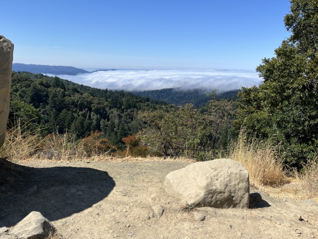
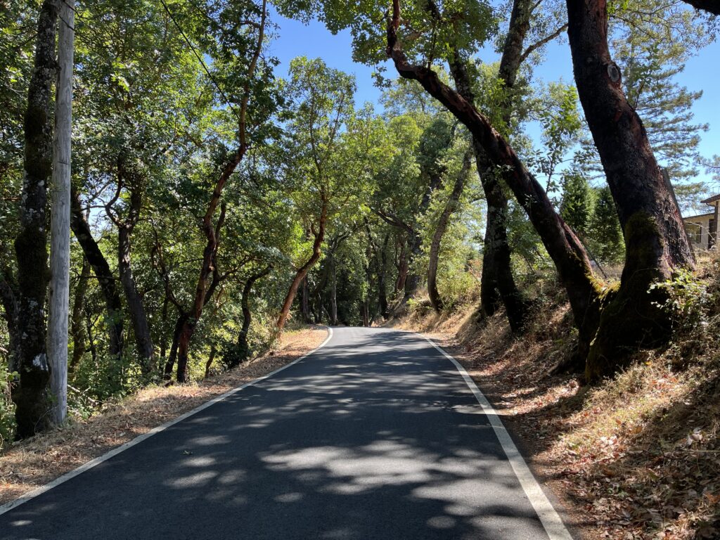
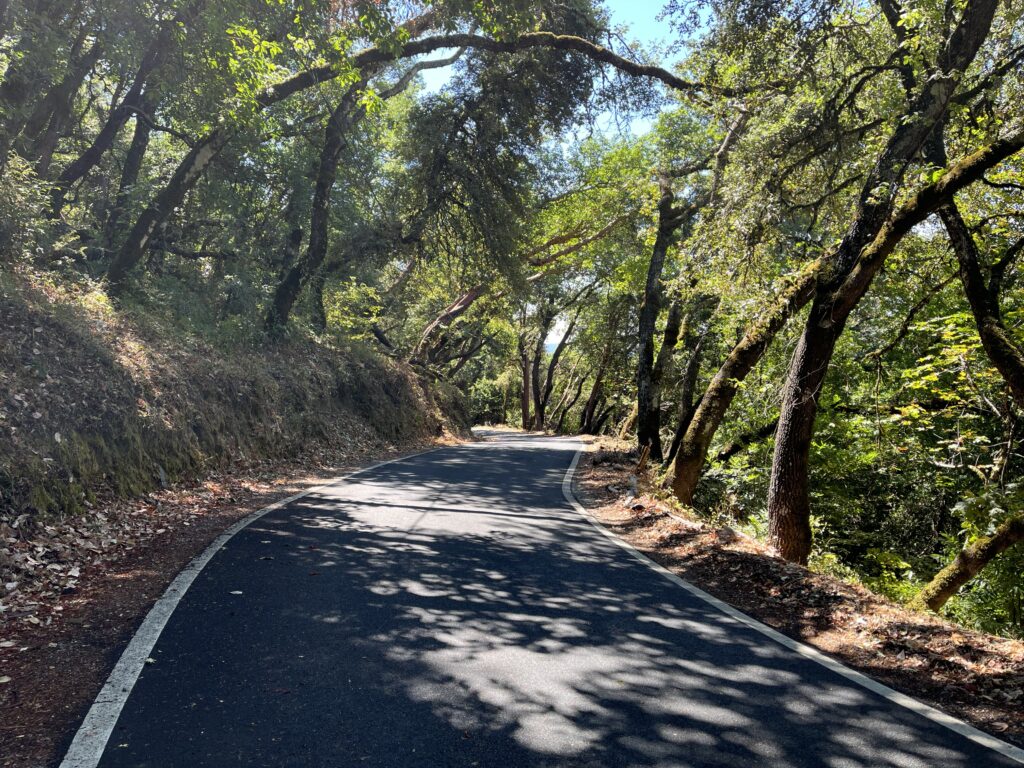
But at its southern end, Skyline turns idyllic. At Saratoga Gap most of the car traffic turns off, and the last ten miles are bliss—next to no traffic, glassy road surface, lazy climbing and descending through pretty woods, grand vistas to the west. Then it gets better. The southernmost 2.5 miles are simply magical—a car-free, almost-one-lane up and down back and forth ramble through drop-dead gorgeous miniature forest. I loved it so much, on the return ride I tried to pedal as little as possible, just to prolong my time in the magic.
As a cherry on this sundae, there’s an add-on that gives you 1-2 miles of killer climbing through typical Santa Cruz redwoods. The total elevation gain for the ride is substantially above our 100-ft-per-mile benchmark, but almost all the work is in these 4 miles, so you can skip them if you’re out for an easy day.
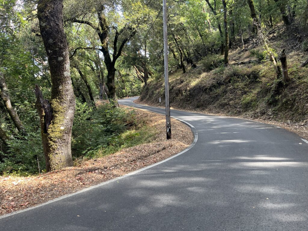
Park at the intersection of Bear Creek Rd. and Skyline. There’s a big dirt parking lot for you. Head north on Skyline. The road is instantly fabulous. There is no reason for any vehicle to be in there—anyone heading toward Boulder Creek should be on Hwy 9 and anyone heading toward Santa Cruz or Scotts Valley should be on Black Rd.—but for some reason the road surface is absolutely pristine. The road is essentially one lane, the contour is all little ups and downs and sweet little turns, and the landscape is fairy-tale pretty. Savor these first 2.5 miles—nothing else on the ride can match them.
At mile 2.5 you hit the intersection of Skyline and Gist Rd. (clearly signed), and you have two decisions to make: 1) do you want to take the Gist/Black detour at all? Doing so commits you to 1-2 miles of serious climbing (10-14%), plus 1-2 miles of steep descending, but it’s splendid scenery, and the only redwood forest on the route; and 2) if you take it, do you want to do it on the outbound or return leg? Outbound gives you 1.2 miles of descending and 1.7 miles of climbing; return reverses the numbers. Black has prettier woods than Gist, which might be an argument for doing it at 4 mph instead of 20.
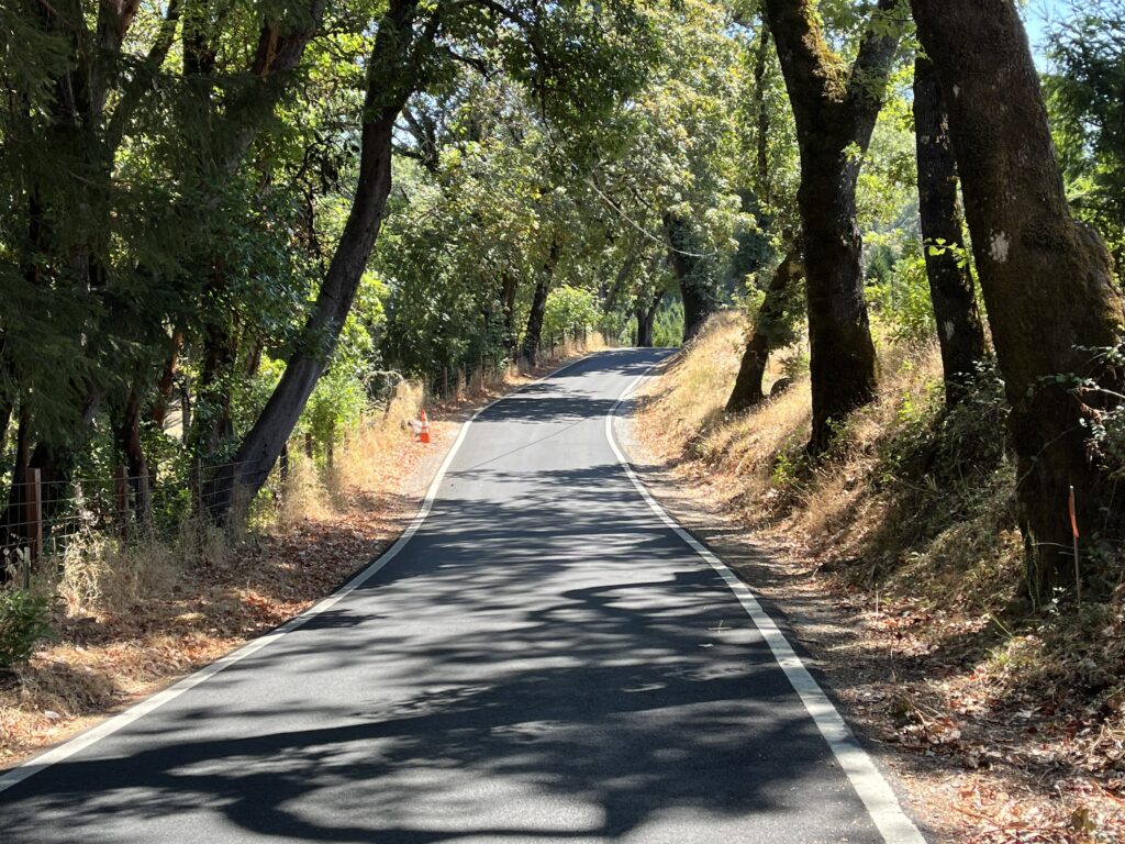
After the Gist/Black detour, Skyline changes—wider, straighter, slightly less car-free, and with more ordinary woods. The contour is moderate, relatively unvaried climbing almost all the way to Saratoga Gap. But it’s still lovely riding, the road surface remains pristine, and you’re treated to some good views of the country off your L shoulder. Midway you pass Castle Rock State Park and the traffic might pick up a little—turn around there if you are determined to remain car-free.
Saratoga Gap is just a large intersection with a parking lot. I’ve stopped the route here because the traffic to the north should be considerably more intense. Turn around and ride home. If you’re doing Black/Gist on this leg, note that Black, while a fairly large and noticeable turn-off to the L, is (oddly) unsigned.
Shortening the route: The jewel in this crown is obviously the first/last 2.5 miles—ride it out and back for the best 5-mile ride of your life. If you want short and intense, ride those 5 miles plus Gist/Black.
Adding miles: Our ride takes off from Bear Creek Rd., a road I don’t recommend riding to the west from our starting point because, while on a map it looks like any other pretty, winding Santa Cruz back road, it’s actually the main artery for all the traffic between the Los Gatos area and the bedroom communities of Boulder Creek, Felton, Ben Lomond, and others, so it’s usually constant traffic. East of our starting point, Bear Creek Rd. to Summit Rd. is brief, has a lovely contour and gives you some great westerly vistas (better than Skyline’s). Summit Rd., between BCR and Hwy 17 is fairly built up but is delightful riding and takes you past the turn-around of our East Zayante Road ride. Continuing on down Summit past Hwy 17 takes you to our Bean Creek/Mountain Charlie ride and/or our Eureka Canyon Rd. ride.. I wouldn’t continue on Bear Creek Rd. past Summit—it’s rough and unpleasantly steep, with the usual BCR traffic.