
Distance: 35 miles out and back
Elevation gain: 3925 ft
(A Best of the Best descent)
This is one of seven rides (all detailed in the Adding Miles section of the Mountain View Road post) that are worth doing around Boonville, a charming little town with good food and an interesting history, so I encourage you to find a place to stay in the area, make a cycling holiday out of it, and do all of them.
This ride has its drawbacks. The road is a little too trafficky, a little too wide, and a little too monotonous of pitch and a little too long climbing. But the pros outweigh the cons. The road contour is continuous mellow serpentining, the road surface is immaculate, the vistas in either direction are outstanding (Russian River Valley to the west, Clear Lake to the east), and the descents, on either side of the summit, are superb. I’ll put the descent on the east side up against any descent in Bestrides. It’s that good.
Which brings us to a dilemma: how do you ride a hill with a great descent on both sides? I’ve mapped it as an out and back, which is frankly asking a lot of your climbing legs and your patience. If you’re not up for that, you have three choices: a) arrange a shuttle and ride it one-way, and that way should be west to east; b) ride it as an out-and-back from base to summit, preferably on the east side; or c) do the loop I lay out in Adding Miles. Whatever you do, descending the east side should be your number-one priority.

The first miles
Park on Hwy 175 out of Hopland. The route is very mild climbing for the first 5 miles, but if you want more warm-up you can ride Old River Rd., a perfectly pleasant flat ride, running north and south off 175 (clearly signed—the southern leg soon dead-ends at Hwy 101, the northern leg runs forever).
Back on 175, the vineyards in the first 5 miles are particularly picturesque. After 5 miles you run out of valley, you hit a 180 turn and climb for 5 more miles to the summit at a moderate pitch (6-7%) that hardly varies. Watch for the vistas of the Russian River Valley below you as you climb, but if you miss them the vistas on the east side are grander.

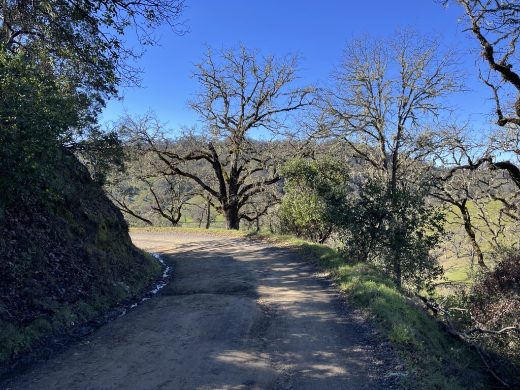
Miles of this
Just before the summit, you pass an “Entering Lake County” sign. If you’re planning on turning around at the summit, continue on a while because the vistas in the quarter-mile past the summit, of Clear Lake to the east and the ridges and canyons to the north, are magnificent. Much of the landscape was burned in the 2018 Mendocino Complex fire, but you’ll hardly notice now.

Just past summit, looking down on Clear Lake and fire damage—click to enlarge
Again, the descent from the summit heading east is simply perfect. Perfect pitch, perfect curves, grand vistas, open sight lines, lovely rock cuts. Notice I have no photos of the east side—I wasn’t about to interrupt my bliss by stopping to take photos.
If you’re following my route, turn around and ride back to the summit. Both climbs are about 5 miles of serious pitch, but RWGPS says the elevation gain on the east side is less because you’re starting higher. Be that as it may, I promise you’ll get your fill of work.

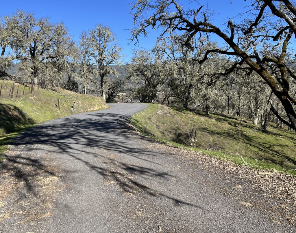
The eastside climb—your road is in center and at 10:30. Click to enlarge
Back at the summit, there’s a sign that reads “9% grade, next 4 miles.” Having already climbed it, you know that’s not true—it averages maybe 7% at the most—but it’s a lovely descent, all smooth, sweeping, banked curves where you can hold your speed easily, and the traffic becomes a non-issue because you’re going as fast as they are. At the bottom of the descent you have 5 miles of perfectly sweet 2% descending to make you feel like a god on the bike.
Shortening the ride: ride from either end to the summit, then return. Again, I recommend the east side.
Added miles: As I mentioned, Old River Rd. near the beginning of the ride is pleasant, easy riding in either direction. Old Toll Rd. takes off from 175 on the R a couple of miles into our route and gives you 2.7 miles of lovely rambling on good pavement before it turns to dirt.
Speaking of Old Toll Rd., after it turns to dirt it wends its way all the way to the eastern terminus of Hwy 175, changing its name midway to Highland Springs Rd. If you like dirt, consider looping the route, riding one way on 175 and the other on Old Toll/Highland Springs. Here’s a map:
I think RWGPS’s got the pavement/dirt proportions exactly right.
The good news is, once on this road it’s impossible to get lost—there are no forks or options, in either direction. The bad news is, the 10 miles of dirt range from OK to nasty. I did it once, on a gravel bike, and it beat my brains out. I feel no need to ever do it again. Don’t even think about it on skinny tires. However, I was riding clockwise, when most of the dirt is rocky downhill—if you do the loop counterclockwise, most of the rocky stuff is a moderate climb and much less jarring. But you give up the east-side descent on 175. It’s a tough call.
At the east end of our ride, 10 pleasant miles down Hwy 29 is our Clear Lake to Cobb route, which by some devil’s logic is also Hwy 175. See the Adding Miles section of Clear Lake to Cobb for more riding in that area. Five miles to the north on Hwy 29 is a short, easy gem, Scotts Valley Road, a pretty, mostly flat saunter through old pear orchards—perfect for a family spin.
Is there a particular reason to ride the Hopland Rd./Old Toll Rd. loop in the clockwise, as opposed to counterclockwise, direction?
Yes. It depends on what you want. Riding clockwise gives you the best downhill. Riding counterclockwise turns the long dirt pitch into a climb, which is nice because it’s rough and beats you up as a descent.